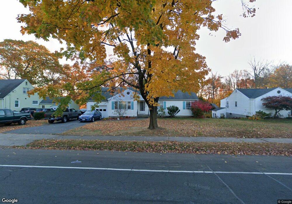
891 Slater Rd New Britain, CT 06053
Estimated Value: $299,000 - $312,968
3
Beds
3
Baths
1,449
Sq Ft
$212/Sq Ft
Est. Value
About This Home
This home is located at 891 Slater Rd, New Britain, CT 06053 and is currently estimated at $306,742, approximately $211 per square foot. 891 Slater Rd is a home located in Hartford County with nearby schools including Gaffney School, Pulaski Middle School, and St. Francis of Assisi Middle School.
Ownership History
Date
Name
Owned For
Owner Type
Purchase Details
Closed on
Oct 29, 2025
Sold by
Ingham Kenneth C
Bought by
Carl Ingham Oath T K and Carl Ingham
Current Estimated Value
Purchase Details
Closed on
Jun 26, 2007
Sold by
Young Lynette C
Bought by
Ingham Kenneth C
Home Financials for this Owner
Home Financials are based on the most recent Mortgage that was taken out on this home.
Original Mortgage
$160,000
Interest Rate
6.14%
Mortgage Type
Purchase Money Mortgage
Purchase Details
Closed on
Jun 22, 1998
Sold by
Michaud Richard and Mochaud Lucille
Bought by
Ingham Kenneth C and Young Lynette C
Home Financials for this Owner
Home Financials are based on the most recent Mortgage that was taken out on this home.
Original Mortgage
$98,900
Interest Rate
7.09%
Mortgage Type
Purchase Money Mortgage
Purchase Details
Closed on
Apr 1, 1992
Sold by
Chojnowski Joseph J and Chojnowski Anne
Bought by
Michaud Richard and Michaud Ronaldo
Create a Home Valuation Report for This Property
The Home Valuation Report is an in-depth analysis detailing your home's value as well as a comparison with similar homes in the area
Home Values in the Area
Average Home Value in this Area
Purchase History
| Date | Buyer | Sale Price | Title Company |
|---|---|---|---|
| Carl Ingham Oath T K | -- | -- | |
| Ingham Kenneth C | $35,000 | -- | |
| Ingham Kenneth C | $102,000 | -- | |
| Michaud Richard | $129,000 | -- |
Source: Public Records
Mortgage History
| Date | Status | Borrower | Loan Amount |
|---|---|---|---|
| Previous Owner | Michaud Richard | $145,900 | |
| Previous Owner | Michaud Richard | $160,000 | |
| Previous Owner | Michaud Richard | $96,250 | |
| Previous Owner | Michaud Richard | $98,900 |
Source: Public Records
Tax History
| Year | Tax Paid | Tax Assessment Tax Assessment Total Assessment is a certain percentage of the fair market value that is determined by local assessors to be the total taxable value of land and additions on the property. | Land | Improvement |
|---|---|---|---|---|
| 2025 | $6,220 | $158,760 | $60,480 | $98,280 |
| 2024 | $6,285 | $158,760 | $60,480 | $98,280 |
| 2023 | $6,077 | $158,760 | $60,480 | $98,280 |
| 2022 | $5,385 | $108,780 | $25,410 | $83,370 |
| 2021 | $5,385 | $108,780 | $25,410 | $83,370 |
| 2020 | $5,493 | $108,780 | $25,410 | $83,370 |
| 2019 | $5,493 | $108,780 | $25,410 | $83,370 |
| 2018 | $5,493 | $108,780 | $25,410 | $83,370 |
| 2017 | $5,660 | $112,070 | $25,410 | $86,660 |
| 2016 | $5,660 | $112,070 | $25,410 | $86,660 |
| 2015 | $5,491 | $112,070 | $25,410 | $86,660 |
| 2014 | $5,491 | $112,070 | $25,410 | $86,660 |
Source: Public Records
Map
Nearby Homes
- 153 Horseplain Rd
- 2453 Corbin Ave
- 234 Pierremount Ave
- 24 Pentlow Ave
- 678 Farmington Ave
- 230 Hillhurst Ave
- 240 Hillhurst Ave
- 432 Mcclintock St
- 527 Burritt St
- 55 Allen St
- 1114 Fienemann Rd
- 54 Fairlane Dr
- 25 Clinton St
- 8128 Colt Hwy
- 50 Curtin Ave
- 45 Tunxis St
- 376 Broad St
- 154 Allen St
- 482 Commonwealth Ave
- 37 Richard St
Your Personal Tour Guide
Ask me questions while you tour the home.