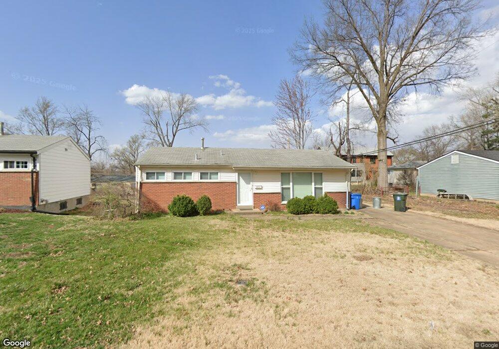
8911 Comanche Dr Saint Louis, MO 63132
Estimated Value: $226,618 - $368,000
3
Beds
1
Bath
1,008
Sq Ft
$272/Sq Ft
Est. Value
About This Home
This home is located at 8911 Comanche Dr, Saint Louis, MO 63132 and is currently estimated at $274,155, approximately $271 per square foot. 8911 Comanche Dr is a home located in St. Louis County with nearby schools including Reed Elementary, Ladue 5th Grade Center, and Ladue Middle.
Ownership History
Date
Name
Owned For
Owner Type
Purchase Details
Closed on
Sep 14, 2015
Sold by
Koenig Jason S
Bought by
The Jason Koenig Revocable Living Trust
Current Estimated Value
Purchase Details
Closed on
Dec 20, 2004
Sold by
Talley P Nathan and Talley Indra B
Bought by
Koenig Jason S
Home Financials for this Owner
Home Financials are based on the most recent Mortgage that was taken out on this home.
Original Mortgage
$74,375
Interest Rate
5.76%
Mortgage Type
Purchase Money Mortgage
Purchase Details
Closed on
Jul 25, 2002
Sold by
Rosenbaum Joseph and Rosenbaum Shirley
Bought by
Talley P Nathan and Talley Indra B
Home Financials for this Owner
Home Financials are based on the most recent Mortgage that was taken out on this home.
Original Mortgage
$85,000
Interest Rate
6.62%
Purchase Details
Closed on
Feb 26, 1997
Sold by
Joseph Rosenbaum and Joseph Shirley M
Bought by
Rosenbaum Shirley and Rosenbaum Joseph
Create a Home Valuation Report for This Property
The Home Valuation Report is an in-depth analysis detailing your home's value as well as a comparison with similar homes in the area
Home Values in the Area
Average Home Value in this Area
Purchase History
| Date | Buyer | Sale Price | Title Company |
|---|---|---|---|
| The Jason Koenig Revocable Living Trust | -- | None Available | |
| Koenig Jason S | $148,750 | -- | |
| Talley P Nathan | $114,000 | -- | |
| Rosenbaum Shirley | -- | -- | |
| Rosenbaum Joseph | -- | -- |
Source: Public Records
Mortgage History
| Date | Status | Borrower | Loan Amount |
|---|---|---|---|
| Closed | Koenig Jason S | $74,375 | |
| Previous Owner | Talley P Nathan | $85,000 |
Source: Public Records
Tax History Compared to Growth
Tax History
| Year | Tax Paid | Tax Assessment Tax Assessment Total Assessment is a certain percentage of the fair market value that is determined by local assessors to be the total taxable value of land and additions on the property. | Land | Improvement |
|---|---|---|---|---|
| 2025 | $2,685 | $40,970 | $34,600 | $6,370 |
| 2024 | $2,685 | $37,730 | $25,440 | $12,290 |
| 2023 | $2,716 | $37,730 | $25,440 | $12,290 |
| 2022 | $2,191 | $29,260 | $25,440 | $3,820 |
| 2021 | $2,178 | $29,260 | $25,440 | $3,820 |
| 2020 | $2,005 | $26,580 | $12,580 | $14,000 |
| 2019 | $1,942 | $26,580 | $12,580 | $14,000 |
| 2018 | $1,403 | $17,560 | $10,360 | $7,200 |
| 2017 | $1,398 | $17,560 | $10,360 | $7,200 |
| 2016 | $1,654 | $20,220 | $10,360 | $9,860 |
| 2015 | $1,586 | $20,220 | $10,360 | $9,860 |
| 2014 | $1,364 | $16,700 | $4,430 | $12,270 |
Source: Public Records
Map
Nearby Homes
- 1173 Hilltop Dr
- 1123 Hilltop Dr
- 1459 Sheridan Dr
- 1022 Dolores Ave
- 1437 Coolidge Dr
- 8450 Kempland Place
- 8634 Mayflower Ct
- 1253 Dielman Rd
- 8364 Fullerton Ave
- 1193 Noa Ln Unit 30
- 1181 Rd Unit 33
- 9401 Olie Way Rd Unit 26
- 1185 Noa Lane Rd Unit 32
- 1189 Noa Lane Rd Unit 31
- 9425 Olie Way Rd Unit 29
- 8362 Braddock Dr
- 8370 Orchard Ave
- 1916 Brassie Dr
- 1910 Leondale Ave
- 9446 Miriam Ave
- 8917 Comanche Dr
- 8901 Comanche Dr
- 1259 Hilltop Dr
- 8910 Comstock Dr
- 8916 Comstock Dr
- 8923 Comanche Dr
- 8900 Comstock Dr
- 8900 Comanche Dr
- 8910 Comanche Dr
- 8922 Comstock Dr
- 8916 Comanche Dr
- 8929 Comanche Dr
- 1211 Hilltop Dr
- 8926 Comstock Dr
- 8922 Comanche Dr
- 8815 Comanche Ct
- 8810 Comanche Ct
- 8915 Comstock Dr
- 8909 Comstock Dr
- 8935 Comanche Dr