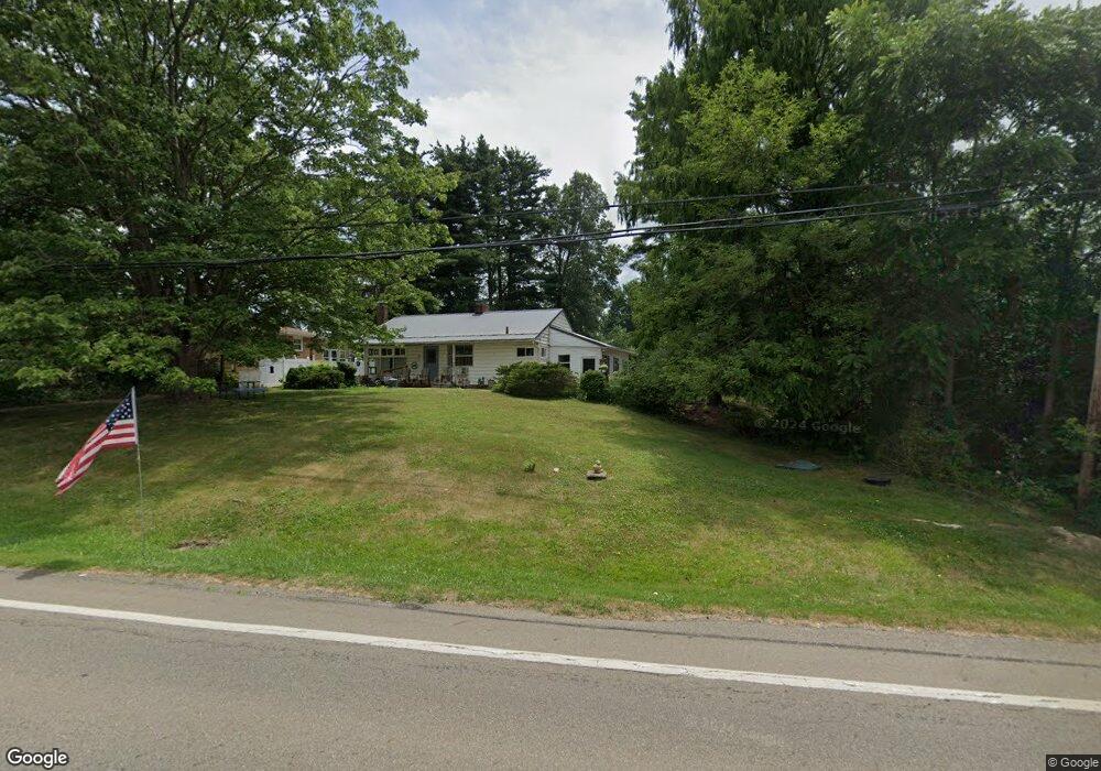
8914 Louisville St Louisville, OH 44641
Estimated Value: $163,000 - $198,235
3
Beds
2
Baths
1,220
Sq Ft
$147/Sq Ft
Est. Value
About This Home
This home is located at 8914 Louisville St, Louisville, OH 44641 and is currently estimated at $178,809, approximately $146 per square foot. 8914 Louisville St is a home located in Stark County with nearby schools including Louisville High School and St. Thomas Aquinas High School & Middle School.
Ownership History
Date
Name
Owned For
Owner Type
Purchase Details
Closed on
Nov 3, 1995
Sold by
Scott Kay J
Bought by
Gomer Bonnie
Current Estimated Value
Home Financials for this Owner
Home Financials are based on the most recent Mortgage that was taken out on this home.
Original Mortgage
$87,875
Outstanding Balance
$1,230
Interest Rate
7.61%
Mortgage Type
New Conventional
Estimated Equity
$177,579
Purchase Details
Closed on
Jul 23, 1992
Create a Home Valuation Report for This Property
The Home Valuation Report is an in-depth analysis detailing your home's value as well as a comparison with similar homes in the area
Home Values in the Area
Average Home Value in this Area
Purchase History
| Date | Buyer | Sale Price | Title Company |
|---|---|---|---|
| Gomer Bonnie | $92,500 | -- | |
| -- | $75,000 | -- |
Source: Public Records
Mortgage History
| Date | Status | Borrower | Loan Amount |
|---|---|---|---|
| Open | Gomer Bonnie | $87,875 |
Source: Public Records
Tax History Compared to Growth
Tax History
| Year | Tax Paid | Tax Assessment Tax Assessment Total Assessment is a certain percentage of the fair market value that is determined by local assessors to be the total taxable value of land and additions on the property. | Land | Improvement |
|---|---|---|---|---|
| 2025 | -- | $49,740 | $15,330 | $34,410 |
| 2024 | -- | $49,740 | $15,330 | $34,410 |
| 2023 | $2,032 | $41,790 | $10,850 | $30,940 |
| 2022 | $2,086 | $41,790 | $10,850 | $30,940 |
| 2021 | $1,617 | $41,790 | $10,850 | $30,940 |
| 2020 | $1,327 | $37,390 | $9,770 | $27,620 |
| 2019 | $1,333 | $37,390 | $9,770 | $27,620 |
| 2018 | $1,328 | $37,390 | $9,770 | $27,620 |
| 2017 | $1,241 | $34,280 | $9,140 | $25,140 |
| 2016 | $1,511 | $40,580 | $9,140 | $31,440 |
| 2015 | $1,515 | $40,580 | $9,140 | $31,440 |
| 2014 | $1,373 | $35,420 | $7,980 | $27,440 |
| 2013 | $690 | $35,420 | $7,980 | $27,440 |
Source: Public Records
Map
Nearby Homes
- 2015 E Main St
- 1812 E Broad St
- 1413 Washington Blvd
- 0 Michigan Blvd
- 2110 Edmar St
- 5495 Meese Rd NE
- 308 Superior St
- 520 S Silver St
- 910 Crosswyck Cir
- 728 E Broad St
- 325 Lincoln Ave
- 8896 Rue Helena St
- 210 E Gorgas St
- 344 E Reno Dr
- 6052 N Nickelplate St
- 3390 Meese Rd NE
- 316 E Reno Dr
- 204 E Broad St
- 107 E Broad St
- 428 Honeycrisp Dr NE
- 4695 Hyland Ave
- 8888 Louisville St
- 8901 Louisville St
- 4671 Hyland Ave
- 8933 Louisville St
- 8885 Louisville St
- 8950 Louisville St
- 4660 Hyland Ave
- 8874 Louisville St
- 8949 Louisville St
- 8976 Louisville St
- 8871 Louisville St
- 4640 Hyland Ave
- 8855 Louisville St
- 4621 Hyland Ave
- 8994 Louisville St
- 4672 Meese Rd
- 8841 Louisville St
- 8995 Louisville St
- 8995 Louisville St