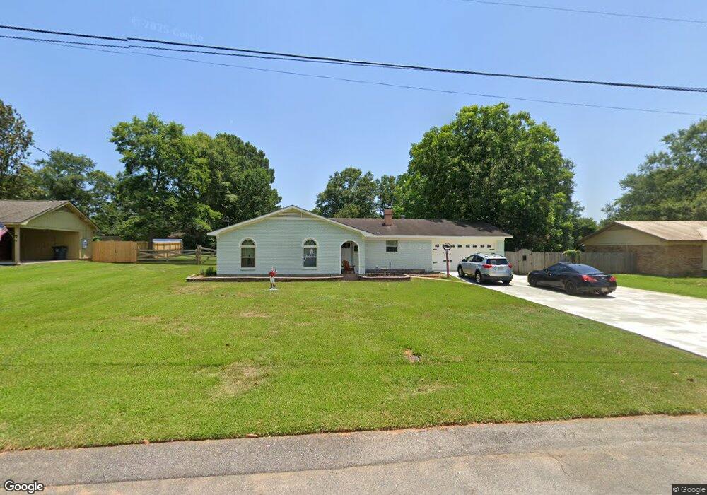
8915 Dawes Point Dr Mobile, AL 36695
Cottage Park NeighborhoodEstimated Value: $191,134 - $218,000
3
Beds
2
Baths
1,519
Sq Ft
$136/Sq Ft
Est. Value
About This Home
This home is located at 8915 Dawes Point Dr, Mobile, AL 36695 and is currently estimated at $207,284, approximately $136 per square foot. 8915 Dawes Point Dr is a home located in Mobile County with nearby schools including Hutchens Elementary School, Dawes Intermediate School, and Bernice J Causey Middle School.
Ownership History
Date
Name
Owned For
Owner Type
Purchase Details
Closed on
Sep 14, 2009
Sold by
Simms James J and Simms Nancy L
Bought by
Powell Ricky Wayne
Current Estimated Value
Home Financials for this Owner
Home Financials are based on the most recent Mortgage that was taken out on this home.
Original Mortgage
$132,554
Outstanding Balance
$85,451
Interest Rate
5.15%
Mortgage Type
FHA
Estimated Equity
$121,833
Create a Home Valuation Report for This Property
The Home Valuation Report is an in-depth analysis detailing your home's value as well as a comparison with similar homes in the area
Home Values in the Area
Average Home Value in this Area
Purchase History
| Date | Buyer | Sale Price | Title Company |
|---|---|---|---|
| Powell Ricky Wayne | $135,054 | Slt |
Source: Public Records
Mortgage History
| Date | Status | Borrower | Loan Amount |
|---|---|---|---|
| Open | Powell Ricky Wayne | $132,554 |
Source: Public Records
Tax History
| Year | Tax Paid | Tax Assessment Tax Assessment Total Assessment is a certain percentage of the fair market value that is determined by local assessors to be the total taxable value of land and additions on the property. | Land | Improvement |
|---|---|---|---|---|
| 2025 | $705 | $17,750 | $3,000 | $14,750 |
| 2024 | $705 | $17,610 | $3,000 | $14,610 |
| 2023 | $732 | $16,480 | $2,800 | $13,680 |
| 2022 | $623 | $14,210 | $2,800 | $11,410 |
| 2021 | $562 | $12,950 | $2,800 | $10,150 |
| 2020 | $575 | $13,230 | $2,800 | $10,430 |
| 2019 | $576 | $13,250 | $2,800 | $10,450 |
| 2018 | $504 | $11,780 | $0 | $0 |
| 2017 | $523 | $12,160 | $0 | $0 |
| 2016 | $534 | $12,400 | $0 | $0 |
| 2013 | -- | $12,180 | $0 | $0 |
Source: Public Records
Map
Nearby Homes
- 2671 Dawes Rd
- 9040 Valley View Dr
- 7611 Anglebrook Rd S
- 7607 Anglebrook Rd S
- 8945 Spring Grove S
- 8601 Cottage Hill Rd
- 7648 Anglebrook Rd N
- 2575 Rosebud Dr
- 7618 Anglebrook Rd S
- 7640 Anglebrook Rd N
- 7644 Anglebrook Rd N
- 8680 Dutchman Woods Dr
- 7652 Anglebrook Rd N
- 0 Dutchman Woods Dr Unit 7452099
- 0 Dutchman Woods Dr Unit 7519300
- 0 Dutchman Woods Dr Unit 45 373633
- 0 Dutchman Woods Dr Unit 47,48,49
- 2261 Vulcan Ct
- 8451 Placid Dr
- 2940 Dawes Rd
- 8901 Dawes Point Dr
- 8925 Dawes Point Dr
- 8940 Mead Ct
- 8930 Mead Ct
- 2558 Dell Dr
- 2570 Dell Dr
- 8935 Dawes Point Dr
- 8900 Dawes Point Dr
- 8910 Dawes Point Dr
- 8880 Dawes Point Dr
- 2602 Dell Dr
- 8920 Dawes Point Dr
- 8950 Mead Ct
- 8933 Mead Ct
- 8870 Dawes Point Dr
- 8945 Dawes Point Dr
- 8930 Dawes Point Dr
- 2618 Dell Dr
- 8860 Dawes Point Dr
- 8851 Dawes Point Dr
Your Personal Tour Guide
Ask me questions while you tour the home.