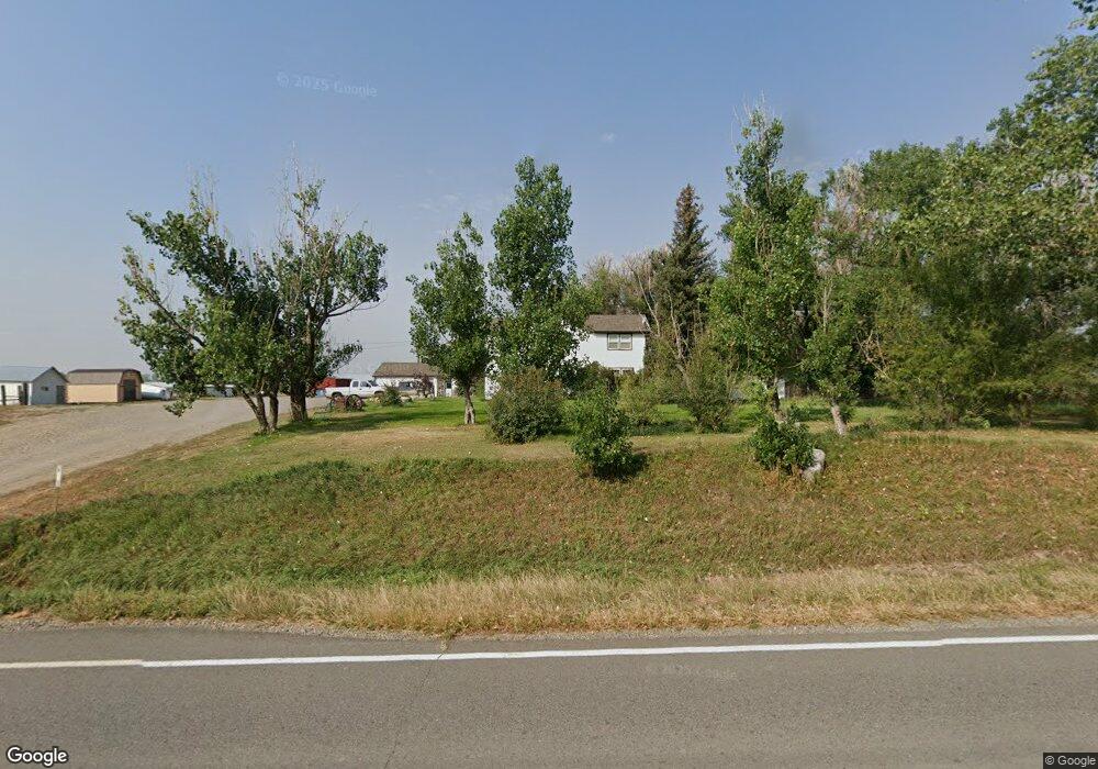
8916 Shepherd Rd Shepherd, MT 59079
Estimated Value: $556,000 - $712,543
3
Beds
3
Baths
3,204
Sq Ft
$199/Sq Ft
Est. Value
About This Home
This home is located at 8916 Shepherd Rd, Shepherd, MT 59079 and is currently estimated at $636,386, approximately $198 per square foot. 8916 Shepherd Rd is a home with nearby schools including Shepherd Elementary School, Shepherd Middle School, and Shepherd High School.
Ownership History
Date
Name
Owned For
Owner Type
Purchase Details
Closed on
Feb 21, 2013
Sold by
Plath Gregory A
Bought by
Plath Gregory A and Plath Heather K
Current Estimated Value
Home Financials for this Owner
Home Financials are based on the most recent Mortgage that was taken out on this home.
Original Mortgage
$264,000
Outstanding Balance
$184,123
Interest Rate
3.36%
Mortgage Type
New Conventional
Estimated Equity
$452,263
Purchase Details
Closed on
Jul 19, 2012
Sold by
Plath A T and Plath Roseanne M
Bought by
Plath Gregory A
Create a Home Valuation Report for This Property
The Home Valuation Report is an in-depth analysis detailing your home's value as well as a comparison with similar homes in the area
Purchase History
| Date | Buyer | Sale Price | Title Company |
|---|---|---|---|
| Plath Gregory A | -- | Chicago Title | |
| Plath Gregory A | -- | None Available | |
| Plath A T | -- | None Available | |
| Plath A T | -- | None Available |
Source: Public Records
Mortgage History
| Date | Status | Borrower | Loan Amount |
|---|---|---|---|
| Open | Plath Gregory A | $264,000 |
Source: Public Records
Tax History
| Year | Tax Paid | Tax Assessment Tax Assessment Total Assessment is a certain percentage of the fair market value that is determined by local assessors to be the total taxable value of land and additions on the property. | Land | Improvement |
|---|---|---|---|---|
| 2025 | $4,629 | $645,416 | $2,326 | $643,090 |
| 2024 | $4,629 | $544,203 | $2,003 | $542,200 |
| 2023 | $4,711 | $544,203 | $2,003 | $542,200 |
| 2022 | $4,312 | $443,776 | $0 | $0 |
| 2021 | $4,301 | $443,776 | $0 | $0 |
| 2020 | $4,087 | $406,404 | $0 | $0 |
| 2019 | $3,380 | $406,404 | $0 | $0 |
| 2018 | $3,252 | $367,162 | $0 | $0 |
| 2017 | $2,950 | $367,162 | $0 | $0 |
| 2016 | $2,816 | $337,323 | $0 | $0 |
| 2015 | $2,791 | $337,323 | $0 | $0 |
| 2014 | $2,390 | $154,823 | $0 | $0 |
Source: Public Records
Map
Nearby Homes
- 5652 Bengston Rd
- 5615 Scandia Rd
- 9705 Shepherd Rd
- 8020 Wade St
- 6835 Eagle Bend Blvd
- 7729 Buckskin Dr
- 7340 Wild Game Trail
- 5430 Cerkoney Ln
- 7420 Whitetail Run
- 10550 Reno Ln
- 7684 12 Mile Rd
- 3835 Nellie Christine Dr
- 3863 Glenn Edward Rd
- 3625 Nellie Christine Dr
- 7445 Horsemans Way
- 6513 Frey Rd
- L5B4 Trumbo Cir
- 0 Shepherd Road Lot Shepherd Rd
- 0 SHepherd Road lot Shepherd Rd
- L4B4 Trumbo Cir
- 8915 Shepherd Rd
- 5903 Creekview Dr
- 5909 Creekview Dr
- 5921 Creekview Dr
- 8647 Shepherd Rd
- 8634 Shepherd Rd
- 5865 Creekview Dr
- 5859 Creekview Dr
- 5916 Creekview Dr
- 5851 Creekview Dr
- 5856 Creekview Dr
- 5920 Creekview Dr
- 5940 Creekview Dr
- 5952 Creekview Dr
- 5848 Creekview Dr
- 5843 Creekview Dr
- 5651 Meadowmist Place
- 5837 Creekview Dr
- 5822 Creekview Dr
- 5825 Creekview Dr
Your Personal Tour Guide
Ask me questions while you tour the home.