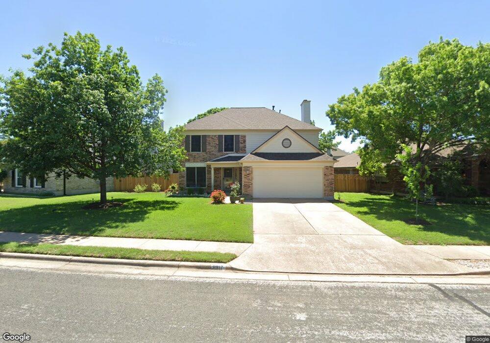
8917 Sharpstone Trail Austin, TX 78717
Brushy Creek NeighborhoodEstimated Value: $449,089 - $517,000
3
Beds
3
Baths
1,895
Sq Ft
$249/Sq Ft
Est. Value
About This Home
This home is located at 8917 Sharpstone Trail, Austin, TX 78717 and is currently estimated at $471,522, approximately $248 per square foot. 8917 Sharpstone Trail is a home located in Williamson County with nearby schools including Great Oaks Elementary School, Cedar Valley Middle School, and Round Rock High School.
Create a Home Valuation Report for This Property
The Home Valuation Report is an in-depth analysis detailing your home's value as well as a comparison with similar homes in the area
Home Values in the Area
Average Home Value in this Area
Tax History
| Year | Tax Paid | Tax Assessment Tax Assessment Total Assessment is a certain percentage of the fair market value that is determined by local assessors to be the total taxable value of land and additions on the property. | Land | Improvement |
|---|---|---|---|---|
| 2025 | $4,099 | $471,891 | $115,000 | $356,891 |
| 2024 | $4,813 | $441,797 | -- | -- |
| 2023 | $4,701 | $401,634 | $0 | $0 |
| 2022 | $7,557 | $365,122 | $0 | $0 |
| 2021 | $7,853 | $331,929 | $85,000 | $262,711 |
| 2020 | $7,177 | $301,754 | $79,917 | $221,837 |
| 2019 | $7,149 | $291,971 | $72,600 | $219,371 |
| 2018 | $6,378 | $274,078 | $66,340 | $207,738 |
| 2017 | $6,587 | $263,915 | $62,000 | $203,518 |
| 2016 | $5,988 | $239,923 | $62,000 | $185,713 |
| 2015 | $4,787 | $218,112 | $50,400 | $178,408 |
| 2014 | $4,787 | $198,284 | $0 | $0 |
Source: Public Records
Map
Nearby Homes
- 16405 Marthas Cove
- 8802 Fritsch Dr
- 9006 Brimstone Ln
- 16605 Denise Dr
- 9209 Meyrick Park Trail
- 9409 Lisi Anne Dr
- 7112 Avignon Dr
- 8903 Halder Cove
- 15802 Neenah Oak Loop
- 16601 Malaga Hills Dr
- 8700 Tin Roof Cove
- 8903 Pocono Cove
- 16113 Indina Hills Cove
- 7018 Avignon Dr
- 16904 Pocono Dr
- 10115 Ida Grove Ln
- 9613 Indina Hills Dr
- 9504 Indina Hills Dr
- 16919 Mouse Trap Dr
- 16803 Dorman Dr
- 8915 Sharpstone Trail
- 8919 Sharpstone Trail
- 8908 Splitarrow Dr
- 8913 Sharpstone Trail
- 9001 Sharpstone Trail
- 8906 Splitarrow Dr
- 8918 Sharpstone Trail
- 9003 Sharpstone Trail
- 8911 Sharpstone Trail
- 8910 Splitarrow Dr
- 8904 Splitarrow Dr
- 8916 Sharpstone Trail
- 8914 Sharpstone Trail
- 8912 Sharpstone Trail
- 16300 Rockgate Dr
- 8902 Splitarrow Dr
- 8910 Sharpstone Trail
- 8911 Splitarrow Dr
- 8909 Sharpstone Trail
- 16303 Rockgate Dr
Your Personal Tour Guide
Ask me questions while you tour the home.