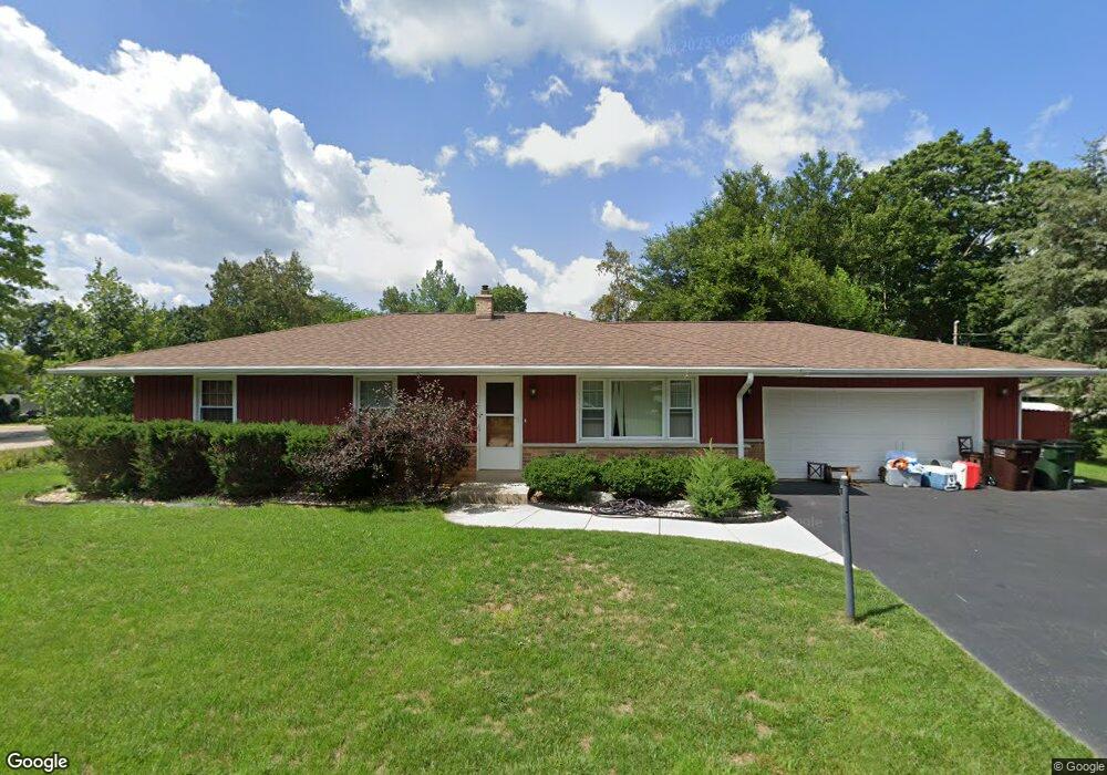
8918 389th Ave Burlington, WI 53105
Estimated Value: $309,000 - $363,441
3
Beds
2
Baths
1,232
Sq Ft
$274/Sq Ft
Est. Value
About This Home
This home is located at 8918 389th Ave, Burlington, WI 53105 and is currently estimated at $337,110, approximately $273 per square foot. 8918 389th Ave is a home located in Kenosha County with nearby schools including Randall Consolidated School and Wilmot High School.
Ownership History
Date
Name
Owned For
Owner Type
Purchase Details
Closed on
Sep 17, 2020
Sold by
Liss Bruce J and Liss Marlene K
Bought by
Mccall Kevin M and Mccall Jill
Current Estimated Value
Home Financials for this Owner
Home Financials are based on the most recent Mortgage that was taken out on this home.
Original Mortgage
$172,000
Outstanding Balance
$152,639
Interest Rate
2.9%
Mortgage Type
New Conventional
Estimated Equity
$184,471
Create a Home Valuation Report for This Property
The Home Valuation Report is an in-depth analysis detailing your home's value as well as a comparison with similar homes in the area
Home Values in the Area
Average Home Value in this Area
Purchase History
| Date | Buyer | Sale Price | Title Company |
|---|---|---|---|
| Mccall Kevin M | $215,000 | None Available |
Source: Public Records
Mortgage History
| Date | Status | Borrower | Loan Amount |
|---|---|---|---|
| Open | Mccall Kevin M | $172,000 |
Source: Public Records
Tax History Compared to Growth
Tax History
| Year | Tax Paid | Tax Assessment Tax Assessment Total Assessment is a certain percentage of the fair market value that is determined by local assessors to be the total taxable value of land and additions on the property. | Land | Improvement |
|---|---|---|---|---|
| 2024 | $3,265 | $216,600 | $41,500 | $175,100 |
| 2023 | $3,184 | $216,600 | $41,500 | $175,100 |
| 2022 | $3,558 | $216,600 | $41,500 | $175,100 |
| 2021 | $3,469 | $216,600 | $41,500 | $175,100 |
| 2020 | $2,816 | $158,900 | $38,700 | $120,200 |
| 2019 | $2,664 | $158,900 | $38,700 | $120,200 |
| 2018 | $2,816 | $158,900 | $38,700 | $120,200 |
| 2017 | $3,178 | $158,900 | $38,700 | $120,200 |
| 2016 | $3,195 | $158,900 | $38,700 | $120,200 |
| 2015 | $2,904 | $158,900 | $38,700 | $120,200 |
| 2014 | -- | $158,900 | $38,700 | $120,200 |
Source: Public Records
Map
Nearby Homes
- 9020 388th Ave
- 9244 391st Ave
- 8627 392nd Ave
- 39918 93rd St
- 39740 Bloomfield Rd
- Lt9 95th St
- Lt10 95th St
- 9499 402nd Ave
- 9631 400th Ave
- 8823 406th Ave
- 478 Tomahawk Dr
- 207 Tomahawk Dr
- 40724 93rd St
- Lt2 Marion Ave
- 1061 Highland Dr
- N1189 Tombeau Rd
- 201 Lance Dr
- 131 Lance Dr Unit 21
- 10536 401st Ave
- W105 Tombeau Blvd