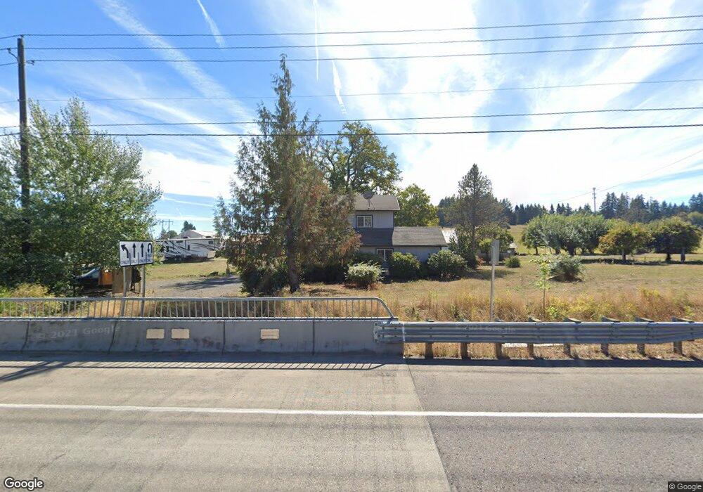
8919 NE 219th St Battle Ground, WA 98604
Estimated Value: $469,000 - $1,264,120
3
Beds
3
Baths
1,347
Sq Ft
$564/Sq Ft
Est. Value
About This Home
This home is located at 8919 NE 219th St, Battle Ground, WA 98604 and is currently estimated at $759,707, approximately $563 per square foot. 8919 NE 219th St is a home located in Clark County with nearby schools including Maple Grove Primary School, Prairie High School, and Firm Foundation Christian School.
Ownership History
Date
Name
Owned For
Owner Type
Purchase Details
Closed on
Feb 19, 2021
Sold by
Crybleskey Sylvia G
Bought by
Crybleskey Sylvia G and The Sylvia G Crybleskey Revoca
Current Estimated Value
Purchase Details
Closed on
Apr 23, 2013
Sold by
Cryblskey Sylvia G and Jones Sylvia G
Bought by
State Of Washington and Department Of Transportation
Purchase Details
Closed on
Jul 11, 2012
Sold by
Harris Wayne A and Harris Dorothy E
Bought by
State Of Washington and Department Of Transportation
Purchase Details
Closed on
Nov 21, 2004
Sold by
Jones Richard
Bought by
Jones Sylvia
Purchase Details
Closed on
Feb 18, 2002
Sold by
Jones Sylvia G and Easter Joy C
Bought by
Jones Sylvia G
Purchase Details
Closed on
Mar 30, 2000
Sold by
Cryblskey Edward J and Estate Of Marjorie M Cryblskey
Bought by
Cryblskey Edward J and Edward J Cryblskey Trust
Purchase Details
Closed on
Aug 15, 1994
Sold by
Cryblskey Edward J and Cryblskey Marjorie M
Bought by
Antell Emmett and Antell Sharon
Create a Home Valuation Report for This Property
The Home Valuation Report is an in-depth analysis detailing your home's value as well as a comparison with similar homes in the area
Home Values in the Area
Average Home Value in this Area
Purchase History
| Date | Buyer | Sale Price | Title Company |
|---|---|---|---|
| Crybleskey Sylvia G | -- | None Available | |
| State Of Washington | -- | Chicago Title Insurance | |
| State Of Washington | -- | Stewart Title | |
| Jones Sylvia | -- | -- | |
| Jones Sylvia G | -- | -- | |
| Cryblskey Edward J | -- | -- | |
| Antell Emmett | -- | Stewart Title |
Source: Public Records
Tax History Compared to Growth
Tax History
| Year | Tax Paid | Tax Assessment Tax Assessment Total Assessment is a certain percentage of the fair market value that is determined by local assessors to be the total taxable value of land and additions on the property. | Land | Improvement |
|---|---|---|---|---|
| 2025 | $8,149 | $965,362 | $644,479 | $320,883 |
| 2024 | $7,483 | $935,691 | $644,479 | $291,212 |
| 2023 | $6,525 | $961,718 | $664,763 | $296,955 |
| 2022 | $6,532 | $768,019 | $472,077 | $295,942 |
| 2021 | $6,146 | $712,734 | $458,472 | $254,262 |
| 2020 | $6,236 | $611,720 | $390,451 | $221,269 |
| 2019 | $4,984 | $608,873 | $397,253 | $211,620 |
| 2018 | $6,233 | $557,279 | $0 | $0 |
| 2017 | $4,784 | $533,123 | $0 | $0 |
| 2015 | $4,608 | $407,547 | $0 | $0 |
| 2014 | -- | $375,686 | $0 | $0 |
| 2013 | -- | $339,970 | $0 | $0 |
Source: Public Records
Map
Nearby Homes
- 151 NW 30th Ave
- 344 NW 29th Way
- 2514 W Main St
- 2507 SW 5th Way
- 23001 NE 82nd Ave
- 23403 NE 92nd Ave
- 2307 SW 5th Cir
- 1019 SW 27th Ct
- 2301 SW 5th Cir
- 810 NW 25th Ave
- 1410 NW 30th Ave
- 23615 NE 92nd Ave
- 2111 SW 5th St
- 2213 SW 10th St
- 2812 NW 14th St
- 20204 NE 104th Ave
- 2200 NW 5th St
- 2401 NW 10th Way
- 1210 NW 24th Ave
- 1816 SW 6th St
- 8918 NE 219th St
- 3815 W Main St
- 9301 NE 219th St
- 3716 W Main St
- 8728 NE 219th St
- 9009 NE 223rd Cir
- 8614 NE 219th St
- 21812 NE 87th Ave
- 21812 NE 87th Ave
- 3 NE 214th St
- 4 NE 214th St
- 8909 NE 223rd Cir
- 8915 NE 214th St
- 3616 W Main St
- 3616 W Main St
- 8602 NE 219th St
- 8515 NE 219th St
- 21600 NE 87th Ave
- 8909 NE 214th St
- 00 NE 92nd Ave