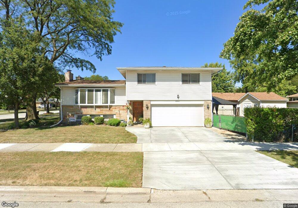
8919 Oak Park Ave Unit 2 Morton Grove, IL 60053
Estimated Value: $467,000 - $521,000
3
Beds
2
Baths
1,597
Sq Ft
$310/Sq Ft
Est. Value
About This Home
This home is located at 8919 Oak Park Ave Unit 2, Morton Grove, IL 60053 and is currently estimated at $495,386, approximately $310 per square foot. 8919 Oak Park Ave Unit 2 is a home located in Cook County with nearby schools including Hynes Elementary School, Golf Middle School, and Niles North High School.
Ownership History
Date
Name
Owned For
Owner Type
Purchase Details
Closed on
Jul 28, 1995
Sold by
Abraham Kathleen and Gabel Eleanora I
Bought by
Antkowiak Gregory J and Antkowiak Suzanne E
Current Estimated Value
Home Financials for this Owner
Home Financials are based on the most recent Mortgage that was taken out on this home.
Original Mortgage
$122,000
Interest Rate
7.51%
Create a Home Valuation Report for This Property
The Home Valuation Report is an in-depth analysis detailing your home's value as well as a comparison with similar homes in the area
Home Values in the Area
Average Home Value in this Area
Purchase History
| Date | Buyer | Sale Price | Title Company |
|---|---|---|---|
| Antkowiak Gregory J | $200,000 | -- |
Source: Public Records
Mortgage History
| Date | Status | Borrower | Loan Amount |
|---|---|---|---|
| Closed | Antkowiak Gregory J | $122,000 |
Source: Public Records
Tax History Compared to Growth
Tax History
| Year | Tax Paid | Tax Assessment Tax Assessment Total Assessment is a certain percentage of the fair market value that is determined by local assessors to be the total taxable value of land and additions on the property. | Land | Improvement |
|---|---|---|---|---|
| 2024 | $8,618 | $34,999 | $7,930 | $27,069 |
| 2023 | $8,987 | $34,999 | $7,930 | $27,069 |
| 2022 | $8,987 | $38,000 | $7,930 | $30,070 |
| 2021 | $8,016 | $30,400 | $4,880 | $25,520 |
| 2020 | $8,402 | $31,993 | $4,880 | $27,113 |
| 2019 | $8,495 | $35,948 | $4,880 | $31,068 |
| 2018 | $7,069 | $27,738 | $4,422 | $23,316 |
| 2017 | $8,133 | $31,233 | $4,422 | $26,811 |
| 2016 | $7,934 | $31,233 | $4,422 | $26,811 |
| 2015 | $7,339 | $26,866 | $3,812 | $23,054 |
| 2014 | $7,214 | $26,866 | $3,812 | $23,054 |
| 2013 | $7,073 | $26,866 | $3,812 | $23,054 |
Source: Public Records
Map
Nearby Homes
- 8929 Cherry Ave
- 6638 Hazel St
- 8927 Belleforte Ave
- 8620 Waukegan Rd Unit 308
- 8661 N National Ave
- 8630 Waukegan Rd Unit 316
- 6712 Maple St
- 9244 Newcastle Ave
- 6909 Beckwith Rd
- 7014 Church St
- 6346 Hennings Ct
- 6727 Beckwith Rd
- 6344 Hennings Ct
- 6342 Hennings Ct
- 307 Narragansett Ct
- 6340 Hennings Ct
- 6336 Hennings Ct
- 6338 Hennings Ct
- 6334 Hennings Ct
- 6332 Hennings Ct
- 8921 Oak Park Ave
- 8925 Oak Park Ave
- 8917 Oak Park Ave
- 8918 Birch Ave Unit 2
- 8922 Birch Ave
- 8929 Oak Park Ave
- 8926 Birch Ave
- 8915 Oak Park Ave
- 8916 Birch Ave
- 8918 Oak Park Ave Unit 2
- 8930 Birch Ave
- 8922 Oak Park Ave Unit 2
- 8933 Oak Park Ave
- 8926 Oak Park Ave
- 8912 Birch Ave
- 8916 Oak Park Ave
- 8911 Oak Park Ave
- 8934 Birch Ave
- 8930 Oak Park Ave
- 8912 Oak Park Ave