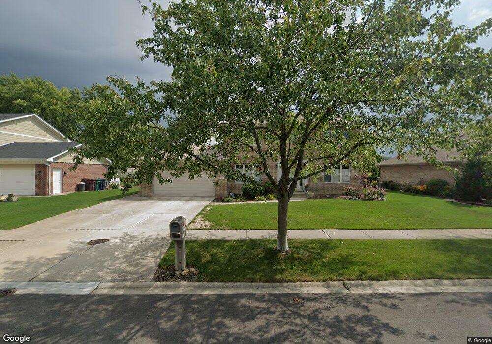
8919 Palos Springs Dr Orland Park, IL 60462
Silver Lake North NeighborhoodEstimated Value: $458,000 - $505,000
3
Beds
3
Baths
2,088
Sq Ft
$231/Sq Ft
Est. Value
About This Home
This home is located at 8919 Palos Springs Dr, Orland Park, IL 60462 and is currently estimated at $482,678, approximately $231 per square foot. 8919 Palos Springs Dr is a home located in Cook County with nearby schools including Palos West Elementary School, Palos South Middle School, and Carl Sandburg High School.
Ownership History
Date
Name
Owned For
Owner Type
Purchase Details
Closed on
Mar 30, 1994
Sold by
Standard Bank & Trust Company
Bought by
Serdiuk Brian and Serdiuk Della
Current Estimated Value
Home Financials for this Owner
Home Financials are based on the most recent Mortgage that was taken out on this home.
Original Mortgage
$203,150
Interest Rate
7.66%
Create a Home Valuation Report for This Property
The Home Valuation Report is an in-depth analysis detailing your home's value as well as a comparison with similar homes in the area
Home Values in the Area
Average Home Value in this Area
Purchase History
| Date | Buyer | Sale Price | Title Company |
|---|---|---|---|
| Serdiuk Brian | $158,000 | -- |
Source: Public Records
Mortgage History
| Date | Status | Borrower | Loan Amount |
|---|---|---|---|
| Closed | Serdiuk Brian | $203,150 |
Source: Public Records
Tax History Compared to Growth
Tax History
| Year | Tax Paid | Tax Assessment Tax Assessment Total Assessment is a certain percentage of the fair market value that is determined by local assessors to be the total taxable value of land and additions on the property. | Land | Improvement |
|---|---|---|---|---|
| 2024 | $9,203 | $41,000 | $7,750 | $33,250 |
| 2023 | $9,877 | $41,000 | $7,750 | $33,250 |
| 2022 | $9,877 | $36,275 | $6,750 | $29,525 |
| 2021 | $9,256 | $36,275 | $6,750 | $29,525 |
| 2020 | $8,952 | $36,275 | $6,750 | $29,525 |
| 2019 | $9,728 | $40,384 | $6,250 | $34,134 |
| 2018 | $9,482 | $40,384 | $6,250 | $34,134 |
| 2017 | $9,263 | $40,384 | $6,250 | $34,134 |
| 2016 | $8,397 | $33,450 | $5,500 | $27,950 |
| 2015 | $8,280 | $33,450 | $5,500 | $27,950 |
| 2014 | $8,204 | $33,450 | $5,500 | $27,950 |
| 2013 | $7,506 | $32,797 | $5,500 | $27,297 |
Source: Public Records
Map
Nearby Homes
- 13411 Westgate Ct
- 8756 Butterfield Ln
- 8841 Briarwood Ln
- 13520 Idlewild Dr
- 13315 Strawberry Ln
- 13550 86th Ave
- 9249 Dunmore Dr
- 8932 Pebble Beach Ln
- 8309 W 132nd St
- 13623 S 84th Ave
- 9590 Southmoor Dr
- 8820 W 140th St Unit 2A
- 12604 S Pawnee Rd
- 9114 W 140th St Unit 204
- 9146 W 140th St Unit 3NE
- 12525 S Pawnee Rd
- 13904 Virginia Ct
- 14040 Boxwood Ln
- 13028 S 82nd Ave
- 12905 S 82nd Ct
- 8913 Palos Springs Dr
- 8925 Palos Springs Dr
- 8920 Butterfield Ln
- 8914 Butterfield Ln
- 8907 Palos Springs Dr
- 8931 Palos Springs Dr
- 8908 Butterfield Ln
- 8924 Palos Springs Dr
- 8918 Palos Springs Dr
- 8912 Palos Springs Dr
- 8926 Butterfield Ln
- 8901 Palos Springs Dr
- 8902 Butterfield Ln
- 8939 Palos Springs Dr
- 13250 Jean Creek Dr
- 8931 Patty Ln
- 8835 Palos Springs Dr
- 8946 Patty Ln
- 8838 Butterfield Ln
- 13244 Jean Creek Dr