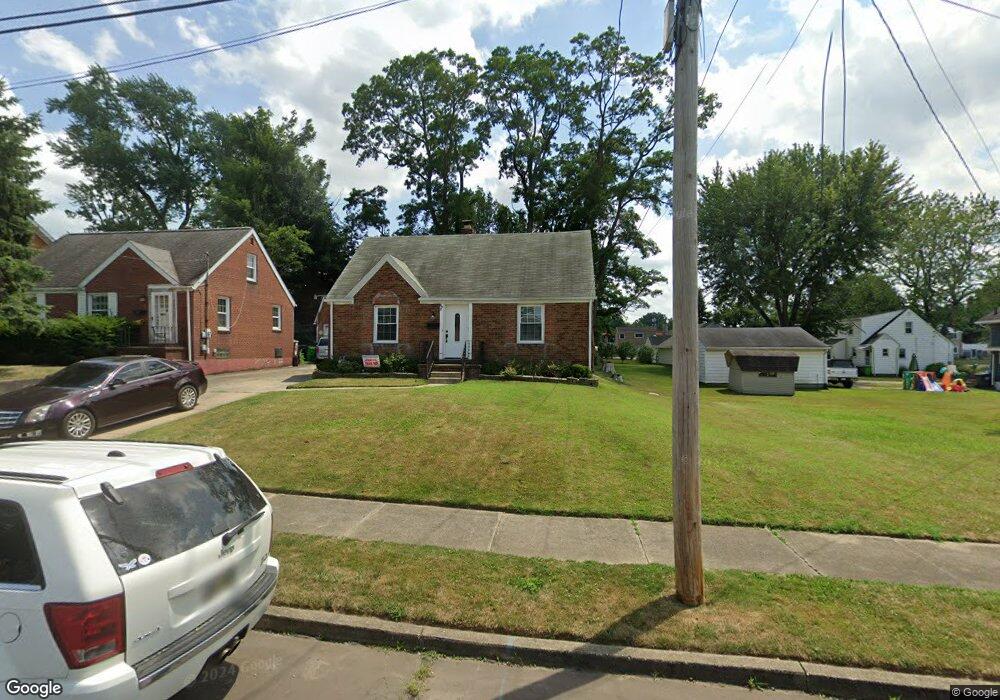
892 Roseland Rd Alliance, OH 44601
Estimated Value: $115,000 - $170,000
3
Beds
2
Baths
1,344
Sq Ft
$104/Sq Ft
Est. Value
About This Home
This home is located at 892 Roseland Rd, Alliance, OH 44601 and is currently estimated at $139,171, approximately $103 per square foot. 892 Roseland Rd is a home located in Stark County with nearby schools including Alliance Early Learning School, Alliance Intermediate School at Northside, and Alliance Middle School.
Ownership History
Date
Name
Owned For
Owner Type
Purchase Details
Closed on
Jan 20, 2017
Sold by
Lalli Veneta J and Lalli Peter J
Bought by
Lawson Angela
Current Estimated Value
Home Financials for this Owner
Home Financials are based on the most recent Mortgage that was taken out on this home.
Original Mortgage
$52,530
Outstanding Balance
$43,302
Interest Rate
4.13%
Mortgage Type
FHA
Estimated Equity
$95,869
Purchase Details
Closed on
Jan 17, 2017
Sold by
Lalli Veneta J and Lalli Peter J
Bought by
Lawson Angela
Home Financials for this Owner
Home Financials are based on the most recent Mortgage that was taken out on this home.
Original Mortgage
$52,530
Outstanding Balance
$43,302
Interest Rate
4.13%
Mortgage Type
FHA
Estimated Equity
$95,869
Purchase Details
Closed on
Feb 10, 1995
Sold by
United National Bank & T
Bought by
Lalli Veneta J
Purchase Details
Closed on
Jul 23, 1991
Create a Home Valuation Report for This Property
The Home Valuation Report is an in-depth analysis detailing your home's value as well as a comparison with similar homes in the area
Home Values in the Area
Average Home Value in this Area
Purchase History
| Date | Buyer | Sale Price | Title Company |
|---|---|---|---|
| Lawson Angela | $53,500 | Diamond Title | |
| Lawson Angela | $53,500 | Diamond Title | |
| Lalli Veneta J | $51,000 | -- | |
| -- | -- | -- |
Source: Public Records
Mortgage History
| Date | Status | Borrower | Loan Amount |
|---|---|---|---|
| Open | Lawson Angela | $52,530 | |
| Closed | Lawson Angela | $52,530 |
Source: Public Records
Tax History Compared to Growth
Tax History
| Year | Tax Paid | Tax Assessment Tax Assessment Total Assessment is a certain percentage of the fair market value that is determined by local assessors to be the total taxable value of land and additions on the property. | Land | Improvement |
|---|---|---|---|---|
| 2025 | -- | $31,820 | $8,720 | $23,100 |
| 2024 | -- | $31,820 | $8,720 | $23,100 |
| 2023 | $1,109 | $27,590 | $6,900 | $20,690 |
| 2022 | $1,116 | $27,590 | $6,900 | $20,690 |
| 2021 | $1,117 | $27,590 | $6,900 | $20,690 |
| 2020 | $1,035 | $23,880 | $5,990 | $17,890 |
| 2019 | $1,021 | $23,880 | $5,990 | $17,890 |
| 2018 | $1,025 | $23,880 | $5,990 | $17,890 |
| 2017 | $494 | $20,060 | $4,660 | $15,400 |
| 2016 | $498 | $20,060 | $4,660 | $15,400 |
| 2015 | $502 | $20,060 | $4,660 | $15,400 |
| 2014 | $470 | $18,840 | $4,380 | $14,460 |
| 2013 | $235 | $18,840 | $4,380 | $14,460 |
Source: Public Records
Map
Nearby Homes
- 884 W College Rd
- 1515 S Rockhill Ave
- 1321 Parkway Blvd
- 2112 Blenheim Ave
- 2050 Federal Ave
- 1201 Overlook Dr
- 738 Kingsway St
- 970 Kingsway St
- 1038 Fairview Place
- 1059 Oakwood Dr
- 896 Parkway Blvd
- 2839 S Rockhill Ave
- 2220 Western Ave
- 112 E College St
- 1475 Chatauqua Ct
- 734 Parkway Blvd
- 725 W Summit St
- 317 E State St
- 645 W Summit St
- 3101 Ridgehill Ave
- 884 Roseland Rd
- 860 Roseland Rd
- 1820 Parkway Blvd
- 1810 Parkway Blvd
- 1830 Parkway Blvd
- 885 Hartshorn St
- 864 Roseland Rd
- 895 Roseland Rd
- 875 Hartshorn St
- 899 Roseland Rd
- 885 Roseland Rd
- 1842 Parkway Blvd
- 1750 Parkway Blvd
- 875 Roseland Rd
- 854 Roseland Rd
- 865 Hartshorn St
- 831 Roseland Rd
- 1732 Parkway Blvd
- 825 Hartshorn St
- 845 Roseland Rd