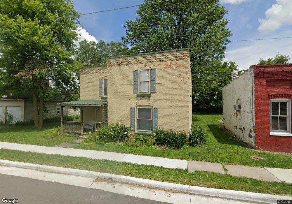
8924 Custar Rd Custar, OH 43511
Estimated Value: $87,677 - $146,000
3
Beds
1
Bath
1,931
Sq Ft
$58/Sq Ft
Est. Value
About This Home
This home is located at 8924 Custar Rd, Custar, OH 43511 and is currently estimated at $111,169, approximately $57 per square foot. 8924 Custar Rd is a home located in Wood County with nearby schools including Bowling Green High School.
Ownership History
Date
Name
Owned For
Owner Type
Purchase Details
Closed on
Jul 11, 2012
Sold by
Globex Capital Llc
Bought by
Mccaig Heather
Current Estimated Value
Home Financials for this Owner
Home Financials are based on the most recent Mortgage that was taken out on this home.
Original Mortgage
$26,400
Outstanding Balance
$3,170
Interest Rate
3.73%
Mortgage Type
Future Advance Clause Open End Mortgage
Estimated Equity
$107,999
Purchase Details
Closed on
Oct 19, 2011
Sold by
Hsbc Mortgage Services Inc
Bought by
Globex Capital Llc
Purchase Details
Closed on
Aug 31, 2011
Sold by
Drew Paul D
Bought by
Hsbc Mortgage Services Inc
Purchase Details
Closed on
Jul 29, 2005
Sold by
Thompson Tim
Bought by
Drew Paul D
Home Financials for this Owner
Home Financials are based on the most recent Mortgage that was taken out on this home.
Original Mortgage
$72,000
Interest Rate
5.71%
Mortgage Type
Fannie Mae Freddie Mac
Purchase Details
Closed on
Sep 17, 1982
Bought by
Richardson Raymond R
Create a Home Valuation Report for This Property
The Home Valuation Report is an in-depth analysis detailing your home's value as well as a comparison with similar homes in the area
Purchase History
| Date | Buyer | Sale Price | Title Company |
|---|---|---|---|
| Mccaig Heather | $33,000 | None Available | |
| Globex Capital Llc | $23,000 | Attorney | |
| Hsbc Mortgage Services Inc | $40,000 | None Available | |
| Drew Paul D | $75,000 | -- | |
| Richardson Raymond R | -- | -- |
Source: Public Records
Mortgage History
| Date | Status | Borrower | Loan Amount |
|---|---|---|---|
| Open | Mccaig Heather | $26,400 | |
| Previous Owner | Drew Paul D | $72,000 |
Source: Public Records
Tax History
| Year | Tax Paid | Tax Assessment Tax Assessment Total Assessment is a certain percentage of the fair market value that is determined by local assessors to be the total taxable value of land and additions on the property. | Land | Improvement |
|---|---|---|---|---|
| 2025 | $1,025 | $21,980 | $1,960 | $20,020 |
| 2024 | $1,019 | $21,980 | $1,960 | $20,020 |
| 2023 | $1,019 | $21,980 | $1,960 | $20,020 |
| 2021 | $835 | $17,190 | $1,330 | $15,860 |
| 2020 | $818 | $17,190 | $1,330 | $15,860 |
| 2019 | $805 | $16,420 | $1,330 | $15,090 |
| 2018 | $801 | $16,420 | $1,330 | $15,090 |
| 2017 | $774 | $16,420 | $1,330 | $15,090 |
| 2016 | $732 | $15,090 | $1,330 | $13,760 |
| 2015 | $732 | $15,090 | $1,330 | $13,760 |
| 2014 | $766 | $15,090 | $1,330 | $13,760 |
| 2013 | $848 | $15,090 | $1,330 | $13,760 |
Source: Public Records
Map
Nearby Homes
- 22759 Defiance Pike
- 21490 Portage Rd
- 24642 Hammansburg Rd Unit 309-0700
- 117 Meadow Ln
- 115 Meadow Ln
- 113 N Meadow Ln
- 116 Meadow Ln
- 119 N Harvest St
- 112 N Harvest Dr
- 121 N Harvest St
- 118 N Harvest Dr
- 120 N Harvest Dr
- 102 N Harvest Dr
- 107 N Harvest St
- 125 N Harvest Dr
- 117 N Harvest St
- 123 N Harvest St
- 104 N Harvest Dr
- 100 N Harvest Dr
- 110 N Harvest Dr
Your Personal Tour Guide
Ask me questions while you tour the home.