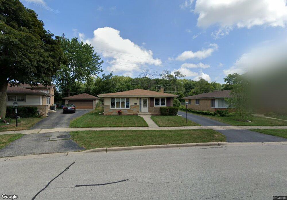
8925 Neenah Ave Morton Grove, IL 60053
Estimated Value: $453,000 - $506,000
3
Beds
3
Baths
1,371
Sq Ft
$344/Sq Ft
Est. Value
About This Home
This home is located at 8925 Neenah Ave, Morton Grove, IL 60053 and is currently estimated at $471,389, approximately $343 per square foot. 8925 Neenah Ave is a home located in Cook County with nearby schools including Hynes Elementary School, Golf Middle School, and Niles North High School.
Ownership History
Date
Name
Owned For
Owner Type
Purchase Details
Closed on
Jul 13, 2001
Sold by
Dimaria Builders & Developers Llc
Bought by
Newcomb Philip C and Newcomb Linda C
Current Estimated Value
Home Financials for this Owner
Home Financials are based on the most recent Mortgage that was taken out on this home.
Original Mortgage
$140,000
Interest Rate
7.22%
Purchase Details
Closed on
Feb 1, 2001
Sold by
Lindenman Elaine E
Bought by
Dimaria Builders & Developers Llc
Create a Home Valuation Report for This Property
The Home Valuation Report is an in-depth analysis detailing your home's value as well as a comparison with similar homes in the area
Home Values in the Area
Average Home Value in this Area
Purchase History
| Date | Buyer | Sale Price | Title Company |
|---|---|---|---|
| Newcomb Philip C | $275,000 | -- | |
| Dimaria Builders & Developers Llc | $140,000 | -- |
Source: Public Records
Mortgage History
| Date | Status | Borrower | Loan Amount |
|---|---|---|---|
| Closed | Newcomb Philip C | $140,000 |
Source: Public Records
Tax History Compared to Growth
Tax History
| Year | Tax Paid | Tax Assessment Tax Assessment Total Assessment is a certain percentage of the fair market value that is determined by local assessors to be the total taxable value of land and additions on the property. | Land | Improvement |
|---|---|---|---|---|
| 2024 | $7,625 | $34,000 | $8,802 | $25,198 |
| 2023 | $7,236 | $34,000 | $8,802 | $25,198 |
| 2022 | $7,236 | $34,000 | $8,802 | $25,198 |
| 2021 | $6,152 | $26,768 | $5,416 | $21,352 |
| 2020 | $6,161 | $26,768 | $5,416 | $21,352 |
| 2019 | $6,245 | $30,077 | $5,416 | $24,661 |
| 2018 | $6,986 | $30,201 | $4,908 | $25,293 |
| 2017 | $7,043 | $30,201 | $4,908 | $25,293 |
| 2016 | $7,157 | $30,201 | $4,908 | $25,293 |
| 2015 | $6,787 | $25,043 | $4,231 | $20,812 |
| 2014 | $6,673 | $25,043 | $4,231 | $20,812 |
| 2013 | $6,541 | $25,043 | $4,231 | $20,812 |
Source: Public Records
Map
Nearby Homes
- 8929 Cherry Ave
- 6638 Hazel St
- 6346 Hennings Ct
- 6344 Hennings Ct
- 6342 Hennings Ct
- 6340 Hennings Ct
- 6712 Maple St
- 6336 Hennings Ct
- 6334 Hennings Ct
- 6338 Hennings Ct
- 6332 Hennings Ct
- 6330 Hennings Ct
- 307 Narragansett Ct
- 9247 Natchez Ave
- 8712 Ferris Ave
- 8650 Ferris Ave Unit 203
- 9244 Newcastle Ave
- 6909 Beckwith Rd
- 6330 Lincoln Ave Unit 2A
- 8620 Waukegan Rd Unit 308
- 8921 Neenah Ave
- 8929 Neenah Ave
- 8917 Neenah Ave
- 8933 Neenah Ave
- 8926 Neenah Ave
- 8937 Neenah Ave Unit 1
- 8922 Neenah Ave
- 8930 Neenah Ave
- 8918 Neenah Ave
- 8941 Neenah Ave Unit 1
- 8933 Nashville Ave
- 8925 Nashville Ave
- 8929 Nashville Ave
- 8921 Nashville Ave Unit 1
- 8945 Neenah Ave Unit 1
- 8937 Nashville Ave
- 8917 Nashville Ave Unit 1
- 8941 Nashville Ave Unit 1
- 8949 Neenah Ave Unit 1
- 8953 Neenah Ave Unit 1