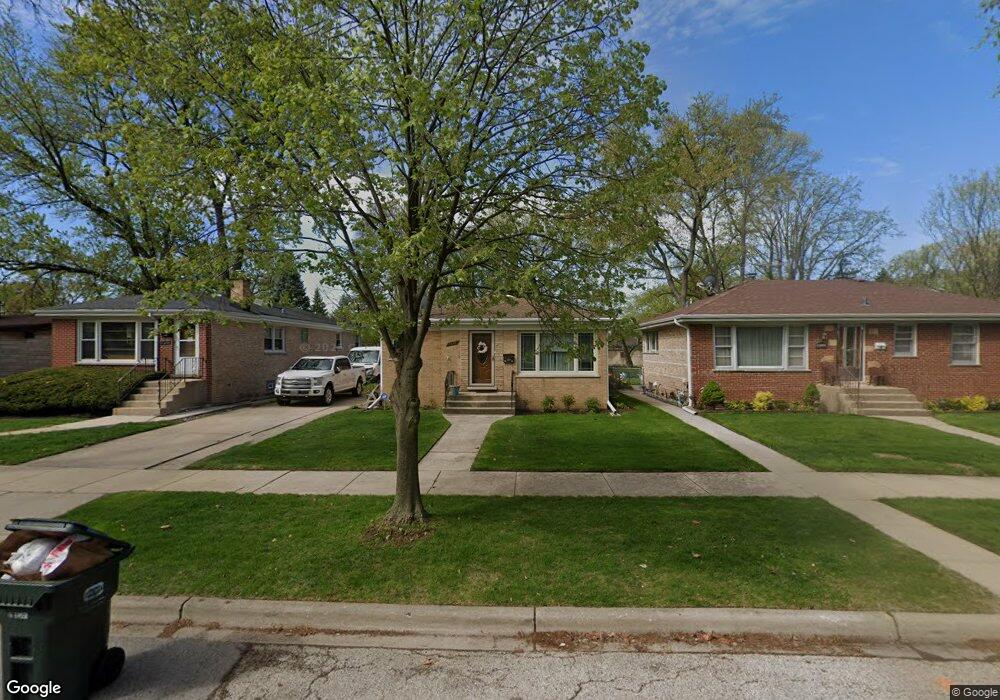
8928 Harms Rd Morton Grove, IL 60053
Estimated Value: $398,000 - $426,000
3
Beds
1
Bath
1,108
Sq Ft
$371/Sq Ft
Est. Value
About This Home
This home is located at 8928 Harms Rd, Morton Grove, IL 60053 and is currently estimated at $410,923, approximately $370 per square foot. 8928 Harms Rd is a home located in Cook County with nearby schools including Park View Elementary School, Niles West High School, and Arie Crown Hebrew Day School.
Ownership History
Date
Name
Owned For
Owner Type
Purchase Details
Closed on
Feb 14, 2013
Sold by
Assets Recovery 23 Llc
Bought by
Cioran Darius
Current Estimated Value
Home Financials for this Owner
Home Financials are based on the most recent Mortgage that was taken out on this home.
Original Mortgage
$138,750
Outstanding Balance
$97,397
Interest Rate
3.5%
Mortgage Type
New Conventional
Estimated Equity
$313,526
Purchase Details
Closed on
Oct 18, 2011
Sold by
Wisniewski Tamara
Bought by
Assets Recovery 23 Llc
Purchase Details
Closed on
Aug 18, 2003
Sold by
Wisniewski Peter G and Wisniewski Tamara
Bought by
Wisniewski Tamara
Home Financials for this Owner
Home Financials are based on the most recent Mortgage that was taken out on this home.
Original Mortgage
$236,000
Interest Rate
8.25%
Mortgage Type
Unknown
Create a Home Valuation Report for This Property
The Home Valuation Report is an in-depth analysis detailing your home's value as well as a comparison with similar homes in the area
Home Values in the Area
Average Home Value in this Area
Purchase History
| Date | Buyer | Sale Price | Title Company |
|---|---|---|---|
| Cioran Darius | $185,000 | Attorneys Title Guaranty Fun | |
| Assets Recovery 23 Llc | -- | None Available | |
| Wisniewski Tamara | -- | Stewart Title |
Source: Public Records
Mortgage History
| Date | Status | Borrower | Loan Amount |
|---|---|---|---|
| Open | Cioran Darius | $138,750 | |
| Previous Owner | Wisniewski Tamara | $236,000 |
Source: Public Records
Tax History Compared to Growth
Tax History
| Year | Tax Paid | Tax Assessment Tax Assessment Total Assessment is a certain percentage of the fair market value that is determined by local assessors to be the total taxable value of land and additions on the property. | Land | Improvement |
|---|---|---|---|---|
| 2024 | $4,152 | $16,035 | $4,063 | $11,972 |
| 2023 | $3,942 | $16,035 | $4,063 | $11,972 |
| 2022 | $3,942 | $16,035 | $4,063 | $11,972 |
| 2021 | $3,255 | $11,812 | $2,500 | $9,312 |
| 2020 | $3,204 | $11,812 | $2,500 | $9,312 |
| 2019 | $3,573 | $14,475 | $2,500 | $11,975 |
| 2018 | $3,103 | $11,550 | $2,265 | $9,285 |
| 2017 | $3,393 | $12,361 | $2,265 | $10,096 |
| 2016 | $3,330 | $12,361 | $2,265 | $10,096 |
| 2015 | $2,930 | $10,405 | $1,953 | $8,452 |
| 2014 | $2,936 | $10,405 | $1,953 | $8,452 |
| 2013 | $2,859 | $10,405 | $1,953 | $8,452 |
Source: Public Records
Map
Nearby Homes
- 5536 Greenwood St
- 5459 Suffield Ct
- 8918 Parkside Ave
- 5352 Greenwood St
- 5449 Arcadia St
- 5346 Suffield Terrace
- 8708 Central Ave
- 8841 Menard Ave
- 8655 Harms Rd
- 5247 Suffield Ct
- 8836 Mansfield Ave
- 5309 Crain St
- 9234 Central Ave
- 8541 Lotus Ave Unit 914
- 5128 Suffield Ct
- 9224 Menard Ave
- 5644 Lyons St
- 5510 Lincoln Ave Unit B301
- 5510 Lincoln Ave Unit B101
- 5506 Lincoln Ave Unit A117