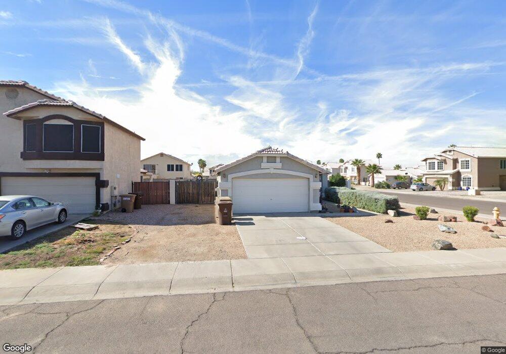
8929 W Anthony Joseph Ln Peoria, AZ 85345
Estimated Value: $302,347 - $375,000
--
Bed
2
Baths
1,299
Sq Ft
$266/Sq Ft
Est. Value
About This Home
This home is located at 8929 W Anthony Joseph Ln, Peoria, AZ 85345 and is currently estimated at $345,837, approximately $266 per square foot. 8929 W Anthony Joseph Ln is a home located in Maricopa County with nearby schools including Cheyenne Elementary School, Peoria High School, and Peoria Accelerated High School.
Ownership History
Date
Name
Owned For
Owner Type
Purchase Details
Closed on
Oct 15, 2015
Sold by
Rosales Joe Jess and Rosales Heidemarie
Bought by
Farah Max
Current Estimated Value
Purchase Details
Closed on
Nov 28, 1994
Sold by
Key Construction Inc
Bought by
Kautman James G
Home Financials for this Owner
Home Financials are based on the most recent Mortgage that was taken out on this home.
Original Mortgage
$98,397
Interest Rate
8.92%
Mortgage Type
FHA
Create a Home Valuation Report for This Property
The Home Valuation Report is an in-depth analysis detailing your home's value as well as a comparison with similar homes in the area
Home Values in the Area
Average Home Value in this Area
Purchase History
| Date | Buyer | Sale Price | Title Company |
|---|---|---|---|
| Farah Max | $189,500 | Great American Title Agency | |
| Kautman James G | $98,950 | Chicago Title Insurance Co |
Source: Public Records
Mortgage History
| Date | Status | Borrower | Loan Amount |
|---|---|---|---|
| Previous Owner | Kautman James G | $98,397 |
Source: Public Records
Tax History Compared to Growth
Tax History
| Year | Tax Paid | Tax Assessment Tax Assessment Total Assessment is a certain percentage of the fair market value that is determined by local assessors to be the total taxable value of land and additions on the property. | Land | Improvement |
|---|---|---|---|---|
| 2025 | $923 | $10,686 | -- | -- |
| 2024 | $933 | $10,177 | -- | -- |
| 2023 | $933 | $25,330 | $5,060 | $20,270 |
| 2022 | $899 | $19,430 | $3,880 | $15,550 |
| 2021 | $948 | $17,620 | $3,520 | $14,100 |
| 2020 | $966 | $16,120 | $3,220 | $12,900 |
| 2019 | $940 | $14,610 | $2,920 | $11,690 |
| 2018 | $912 | $13,400 | $2,680 | $10,720 |
| 2017 | $923 | $11,210 | $2,240 | $8,970 |
| 2016 | $903 | $10,860 | $2,170 | $8,690 |
| 2015 | $853 | $9,800 | $1,960 | $7,840 |
Source: Public Records
Map
Nearby Homes
- 11411 N 91st Ave Unit 235
- 11411 N 91st Ave Unit 75
- 11411 N 91st Ave Unit 114
- 11411 N 91st Ave Unit 195
- 11411 N 91st Ave Unit 139
- 11411 N 91st Ave Unit 143
- 11411 N 91st Ave Unit 28
- 11411 N 91st Ave Unit 218
- 11411 N 91st Ave Unit 221
- 11411 N 91st Ave Unit 225
- 11411 N 91st Ave Unit 188
- 11411 N 91st Ave Unit 80
- 11411 N 91st Ave Unit 87
- 11411 N 91st Ave Unit 215
- 10951 N 91st Ave Unit 120
- 10951 N 91st Ave Unit 266
- 10951 N 91st Ave Unit 84
- 10951 N 91st Ave Unit 177
- 10951 N 91st Ave Unit 158
- 10951 N 91st Ave Unit 263
- 8923 W Anthony Joseph Ln
- 8928 W Jennifer Rose Ct
- 8917 W Anthony Joseph Ln
- 8922 W Jennifer Rose Ct
- 11332 N 89th Dr
- 8916 W Jennifer Rose Ct
- 8930 W Anthony Joseph Ln
- 11336 N 89th Dr
- 8924 W Anthony Joseph Ln
- 11329 N 89th Dr
- 8911 W Anthony Joseph Ln
- 11324 N 89th Dr
- 11340 N 89th Dr
- 8918 W Anthony Joseph Ln
- 11320 N 89th Dr
- 8910 W Jennifer Rose Ct
- 11344 N 89th Dr
- 8912 W Anthony Joseph Ln
- 8905 W Anthony Joseph Ln
- 11316 N 89th Dr