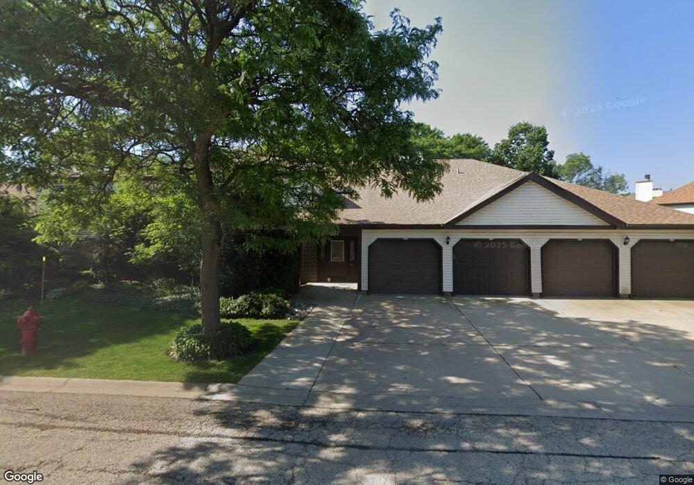
893 Stradford Cir Unit 20C2 Buffalo Grove, IL 60089
South Buffalo Grove NeighborhoodEstimated Value: $219,525 - $251,000
2
Beds
--
Bath
1,000
Sq Ft
$239/Sq Ft
Est. Value
About This Home
This home is located at 893 Stradford Cir Unit 20C2, Buffalo Grove, IL 60089 and is currently estimated at $238,881, approximately $238 per square foot. 893 Stradford Cir Unit 20C2 is a home located in Cook County with nearby schools including Henry W Longfellow Elementary School, Cooper Middle School, and Buffalo Grove High School.
Ownership History
Date
Name
Owned For
Owner Type
Purchase Details
Closed on
Jun 25, 2021
Sold by
Ostertag Michael P and Schieber Heidi A
Bought by
Salinas Ramon and Salinas Maria
Current Estimated Value
Purchase Details
Closed on
May 12, 2006
Sold by
Campbell Scott and Schmidt Cheryl L
Bought by
Ostertag Michael P and Schieber Heidi A
Home Financials for this Owner
Home Financials are based on the most recent Mortgage that was taken out on this home.
Original Mortgage
$180,000
Interest Rate
6.56%
Mortgage Type
Fannie Mae Freddie Mac
Purchase Details
Closed on
Jan 31, 2000
Sold by
Schmidt Cheryl L
Bought by
Campbell Scott and Schmidt Cheryl L
Create a Home Valuation Report for This Property
The Home Valuation Report is an in-depth analysis detailing your home's value as well as a comparison with similar homes in the area
Home Values in the Area
Average Home Value in this Area
Purchase History
| Date | Buyer | Sale Price | Title Company |
|---|---|---|---|
| Salinas Ramon | $160,000 | Alliance Title Corporation | |
| Ostertag Michael P | $180,000 | Atgf Inc | |
| Campbell Scott | -- | -- |
Source: Public Records
Mortgage History
| Date | Status | Borrower | Loan Amount |
|---|---|---|---|
| Previous Owner | Ostertag Michael P | $180,000 |
Source: Public Records
Tax History Compared to Growth
Tax History
| Year | Tax Paid | Tax Assessment Tax Assessment Total Assessment is a certain percentage of the fair market value that is determined by local assessors to be the total taxable value of land and additions on the property. | Land | Improvement |
|---|---|---|---|---|
| 2024 | $4,713 | $14,725 | $2,388 | $12,337 |
| 2023 | $4,534 | $14,725 | $2,388 | $12,337 |
| 2022 | $4,534 | $14,725 | $2,388 | $12,337 |
| 2021 | $3,098 | $12,100 | $331 | $11,769 |
| 2020 | $3,093 | $12,100 | $331 | $11,769 |
| 2019 | $3,090 | $13,411 | $331 | $13,080 |
| 2018 | $2,626 | $11,061 | $265 | $10,796 |
| 2017 | $2,598 | $11,061 | $265 | $10,796 |
| 2016 | $2,690 | $11,061 | $265 | $10,796 |
| 2015 | $2,705 | $10,586 | $1,127 | $9,459 |
| 2014 | $2,679 | $10,586 | $1,127 | $9,459 |
| 2013 | $2,457 | $10,586 | $1,127 | $9,459 |
Source: Public Records
Map
Nearby Homes
- 813 Stradford Cir Unit 21B2
- 780 Weidner Rd Unit 300
- 859 Beechwood Rd
- 820 Weidner Rd Unit 409
- 720 Weidner Rd Unit 302
- 535 Estate Dr
- 671 Hapsfield Ln Unit 105
- 410 Chatham Cir
- 408 Indian Hill Dr
- 921 Bernard Dr
- 329 Timber Hill Rd
- 18 E Heritage Ct
- 1115 Miller Ln Unit 104
- 1127 Miller Ln Unit 107
- 972 Thornton Ln Unit 102
- 705 Grove Dr Unit 101
- 455 Mayfair Ln
- 1130 Bernard Dr
- 3300 N Carriageway Dr Unit 317
- 1149 Miller Ln Unit 107
- 895 Stradford Cir Unit 20A3
- 891 Stradford Cir Unit 20C1
- 897 Stradford Cir Unit 20A4
- 887 Stradford Cir Unit 20B2
- 885 Stradford Cir Unit 20B1
- 883 Stradford Cir Unit 20A2
- 881 Stradford Cir Unit 20A1
- 703 Weidner Rd Unit 22A2
- 705 Weidner Rd Unit 22B1
- 705 Weidner Rd Unit 705
- 707 Weidner Rd Unit 22B2
- 701 Weidner Rd Unit 22A1
- 913 Stradford Cir Unit 19C2
- 915 Stradford Cir Unit 19D1
- 911 Stradford Cir Unit 19C1
- 715 Weidner Rd Unit 22A3
- 917 Stradford Cir Unit 19D2
- 711 Weidner Rd Unit 22C1
- 717 Weidner Rd Unit 22A4
- 717 Weidner Rd Unit 717