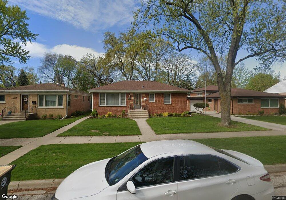
8930 Harms Rd Morton Grove, IL 60053
Estimated Value: $443,877 - $512,000
4
Beds
2
Baths
1,480
Sq Ft
$323/Sq Ft
Est. Value
About This Home
This home is located at 8930 Harms Rd, Morton Grove, IL 60053 and is currently estimated at $477,969, approximately $322 per square foot. 8930 Harms Rd is a home located in Cook County with nearby schools including Park View Elementary School, Niles West High School, and Arie Crown Hebrew Day School.
Create a Home Valuation Report for This Property
The Home Valuation Report is an in-depth analysis detailing your home's value as well as a comparison with similar homes in the area
Home Values in the Area
Average Home Value in this Area
Tax History Compared to Growth
Tax History
| Year | Tax Paid | Tax Assessment Tax Assessment Total Assessment is a certain percentage of the fair market value that is determined by local assessors to be the total taxable value of land and additions on the property. | Land | Improvement |
|---|---|---|---|---|
| 2024 | $4,356 | $18,066 | $4,063 | $14,003 |
| 2023 | $2,138 | $18,066 | $4,063 | $14,003 |
| 2022 | $2,138 | $18,066 | $4,063 | $14,003 |
| 2021 | $2,426 | $12,727 | $2,500 | $10,227 |
| 2020 | $2,200 | $12,727 | $2,500 | $10,227 |
| 2019 | $2,180 | $14,300 | $2,500 | $11,800 |
| 2018 | $2,462 | $14,635 | $2,265 | $12,370 |
| 2017 | $2,437 | $14,635 | $2,265 | $12,370 |
| 2016 | $2,748 | $14,635 | $2,265 | $12,370 |
| 2015 | $3,105 | $11,911 | $1,953 | $9,958 |
| 2014 | $3,037 | $11,911 | $1,953 | $9,958 |
| 2013 | $3,038 | $11,911 | $1,953 | $9,958 |
Source: Public Records
Map
Nearby Homes
- 5536 Greenwood St
- 5459 Suffield Ct
- 8918 Parkside Ave
- 5449 Arcadia St
- 5352 Greenwood St
- 5346 Suffield Terrace
- 5317 Suffield Ct
- 5247 Suffield Ct
- 8841 Menard Ave
- 8708 Central Ave
- 9234 Central Ave
- 8655 Harms Rd
- 8836 Mansfield Ave
- 5309 Crain St
- 5644 Lyons St
- 9224 Menard Ave
- 5128 Suffield Ct
- 8717 Gross Point Rd
- 9314 Menard Ave
- 9320 Menard Ave