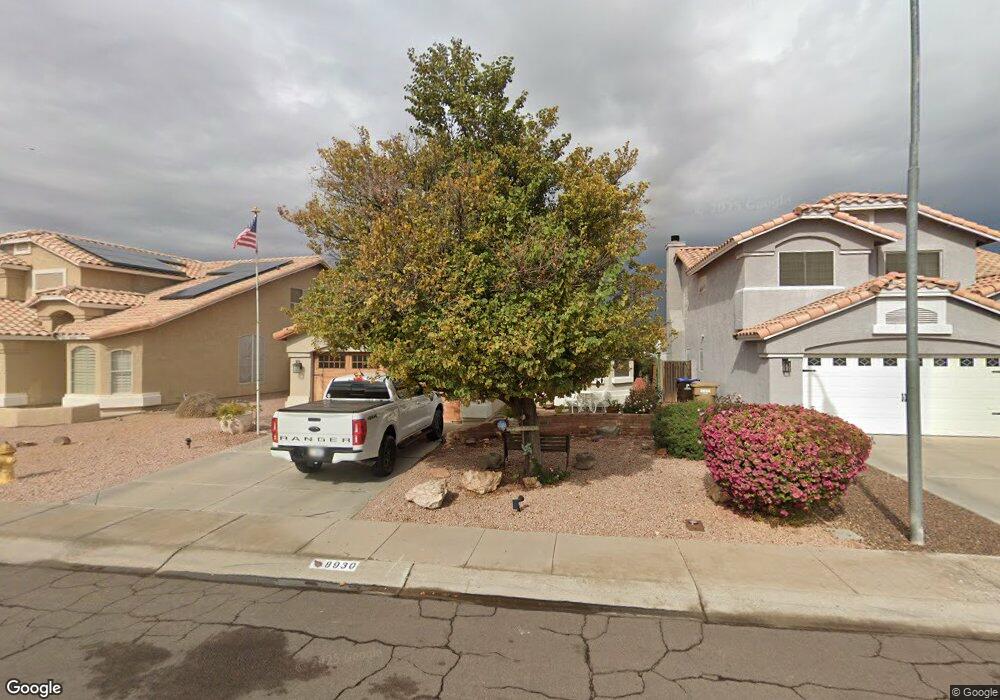
8930 W Lockland Ct Peoria, AZ 85382
Arrowhead NeighborhoodEstimated Value: $335,375 - $409,000
--
Bed
3
Baths
1,518
Sq Ft
$254/Sq Ft
Est. Value
About This Home
This home is located at 8930 W Lockland Ct, Peoria, AZ 85382 and is currently estimated at $384,844, approximately $253 per square foot. 8930 W Lockland Ct is a home located in Maricopa County with nearby schools including Desert Harbor Elementary School, Centennial High School, and Sonoran Science Academy-Peoria.
Ownership History
Date
Name
Owned For
Owner Type
Purchase Details
Closed on
Apr 27, 2015
Sold by
Benjamin Darrell F and Benjamin Nancy L
Bought by
The Benjamin Family Living Trust and Benjamin Nancy L
Current Estimated Value
Purchase Details
Closed on
May 9, 1994
Sold by
Continental Homes Inc
Bought by
Benjamin Darrell F and Benjamin Nancy L
Home Financials for this Owner
Home Financials are based on the most recent Mortgage that was taken out on this home.
Original Mortgage
$71,200
Interest Rate
8.1%
Mortgage Type
New Conventional
Create a Home Valuation Report for This Property
The Home Valuation Report is an in-depth analysis detailing your home's value as well as a comparison with similar homes in the area
Home Values in the Area
Average Home Value in this Area
Purchase History
| Date | Buyer | Sale Price | Title Company |
|---|---|---|---|
| The Benjamin Family Living Trust | -- | None Available | |
| Benjamin Darrell F | $91,230 | First American Title |
Source: Public Records
Mortgage History
| Date | Status | Borrower | Loan Amount |
|---|---|---|---|
| Closed | Benjamin Darrell F | $71,200 |
Source: Public Records
Tax History Compared to Growth
Tax History
| Year | Tax Paid | Tax Assessment Tax Assessment Total Assessment is a certain percentage of the fair market value that is determined by local assessors to be the total taxable value of land and additions on the property. | Land | Improvement |
|---|---|---|---|---|
| 2025 | $1,376 | $17,328 | -- | -- |
| 2024 | $1,353 | $16,502 | -- | -- |
| 2023 | $1,353 | $28,860 | $5,770 | $23,090 |
| 2022 | $1,324 | $22,310 | $4,460 | $17,850 |
| 2021 | $1,416 | $20,450 | $4,090 | $16,360 |
| 2020 | $1,430 | $19,100 | $3,820 | $15,280 |
| 2019 | $1,385 | $17,360 | $3,470 | $13,890 |
| 2018 | $1,330 | $16,200 | $3,240 | $12,960 |
| 2017 | $1,331 | $14,780 | $2,950 | $11,830 |
| 2016 | $1,294 | $14,030 | $2,800 | $11,230 |
| 2015 | $1,229 | $13,010 | $2,600 | $10,410 |
Source: Public Records
Map
Nearby Homes
- 16251 N 91st Dr
- 8809 W Sandra Terrace
- 9235 W Marconi Ave
- 8653 W Paradise Ln
- 9002 W Caribbean Ln
- 16017 N Nicklaus Ln
- 8630 W Marconi Ave
- 8640 W Mauro Ln
- 16414 N Meadow Park Dr
- 15360 N 87th Ave
- 15211 N 89th Ave
- 9151 W Greenway Rd Unit 288
- 16801 N Pine Valley Dr
- 15099 N 89th Ave
- 15430 N Bowling Green Dr
- 16832 N Pine Valley Dr
- 15406 N Bowling Green Dr
- 9326 W Briarwood Cir
- 15088 N 85th Dr
- 8849 W Port Royale Ln
- 8934 W Lockland Ct Unit 1
- 8922 W Lockland Ct
- 8938 W Lockland Ct
- 8929 W Davis Rd
- 8925 W Davis Rd
- 8933 W Davis Rd
- 8918 W Lockland Ct
- 8921 W Davis Rd
- 8937 W Davis Rd
- 8937 W Lockland Ct
- 8942 W Lockland Ct
- 8917 W Davis Rd
- 8914 W Lockland Ct
- 8917 W Lockland Ct
- 8941 W Davis Rd
- 8913 W Davis Rd
- 8946 W Lockland Ct
- 8933 W Lockland Ct
- 8941 W Lockland Ct
- 8921 W Lockland Ct