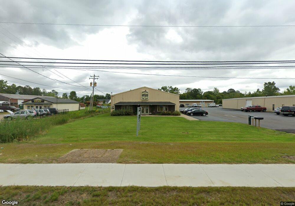
8932 State Route 14 Streetsboro, OH 44241
--
Bed
2
Baths
7,380
Sq Ft
0.76
Acres
About This Home
This home is located at 8932 State Route 14, Streetsboro, OH 44241. 8932 State Route 14 is a home located in Portage County with nearby schools including Streetsboro High School and Crossroads Christian Academy.
Ownership History
Date
Name
Owned For
Owner Type
Purchase Details
Closed on
Jan 9, 2020
Sold by
Lorandy Group Llc
Bought by
The City Of Streetsboro
Purchase Details
Closed on
Jun 20, 2016
Sold by
Mcgee Enterprise Llc
Bought by
The Lorandy Group Llc
Home Financials for this Owner
Home Financials are based on the most recent Mortgage that was taken out on this home.
Original Mortgage
$487,500
Interest Rate
3.6%
Mortgage Type
Commercial
Purchase Details
Closed on
Aug 3, 2011
Sold by
Walter Gary D and Walter Randy D
Bought by
Mcgee Enterprises Llc
Purchase Details
Closed on
May 16, 2008
Sold by
Estate Of Donald L Walter
Bought by
Walter Gary D and Walter Randy D
Purchase Details
Closed on
Sep 24, 1990
Bought by
Walter Donald L
Create a Home Valuation Report for This Property
The Home Valuation Report is an in-depth analysis detailing your home's value as well as a comparison with similar homes in the area
Home Values in the Area
Average Home Value in this Area
Purchase History
| Date | Buyer | Sale Price | Title Company |
|---|---|---|---|
| The City Of Streetsboro | $3,100 | None Available | |
| The Lorandy Group Llc | $613,000 | None Available | |
| Mcgee Enterprises Llc | $235,000 | Attorney | |
| Walter Gary D | -- | None Available | |
| Walter Donald L | $160,000 | -- |
Source: Public Records
Mortgage History
| Date | Status | Borrower | Loan Amount |
|---|---|---|---|
| Previous Owner | The Lorandy Group Llc | $487,500 |
Source: Public Records
Tax History Compared to Growth
Tax History
| Year | Tax Paid | Tax Assessment Tax Assessment Total Assessment is a certain percentage of the fair market value that is determined by local assessors to be the total taxable value of land and additions on the property. | Land | Improvement |
|---|---|---|---|---|
| 2024 | $5,788 | $104,720 | $26,460 | $78,260 |
| 2023 | $5,422 | $81,770 | $22,160 | $59,610 |
| 2022 | $5,457 | $81,770 | $22,160 | $59,610 |
| 2021 | $5,538 | $81,770 | $22,160 | $59,610 |
| 2020 | $5,482 | $81,450 | $21,840 | $59,610 |
| 2019 | $5,517 | $81,450 | $21,840 | $59,610 |
| 2018 | $4,463 | $75,460 | $20,230 | $55,230 |
| 2017 | $4,463 | $75,460 | $20,230 | $55,230 |
| 2016 | $4,476 | $75,460 | $20,230 | $55,230 |
| 2015 | $4,492 | $75,460 | $20,230 | $55,230 |
| 2014 | $4,559 | $75,460 | $20,230 | $55,230 |
| 2013 | $4,536 | $75,460 | $20,230 | $55,230 |
Source: Public Records
Map
Nearby Homes
- V/L State Route 14
- 1648 Maple View Ct
- 8807 Kelly Ln
- 9244 Lakeside Dr
- 9012 Patriot Dr
- 9018 Patriot Dr
- 1446 Trader Dr Unit H5
- 1440 Trader Dr
- 1489 Crescent Dr
- 1654 Leslie Dr
- 1678 Duncan Way
- 1675 Duncan Way
- 1448 Jude Ave
- 9315 June Dr
- 1490 Evergreen Dr
- 9495 Nita Ln
- 1725 Pike Pkwy
- 1516 Gillie Dr
- 1405 Gillie Dr
- 1280 Shawnee Trail
- 8932 Ohio 14
- 8936 State Route 14 Unit B or C
- 8936 State Route 14 Unit D
- 8936 State Route 14 Unit C
- 8936 State Route 14 Unit B
- 8936 State Route 14 Unit A
- 8919 State Route 14
- 8938 State Route 14
- 8929 State Route 14 Unit D
- 8929 State Route 14 Unit B
- 8929 State Route 14 Unit 1
- 8976 State Route 14
- 8973 Wiencek Rd
- 1838 Annalane Dr
- 8987 Wiencek Rd
- 8997 Wiencek Rd
- 8984 Wiencek Rd
- 9007 Wiencek Rd
- 1856 Annalane Dr
- 8998 Wiencek Rd