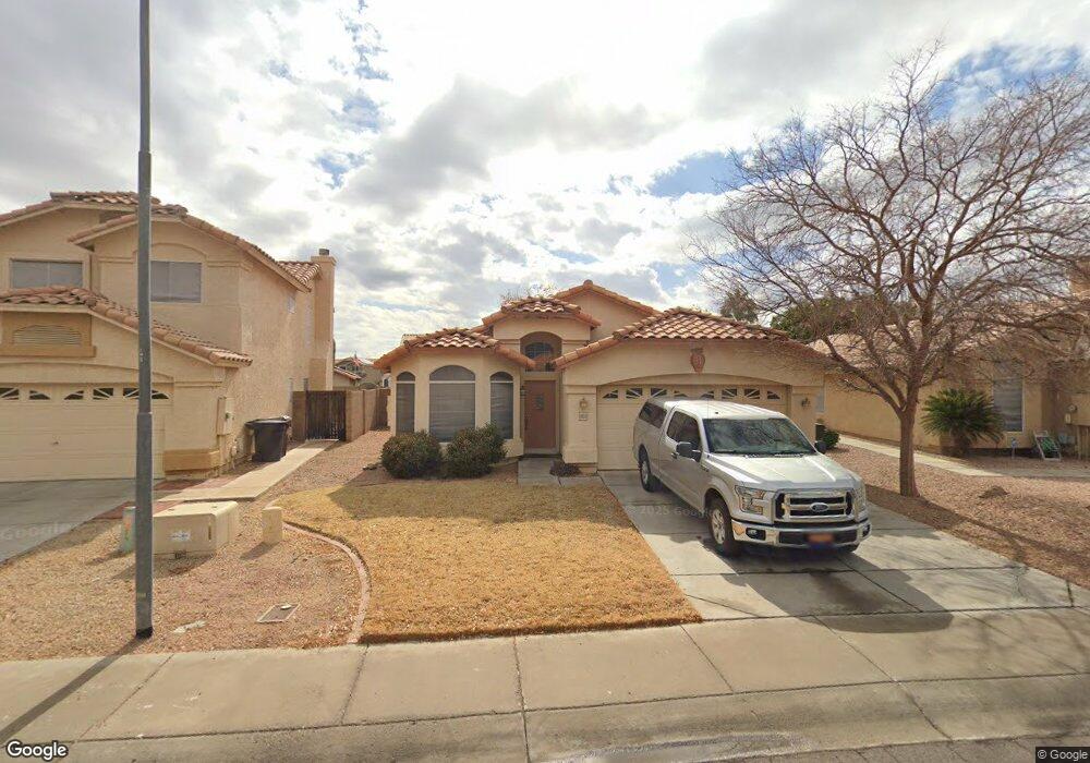
8933 W Davis Rd Peoria, AZ 85382
Arrowhead NeighborhoodEstimated Value: $346,355 - $414,000
--
Bed
3
Baths
1,670
Sq Ft
$236/Sq Ft
Est. Value
About This Home
This home is located at 8933 W Davis Rd, Peoria, AZ 85382 and is currently estimated at $394,339, approximately $236 per square foot. 8933 W Davis Rd is a home located in Maricopa County with nearby schools including Desert Harbor Elementary School, Centennial High School, and Sonoran Science Academy-Peoria.
Ownership History
Date
Name
Owned For
Owner Type
Purchase Details
Closed on
Mar 30, 2001
Sold by
Aguilar Walter and Aguilar Maria Jesus
Bought by
Miller Mark L and Keefe Katherine E
Current Estimated Value
Home Financials for this Owner
Home Financials are based on the most recent Mortgage that was taken out on this home.
Original Mortgage
$123,500
Outstanding Balance
$45,391
Interest Rate
6.98%
Mortgage Type
New Conventional
Estimated Equity
$348,948
Purchase Details
Closed on
Sep 10, 1998
Sold by
Aguilar Maria Jesus
Bought by
Aguilar Walter and Aguilar Maria Jesus
Home Financials for this Owner
Home Financials are based on the most recent Mortgage that was taken out on this home.
Original Mortgage
$20,000
Interest Rate
6.92%
Create a Home Valuation Report for This Property
The Home Valuation Report is an in-depth analysis detailing your home's value as well as a comparison with similar homes in the area
Home Values in the Area
Average Home Value in this Area
Purchase History
| Date | Buyer | Sale Price | Title Company |
|---|---|---|---|
| Miller Mark L | $130,000 | Security Title Agency | |
| Aguilar Walter | -- | Ati Title Agency |
Source: Public Records
Mortgage History
| Date | Status | Borrower | Loan Amount |
|---|---|---|---|
| Open | Miller Mark L | $123,500 | |
| Previous Owner | Aguilar Walter | $20,000 |
Source: Public Records
Tax History Compared to Growth
Tax History
| Year | Tax Paid | Tax Assessment Tax Assessment Total Assessment is a certain percentage of the fair market value that is determined by local assessors to be the total taxable value of land and additions on the property. | Land | Improvement |
|---|---|---|---|---|
| 2025 | $1,460 | $18,381 | -- | -- |
| 2024 | $1,435 | $17,506 | -- | -- |
| 2023 | $1,435 | $30,160 | $6,030 | $24,130 |
| 2022 | $1,405 | $23,400 | $4,680 | $18,720 |
| 2021 | $1,502 | $21,460 | $4,290 | $17,170 |
| 2020 | $1,517 | $20,110 | $4,020 | $16,090 |
| 2019 | $1,469 | $18,320 | $3,660 | $14,660 |
| 2018 | $1,410 | $17,160 | $3,430 | $13,730 |
| 2017 | $1,412 | $15,720 | $3,140 | $12,580 |
| 2016 | $1,397 | $14,910 | $2,980 | $11,930 |
| 2015 | $1,304 | $13,800 | $2,760 | $11,040 |
Source: Public Records
Map
Nearby Homes
- 16251 N 91st Dr
- 8809 W Sandra Terrace
- 9235 W Marconi Ave
- 8653 W Paradise Ln
- 9002 W Caribbean Ln
- 16017 N Nicklaus Ln
- 8630 W Marconi Ave
- 8640 W Mauro Ln
- 16414 N Meadow Park Dr
- 15360 N 87th Ave
- 15211 N 89th Ave
- 9151 W Greenway Rd Unit 288
- 16801 N Pine Valley Dr
- 15099 N 89th Ave
- 15430 N Bowling Green Dr
- 16832 N Pine Valley Dr
- 15406 N Bowling Green Dr
- 9326 W Briarwood Cir
- 15088 N 85th Dr
- 8849 W Port Royale Ln
- 8937 W Davis Rd
- 8929 W Davis Rd
- 8925 W Davis Rd
- 8941 W Davis Rd
- 8934 W Lockland Ct Unit 1
- 8938 W Lockland Ct
- 8930 W Lockland Ct
- 8942 W Lockland Ct
- 8921 W Davis Rd
- 16107 N 90th Ave
- 8946 W Lockland Ct
- 8928 W Davis Rd
- 8922 W Lockland Ct
- 8917 W Davis Rd
- 16115 N 90th Ave
- 8924 W Davis Rd
- 8918 W Lockland Ct
- 8913 W Davis Rd
- 16123 N 90th Ave
- 16036 N 90th Ave