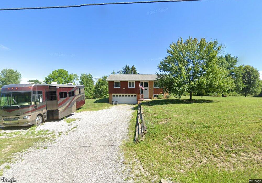
8933 Yale Rd Diamond, OH 44412
Estimated Value: $192,133 - $287,000
3
Beds
1
Bath
1,559
Sq Ft
$155/Sq Ft
Est. Value
About This Home
This home is located at 8933 Yale Rd, Diamond, OH 44412 and is currently estimated at $242,033, approximately $155 per square foot. 8933 Yale Rd is a home located in Portage County with nearby schools including Southeast High School.
Ownership History
Date
Name
Owned For
Owner Type
Purchase Details
Closed on
Sep 19, 2019
Sold by
Howe Renee C
Bought by
Sworak Peter V and Sworak Karen J
Current Estimated Value
Home Financials for this Owner
Home Financials are based on the most recent Mortgage that was taken out on this home.
Original Mortgage
$84,000
Outstanding Balance
$72,767
Interest Rate
3.6%
Mortgage Type
New Conventional
Estimated Equity
$169,266
Purchase Details
Closed on
Jul 26, 2019
Sold by
Howe Aboul Renee C and Aboul Ali
Bought by
Howe Renee C
Home Financials for this Owner
Home Financials are based on the most recent Mortgage that was taken out on this home.
Original Mortgage
$84,000
Outstanding Balance
$72,767
Interest Rate
3.6%
Mortgage Type
New Conventional
Estimated Equity
$169,266
Purchase Details
Closed on
Jun 18, 2010
Sold by
Reese Ray T and Reese Patricia A
Bought by
Aboul Ali M and Howe Aboul Renee C
Home Financials for this Owner
Home Financials are based on the most recent Mortgage that was taken out on this home.
Original Mortgage
$98,671
Interest Rate
4.87%
Mortgage Type
FHA
Purchase Details
Closed on
Oct 9, 2007
Sold by
Reese Patricia A
Bought by
Reese Patricia A and Reese Ray T
Purchase Details
Closed on
Jun 20, 2007
Sold by
Estate Of Herbert C Mcgovern
Bought by
Reese Patricia A and Roby Patricia A
Purchase Details
Closed on
Jan 1, 1990
Bought by
Mcgovern Hubert
Create a Home Valuation Report for This Property
The Home Valuation Report is an in-depth analysis detailing your home's value as well as a comparison with similar homes in the area
Purchase History
| Date | Buyer | Sale Price | Title Company |
|---|---|---|---|
| Sworak Peter V | $112,000 | Bennett Land Title Agency | |
| Howe Renee C | -- | None Available | |
| Howe Renee C | -- | None Available | |
| Howe Renee C | -- | None Available | |
| Aboul Ali M | $100,000 | Bennett Land Title Agency | |
| Reese Patricia A | -- | Attorney | |
| Reese Patricia A | -- | None Available | |
| Mcgovern Herbert C | -- | None Available | |
| Mcgovern Hubert | -- | -- |
Source: Public Records
Mortgage History
| Date | Status | Borrower | Loan Amount |
|---|---|---|---|
| Open | Sworak Peter V | $84,000 | |
| Closed | Aboul Ali M | $98,671 |
Source: Public Records
Tax History
| Year | Tax Paid | Tax Assessment Tax Assessment Total Assessment is a certain percentage of the fair market value that is determined by local assessors to be the total taxable value of land and additions on the property. | Land | Improvement |
|---|---|---|---|---|
| 2025 | $2,102 | $56,530 | $9,280 | $47,250 |
| 2024 | $2,054 | $56,530 | $9,280 | $47,250 |
| 2023 | $1,617 | $40,180 | $6,790 | $33,390 |
| 2022 | $1,679 | $40,180 | $6,790 | $33,390 |
| 2021 | $1,693 | $40,180 | $6,790 | $33,390 |
| 2020 | $1,455 | $33,080 | $6,790 | $26,290 |
| 2019 | $1,424 | $33,080 | $6,790 | $26,290 |
| 2018 | $1,414 | $30,660 | $6,790 | $23,870 |
| 2017 | $1,401 | $30,660 | $6,790 | $23,870 |
| 2016 | $1,396 | $30,660 | $6,790 | $23,870 |
| 2015 | $1,338 | $30,660 | $6,790 | $23,870 |
| 2014 | $1,364 | $30,660 | $6,790 | $23,870 |
| 2013 | $1,350 | $30,660 | $6,790 | $23,870 |
Source: Public Records
Map
Nearby Homes
- 0 Yale Rd Unit 5190725
- 3207 Prairie Cir
- 2434 Taft Ave
- 3609 State Route 225
- 00 Ohio 14
- 1731 Ohio 225
- 700 Stillwater Dr
- 8464 & 8446 Tallmadge Rd
- 8492 & 8476 Tallmadge Rd
- 0 Ohio 225 Unit 5174573
- 4133 State Route 225
- 9865 Tallmadge Rd
- 3545 Porter Rd
- 1071 State Route 14
- 941 Porter Rd
- 3686 Jones Rd
- 9672 Whippoorwill Rd
- 0 Wayland Rd Unit 5191883
- 0 Mahoning Rd
- 717 Bandy Rd
- 81 Yale Rd
- 0 Lot Y4 Yale
- 0 Lot Y2 Yale
- 0 Lot M1 Yale
- 0 Lot Y3 Yale
- 81 V/L Yale Rd
- 8959 Yale Rd
- 2689 Wayland Rd
- 2750 Wayland Rd
- 2743 Wayland Rd
- 0 Yale Rd Unit 1139646
- 0 Yale Rd Unit 1071931
- 0 Yale Rd Unit 1071898
- 0 Yale Rd Unit 1120200
- 0 Yale Rd Unit 1116756
- 0 Yale Rd Unit 1112031
- 0 Yale Rd Unit 1115647
- 0 Yale Rd Unit 1115651
- 0 Yale Rd Unit 1112025
- 0 Yale Rd Unit 1112249
Your Personal Tour Guide
Ask me questions while you tour the home.