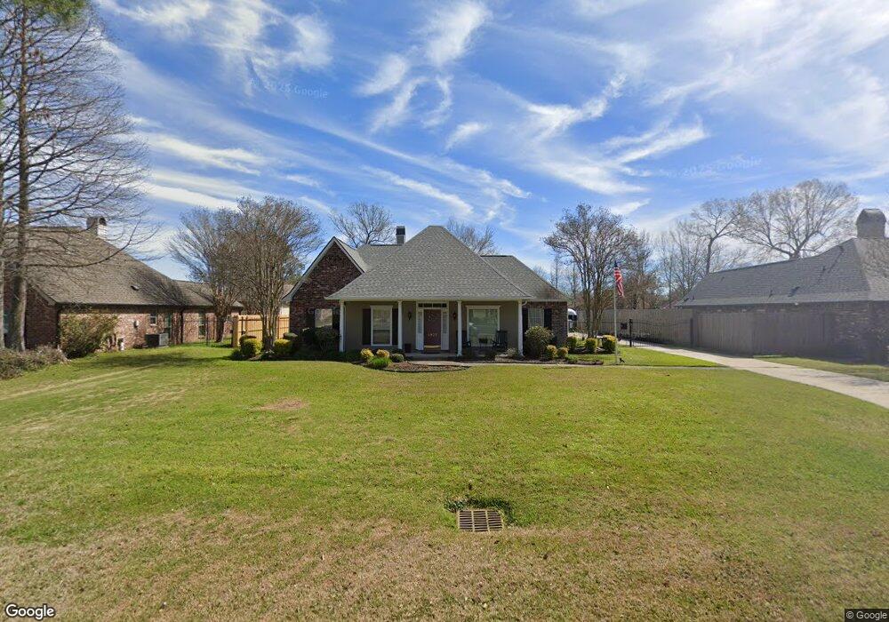
8937 Smoke Rock Dr Baton Rouge, LA 70817
Estimated Value: $313,598 - $353,000
3
Beds
2
Baths
1,987
Sq Ft
$167/Sq Ft
Est. Value
About This Home
This home is located at 8937 Smoke Rock Dr, Baton Rouge, LA 70817 and is currently estimated at $332,650, approximately $167 per square foot. 8937 Smoke Rock Dr is a home located in East Baton Rouge Parish with nearby schools including Woodlawn Elementary School, Woodlawn Middle School, and Woodlawn High School.
Ownership History
Date
Name
Owned For
Owner Type
Purchase Details
Closed on
Aug 5, 2005
Sold by
Kadair Michael J
Bought by
Keith Wilbur D
Current Estimated Value
Home Financials for this Owner
Home Financials are based on the most recent Mortgage that was taken out on this home.
Original Mortgage
$165,600
Outstanding Balance
$86,376
Interest Rate
5.55%
Mortgage Type
New Conventional
Estimated Equity
$246,274
Purchase Details
Closed on
Dec 10, 2004
Sold by
Gravois Walter
Bought by
Kadir Michael
Home Financials for this Owner
Home Financials are based on the most recent Mortgage that was taken out on this home.
Original Mortgage
$139,300
Interest Rate
5.64%
Mortgage Type
New Conventional
Create a Home Valuation Report for This Property
The Home Valuation Report is an in-depth analysis detailing your home's value as well as a comparison with similar homes in the area
Home Values in the Area
Average Home Value in this Area
Purchase History
| Date | Buyer | Sale Price | Title Company |
|---|---|---|---|
| Keith Wilbur D | $207,000 | -- | |
| Kadir Michael | $199,000 | -- |
Source: Public Records
Mortgage History
| Date | Status | Borrower | Loan Amount |
|---|---|---|---|
| Open | Keith Wilbur D | $165,600 | |
| Previous Owner | Kadir Michael | $139,300 |
Source: Public Records
Tax History Compared to Growth
Tax History
| Year | Tax Paid | Tax Assessment Tax Assessment Total Assessment is a certain percentage of the fair market value that is determined by local assessors to be the total taxable value of land and additions on the property. | Land | Improvement |
|---|---|---|---|---|
| 2024 | $2,668 | $30,610 | $3,000 | $27,610 |
| 2023 | $2,680 | $25,610 | $3,000 | $22,610 |
| 2022 | $2,905 | $25,610 | $3,000 | $22,610 |
| 2021 | $2,849 | $25,610 | $3,000 | $22,610 |
| 2020 | $2,886 | $25,610 | $3,000 | $22,610 |
| 2019 | $2,660 | $22,650 | $3,000 | $19,650 |
| 2018 | $2,626 | $22,650 | $3,000 | $19,650 |
| 2017 | $2,626 | $22,650 | $3,000 | $19,650 |
| 2016 | $1,722 | $22,650 | $3,000 | $19,650 |
| 2015 | $1,504 | $20,700 | $3,000 | $17,700 |
| 2014 | $1,472 | $20,700 | $3,000 | $17,700 |
| 2013 | -- | $20,700 | $3,000 | $17,700 |
Source: Public Records
Map
Nearby Homes
- 16632 Highland Club Ave
- 17483 Waterloo Dr
- 17525 Waterloo Dr
- 9504 Country Lake Dr
- 7223 Antioch Rd
- 8343 Hattic St
- 8318 Hattic St
- 17725 Nine Oaks Ave
- 8613 Greenbrier Cove Rd
- 8619 Greenbrier Cove Rd
- 8625 Greenbrier Cove Rd
- 8607 Greenbrier Cove Rd
- 8631 Greenbrier Cove Rd
- 8637 Greenbrier Cove Rd
- 8622 Hattic St
- 8323 Billiu St
- 8643 Greenbrier Cove Rd
- 17723 Twin Ridge Ave
- 16325 Somersby Ave
- 8614 Greenbrier Cove Rd
- 8927 Smoke Rock Dr
- 8947 Smoke Rock Dr
- 8917 Smoke Rock Dr
- 9019 Smoke Rock Dr
- 8918 Kindletree Dr
- 8908 Kindletree Dr
- 8928 Kindletree Dr
- 8938 Smoke Rock Dr
- 9029 Smoke Rock Dr
- 8948 Smoke Rock Dr
- 8928 Smoke Rock Dr
- 8938 Kindletree Dr
- 9020 Smoke Rock Dr
- 8918 Smoke Rock Dr
- 9039 Smoke Rock Dr
- 9030 Smoke Rock Dr
- 8908 Smoke Rock Dr
- 8904 Kindletree Dr
- 8885 Smoke Rock Dr
- 8885 Smoke Rock Dr