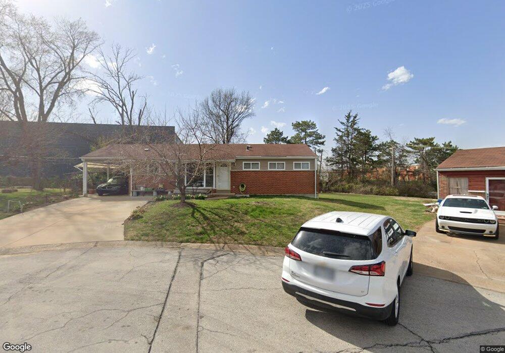
8939 Comstock Dr Saint Louis, MO 63132
Estimated Value: $280,864 - $304,000
3
Beds
2
Baths
1,150
Sq Ft
$253/Sq Ft
Est. Value
About This Home
This home is located at 8939 Comstock Dr, Saint Louis, MO 63132 and is currently estimated at $290,466, approximately $252 per square foot. 8939 Comstock Dr is a home located in St. Louis County with nearby schools including Reed Elementary, Ladue 5th Grade Center, and Ladue Middle School.
Ownership History
Date
Name
Owned For
Owner Type
Purchase Details
Closed on
May 29, 2002
Sold by
Greenberg Donna
Bought by
Chen Guo Ming and Zhou Qui Tian
Current Estimated Value
Home Financials for this Owner
Home Financials are based on the most recent Mortgage that was taken out on this home.
Original Mortgage
$87,920
Outstanding Balance
$37,021
Interest Rate
6.89%
Estimated Equity
$253,445
Create a Home Valuation Report for This Property
The Home Valuation Report is an in-depth analysis detailing your home's value as well as a comparison with similar homes in the area
Home Values in the Area
Average Home Value in this Area
Purchase History
| Date | Buyer | Sale Price | Title Company |
|---|---|---|---|
| Chen Guo Ming | $109,900 | -- |
Source: Public Records
Mortgage History
| Date | Status | Borrower | Loan Amount |
|---|---|---|---|
| Open | Chen Guo Ming | $87,920 |
Source: Public Records
Tax History
| Year | Tax Paid | Tax Assessment Tax Assessment Total Assessment is a certain percentage of the fair market value that is determined by local assessors to be the total taxable value of land and additions on the property. | Land | Improvement |
|---|---|---|---|---|
| 2025 | $3,113 | $48,960 | $36,970 | $11,990 |
| 2024 | $3,113 | $43,850 | $28,350 | $15,500 |
| 2023 | $3,148 | $43,850 | $28,350 | $15,500 |
| 2022 | $2,775 | $37,240 | $28,350 | $8,890 |
| 2021 | $2,759 | $37,240 | $28,350 | $8,890 |
| 2020 | $2,106 | $27,950 | $13,450 | $14,500 |
| 2019 | $2,039 | $27,950 | $13,450 | $14,500 |
| 2018 | $1,748 | $22,040 | $11,530 | $10,510 |
| 2016 | $1,917 | $23,540 | $11,530 | $12,010 |
Source: Public Records
Map
Nearby Homes
- 1123 Hilltop Dr
- 1022 Dolores Ave
- 9311 Kenneth Place
- 1193 Noa Ln Unit 30
- 9409 Olie Way Rd Unit 27
- 1181 Rd Unit 33
- 9401 Olie Way Rd Unit 30
- 1185 Noa Lane Rd Unit 32
- 1189 Noa Lane Rd Unit 31
- 9425 Olie Way Rd Unit 29
- 8637 Mayflower Ct
- 8362 Braddock Dr
- 9547 Ridge Ave
- 1 Hill n Dale Ln
- 1432 Tamerton Ave
- 9608 Miriam Ave
- 31 Bon Hills Dr
- 9112 Watsonia Ct
- 9822 Zykan Dr
- 2000 Wismer Ave
- 8935 Comstock Dr
- 8932 Comstock Dr
- 8940 Chickasaw Dr
- 8927 Comstock Dr
- 8926 Comstock Dr
- 8932 Chickasaw Dr
- 8941 Comanche Dr
- 8922 Comstock Dr
- 8935 Comanche Dr
- 8926 Chickasaw Dr
- 8921 Comstock Dr
- 8929 Comanche Dr
- 8916 Comstock Dr
- 8920 Chickasaw Dr
- 8923 Comanche Dr
- 8915 Comstock Dr
- 1235 Olivette Dr
- 8917 Comanche Dr
- 8931 Chickasaw Dr
- 8910 Comstock Dr
Your Personal Tour Guide
Ask me questions while you tour the home.