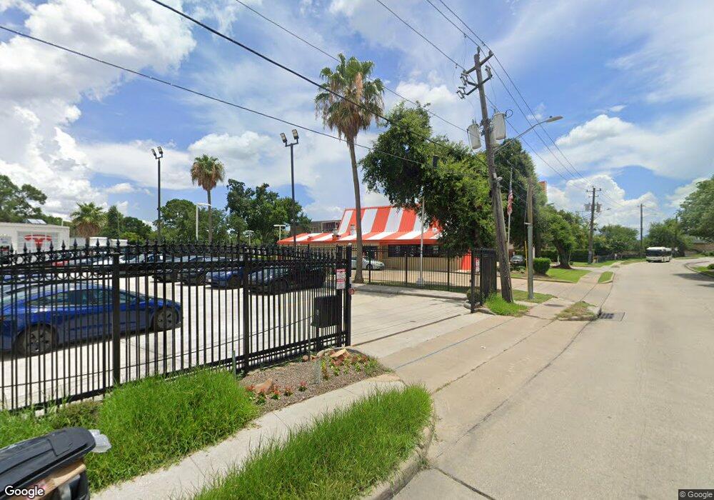
8939 Long Point Rd Houston, TX 77055
Spring Branch Central Neighborhood
--
Bed
--
Bath
2,480
Sq Ft
0.71
Acres
About This Home
This home is located at 8939 Long Point Rd, Houston, TX 77055. 8939 Long Point Rd is a home located in Harris County with nearby schools including Valley Oaks Elementary School, Spring Branch Middle School, and Memorial High School.
Ownership History
Date
Name
Owned For
Owner Type
Purchase Details
Closed on
Nov 1, 2024
Sold by
Bondi Real Estate 2 Llc
Bought by
Terbelo Investments Llc
Home Financials for this Owner
Home Financials are based on the most recent Mortgage that was taken out on this home.
Original Mortgage
$1,000,000
Outstanding Balance
$989,989
Interest Rate
6.09%
Mortgage Type
New Conventional
Purchase Details
Closed on
May 15, 2012
Sold by
Soltani Russell and Soltani Ramal
Bought by
Sayeh Enterprises Inc
Create a Home Valuation Report for This Property
The Home Valuation Report is an in-depth analysis detailing your home's value as well as a comparison with similar homes in the area
Home Values in the Area
Average Home Value in this Area
Purchase History
| Date | Buyer | Sale Price | Title Company |
|---|---|---|---|
| Terbelo Investments Llc | -- | None Listed On Document | |
| Sayeh Enterprises Inc | -- | Startex Title |
Source: Public Records
Mortgage History
| Date | Status | Borrower | Loan Amount |
|---|---|---|---|
| Open | Terbelo Investments Llc | $1,000,000 |
Source: Public Records
Tax History Compared to Growth
Tax History
| Year | Tax Paid | Tax Assessment Tax Assessment Total Assessment is a certain percentage of the fair market value that is determined by local assessors to be the total taxable value of land and additions on the property. | Land | Improvement |
|---|---|---|---|---|
| 2025 | $27,810 | $1,263,770 | $983,840 | $279,930 |
| 2024 | $27,810 | $1,233,839 | $983,839 | $250,000 |
| 2023 | $27,810 | $1,059,243 | $780,825 | $278,418 |
| 2022 | $24,789 | $1,016,800 | $780,825 | $235,975 |
| 2021 | $23,231 | $951,510 | $780,825 | $170,685 |
| 2020 | $24,380 | $935,693 | $780,825 | $154,868 |
| 2019 | $25,690 | $945,187 | $780,825 | $164,362 |
| 2018 | $9,572 | $782,356 | $624,660 | $157,696 |
| 2017 | $20,442 | $781,384 | $624,660 | $156,724 |
| 2016 | $16,467 | $629,467 | $468,495 | $160,972 |
| 2015 | $10,810 | $476,371 | $312,330 | $164,041 |
| 2014 | $10,810 | $391,434 | $224,878 | $166,556 |
Source: Public Records
Map
Nearby Homes
- 8935 Pado St
- 8913 Grovner Place
- 8915 Grovner Place
- 8911 Grovner Place
- 8919 Grovner Place
- 8925 Grovner Place
- 8927 Grovner Place
- 8929 Grovner Place
- 1745 Plan at Regents Court
- 2185 Plan at Regents Court
- 1925 Plan at Regents Court
- 2115 Plan at Regents Court
- 8933 Grovner Place
- 8928 Grovner Place
- 8926 Grovner Place
- 8928 Covenant Place
- 1609 Regents Ct
- 1615 Regents Gate Rd
- 1611 Regents Ct
- 1720 Summerlyn Terrace Dr
- 8940 Pado St
- 8939 Pado St
- 8936 Pado St
- 8940 Turriff St
- 8936 Turriff St
- 8903 Grovner Place
- 8932 Pado St
- 8931 Pado St
- 8916 Grovner Place
- 8932 Turriff St
- 8902 Covenant Place
- 8906 Covenant Place
- 8924 Grovner Place
- 8939 Turriff St
- 8935 Grovner Place
- 8908 Covenant Place
- 8903 Grover
- 1710 Cornelius Trace Loop
- 8903 Covenant Place
- 1714 Cornelius Trace Loop