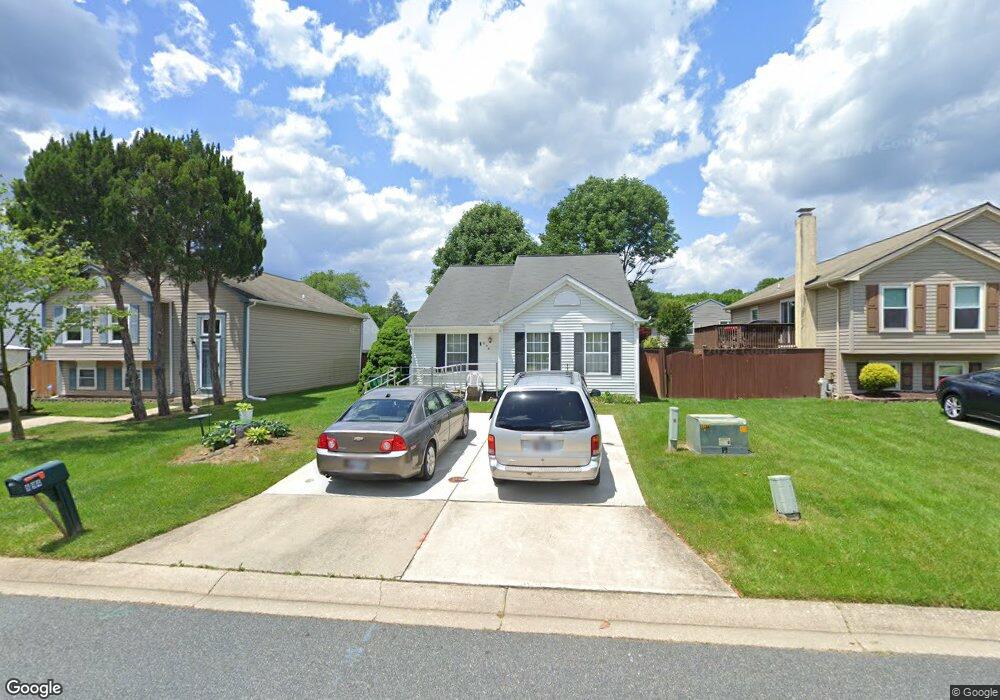
894 Avon Dr Aberdeen, MD 21001
Estimated Value: $239,427 - $322,000
Studio
1
Bath
1,532
Sq Ft
$195/Sq Ft
Est. Value
About This Home
This home is located at 894 Avon Dr, Aberdeen, MD 21001 and is currently estimated at $298,857, approximately $195 per square foot. 894 Avon Dr is a home located in Harford County with nearby schools including G. Lisby Elementary At Hillsdale, Aberdeen Middle School, and Aberdeen High School.
Ownership History
Date
Name
Owned For
Owner Type
Purchase Details
Closed on
Sep 21, 1990
Sold by
Secretary Of Veterans Affairs
Bought by
Powell Steven T and Thompson Greg P
Current Estimated Value
Purchase Details
Closed on
Aug 1, 1990
Sold by
Buttman Dwight
Bought by
Secretary Of Veterans Affairs
Purchase Details
Closed on
Jan 12, 1987
Sold by
Chesapeake Homes Inc
Bought by
Buttman Dwight
Home Financials for this Owner
Home Financials are based on the most recent Mortgage that was taken out on this home.
Original Mortgage
$75,900
Interest Rate
9.32%
Create a Home Valuation Report for This Property
The Home Valuation Report is an in-depth analysis detailing your home's value as well as a comparison with similar homes in the area
Home Values in the Area
Average Home Value in this Area
Purchase History
| Date | Buyer | Sale Price | Title Company |
|---|---|---|---|
| Powell Steven T | $87,500 | -- | |
| Secretary Of Veterans Affairs | $73,300 | -- | |
| Buttman Dwight | $75,900 | -- |
Source: Public Records
Mortgage History
| Date | Status | Borrower | Loan Amount |
|---|---|---|---|
| Previous Owner | Buttman Dwight | $75,900 |
Source: Public Records
Tax History
| Year | Tax Paid | Tax Assessment Tax Assessment Total Assessment is a certain percentage of the fair market value that is determined by local assessors to be the total taxable value of land and additions on the property. | Land | Improvement |
|---|---|---|---|---|
| 2025 | $1,881 | $211,067 | $0 | $0 |
| 2024 | $1,881 | $197,333 | $0 | $0 |
| 2023 | $1,750 | $183,600 | $52,500 | $131,100 |
| 2022 | $1,682 | $176,467 | $0 | $0 |
| 2021 | $1,631 | $169,333 | $0 | $0 |
| 2020 | $1,631 | $162,200 | $52,500 | $109,700 |
| 2019 | $1,612 | $160,333 | $0 | $0 |
| 2018 | $1,580 | $158,467 | $0 | $0 |
| 2017 | $1,561 | $156,600 | $0 | $0 |
| 2016 | -- | $156,600 | $0 | $0 |
| 2015 | $1,865 | $156,600 | $0 | $0 |
| 2014 | $1,865 | $173,900 | $0 | $0 |
Source: Public Records
Map
Nearby Homes
- 890 Oxford Ave
- 760 Cambridge Ave
- 729 Cambridge Ave
- 648 S Rogers St
- 740 Bur Oak Ct Unit 78
- 722 Bur Oak Ct Unit 77
- 449 S Law St
- 444 Chestnut St
- 0 Harford St Unit MDHR2039982
- 0 Evan Ave Unit MDHR2049356
- 321 S Law St
- 647 Elm St
- 0 S Philadelphia Blvd
- 125 Valley Rd
- 754 Custis St
- 687 Plater St
- 107 Moyer Dr
- 136 S Parke St
- 21 Gunnison Dr
- 204 Darlington Ave
Your Personal Tour Guide
Ask me questions while you tour the home.