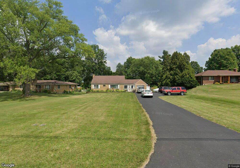
8940 Wuest Rd Cincinnati, OH 45251
Estimated Value: $237,381 - $294,000
3
Beds
1
Bath
900
Sq Ft
$303/Sq Ft
Est. Value
About This Home
This home is located at 8940 Wuest Rd, Cincinnati, OH 45251 and is currently estimated at $272,845, approximately $303 per square foot. 8940 Wuest Rd is a home located in Hamilton County with nearby schools including Colerain Elementary School, Colerain Middle School, and Colerain High School.
Ownership History
Date
Name
Owned For
Owner Type
Purchase Details
Closed on
Aug 27, 2007
Sold by
Porter Iris J
Bought by
Adams Sherrie L
Current Estimated Value
Home Financials for this Owner
Home Financials are based on the most recent Mortgage that was taken out on this home.
Original Mortgage
$115,500
Outstanding Balance
$73,687
Interest Rate
6.72%
Mortgage Type
Unknown
Estimated Equity
$199,158
Purchase Details
Closed on
Dec 10, 2001
Sold by
Parker Ethel M
Bought by
Adams Sherrie L and Porter Iris J
Home Financials for this Owner
Home Financials are based on the most recent Mortgage that was taken out on this home.
Original Mortgage
$105,600
Interest Rate
6.6%
Create a Home Valuation Report for This Property
The Home Valuation Report is an in-depth analysis detailing your home's value as well as a comparison with similar homes in the area
Home Values in the Area
Average Home Value in this Area
Purchase History
| Date | Buyer | Sale Price | Title Company |
|---|---|---|---|
| Adams Sherrie L | -- | Attorney | |
| Adams Sherrie L | $132,000 | -- |
Source: Public Records
Mortgage History
| Date | Status | Borrower | Loan Amount |
|---|---|---|---|
| Open | Adams Sherrie L | $115,500 | |
| Previous Owner | Adams Sherrie L | $105,600 |
Source: Public Records
Tax History Compared to Growth
Tax History
| Year | Tax Paid | Tax Assessment Tax Assessment Total Assessment is a certain percentage of the fair market value that is determined by local assessors to be the total taxable value of land and additions on the property. | Land | Improvement |
|---|---|---|---|---|
| 2024 | $3,714 | $69,070 | $15,768 | $53,302 |
| 2023 | $3,729 | $69,070 | $15,768 | $53,302 |
| 2022 | $3,662 | $55,353 | $14,886 | $40,467 |
| 2021 | $3,639 | $55,353 | $14,886 | $40,467 |
| 2020 | $3,667 | $55,353 | $14,886 | $40,467 |
| 2019 | $3,333 | $46,907 | $12,614 | $34,293 |
| 2018 | $2,991 | $46,907 | $12,614 | $34,293 |
| 2017 | $2,839 | $46,907 | $12,614 | $34,293 |
| 2016 | $2,586 | $42,287 | $12,600 | $29,687 |
| 2015 | $2,609 | $42,287 | $12,600 | $29,687 |
| 2014 | $2,614 | $42,287 | $12,600 | $29,687 |
| 2013 | $2,618 | $44,510 | $13,262 | $31,248 |
Source: Public Records
Map
Nearby Homes
- 3971 Woodsong Dr
- 3889 Brockton Dr
- 9160 Cobblechase Ct
- 8530 Wuest Rd
- 8747 Cheviot Rd
- 3736 Vernier Dr
- 9340 Wilcox Dr
- 0 Springdale Rd Unit 1850271
- 4893 Blue Meadow Ln
- 8812 Carrousel Park Cir
- 9125 Round Top Rd
- 9126 Round Top Rd
- 3663 Sandralin Dr
- 3474 Oakmeadow Ln
- 5613 Old Blue Rock Rd
- 3950 Olde Savannah Dr
- 3960 Olde Savannah Dr
- 3937 Olde Savannah Dr Unit 3937
- 5647 Old Blue Rock Rd Unit 43
- 5658 Springdale Rd
- 8952 Wuest Rd
- 8926 Wuest Rd
- 8912 Wuest Rd
- 4021 Woodthrush Dr
- 4035 Woodthrush Dr
- 8937 Wuest Rd
- 4007 Woodthrush Dr
- 8949 Wuest Rd
- 4049 Woodthrush Dr
- 8980 Wuest Rd
- 8925 Wuest Rd
- 8896 Wuest Rd
- 3993 Woodthrush Dr
- 8911 Wuest Rd
- 4115 Poole Rd
- 4265 Poole Rd
- 3979 Woodthrush Dr
- 8882 Wuest Rd
- 8895 Wuest Rd
- 4034 Woodthrush Dr