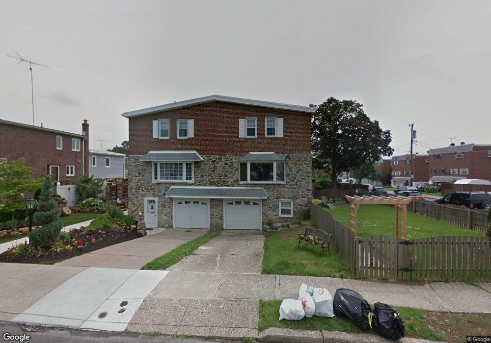
8943 Dewees St Philadelphia, PA 19152
Pennypack NeighborhoodEstimated Value: $358,760 - $385,000
4
Beds
1
Bath
2,000
Sq Ft
$185/Sq Ft
Est. Value
About This Home
This home is located at 8943 Dewees St, Philadelphia, PA 19152 and is currently estimated at $370,940, approximately $185 per square foot. 8943 Dewees St is a home with nearby schools including Lincoln High School, Robert B. Pollock School, and Meehan Austin Middle School.
Ownership History
Date
Name
Owned For
Owner Type
Purchase Details
Closed on
Jul 3, 2003
Sold by
Ochs John J and Beaudet Eleanor A
Bought by
Kreamer Richard S and Kreamer Lisa A
Current Estimated Value
Home Financials for this Owner
Home Financials are based on the most recent Mortgage that was taken out on this home.
Original Mortgage
$70,000
Interest Rate
5.34%
Mortgage Type
Purchase Money Mortgage
Create a Home Valuation Report for This Property
The Home Valuation Report is an in-depth analysis detailing your home's value as well as a comparison with similar homes in the area
Home Values in the Area
Average Home Value in this Area
Purchase History
| Date | Buyer | Sale Price | Title Company |
|---|---|---|---|
| Kreamer Richard S | $114,000 | -- |
Source: Public Records
Mortgage History
| Date | Status | Borrower | Loan Amount |
|---|---|---|---|
| Closed | Kreamer Richard S | $70,000 |
Source: Public Records
Tax History Compared to Growth
Tax History
| Year | Tax Paid | Tax Assessment Tax Assessment Total Assessment is a certain percentage of the fair market value that is determined by local assessors to be the total taxable value of land and additions on the property. | Land | Improvement |
|---|---|---|---|---|
| 2026 | $3,883 | $356,400 | $71,280 | $285,120 |
| 2025 | $3,883 | $356,400 | $71,280 | $285,120 |
| 2024 | $3,883 | $356,400 | $71,280 | $285,120 |
| 2023 | $3,883 | $277,400 | $55,480 | $221,920 |
| 2022 | $2,597 | $232,400 | $55,480 | $176,920 |
| 2021 | $3,227 | $0 | $0 | $0 |
| 2020 | $3,227 | $0 | $0 | $0 |
| 2019 | $3,038 | $0 | $0 | $0 |
| 2018 | $2,858 | $0 | $0 | $0 |
| 2017 | $2,858 | $0 | $0 | $0 |
| 2016 | $2,438 | $0 | $0 | $0 |
| 2015 | $2,334 | $0 | $0 | $0 |
| 2014 | -- | $204,200 | $81,578 | $122,622 |
| 2012 | -- | $23,552 | $4,217 | $19,335 |
Source: Public Records
Map
Nearby Homes
- 8920 Maxwell Place
- 9044 Brous Ave
- 8945 Haven Place
- 9028 Brous Ave
- 9009 Brous Ave
- 2777 Welsh Rd
- 2633 Maxwell St
- 8817 R Danbury St
- 2678 Tremont St
- 2742 Welsh Rd
- 8860 Manchester St
- 2651 Tremont St
- 8800 Danbury St
- 8931 Blue Grass Rd
- 8803 Manchester St
- 2831 Chase Rd
- 48 Bonnie Gellman Ct Unit B48
- 9228 38 Blue Grass Rd Unit 38
- 9228 Blue Grass Rd Unit 30
- 75 Bonnie Gellman Ct Unit D75