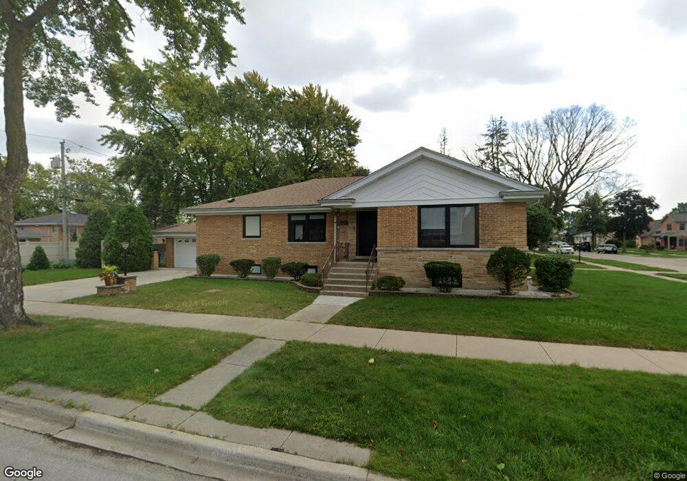
8945 Mansfield Ave Morton Grove, IL 60053
Estimated Value: $486,000 - $512,000
4
Beds
3
Baths
1,791
Sq Ft
$279/Sq Ft
Est. Value
About This Home
This home is located at 8945 Mansfield Ave, Morton Grove, IL 60053 and is currently estimated at $499,122, approximately $278 per square foot. 8945 Mansfield Ave is a home located in Cook County with nearby schools including Park View Elementary School and Niles West High School.
Ownership History
Date
Name
Owned For
Owner Type
Purchase Details
Closed on
Apr 16, 2021
Sold by
Pietersen Carla and Pietersen Paul Simonetti
Bought by
Cirdei Vasile and Pintilei Diana
Current Estimated Value
Home Financials for this Owner
Home Financials are based on the most recent Mortgage that was taken out on this home.
Original Mortgage
$219,000
Outstanding Balance
$198,882
Interest Rate
3.37%
Mortgage Type
New Conventional
Estimated Equity
$300,240
Purchase Details
Closed on
Jan 13, 2016
Sold by
Simonetti Paul and Simonetti Annetta
Bought by
Simonetti Paul and Paul Simonetti Trust
Create a Home Valuation Report for This Property
The Home Valuation Report is an in-depth analysis detailing your home's value as well as a comparison with similar homes in the area
Home Values in the Area
Average Home Value in this Area
Purchase History
| Date | Buyer | Sale Price | Title Company |
|---|---|---|---|
| Cirdei Vasile | $365,000 | Old Republic Title | |
| Simonetti Paul | -- | Attorney |
Source: Public Records
Mortgage History
| Date | Status | Borrower | Loan Amount |
|---|---|---|---|
| Open | Cirdei Vasile | $219,000 |
Source: Public Records
Tax History Compared to Growth
Tax History
| Year | Tax Paid | Tax Assessment Tax Assessment Total Assessment is a certain percentage of the fair market value that is determined by local assessors to be the total taxable value of land and additions on the property. | Land | Improvement |
|---|---|---|---|---|
| 2024 | $6,078 | $21,044 | $4,836 | $16,208 |
| 2023 | $5,791 | $21,044 | $4,836 | $16,208 |
| 2022 | $5,791 | $21,044 | $4,836 | $16,208 |
| 2021 | $1,116 | $15,154 | $2,976 | $12,178 |
| 2020 | $1,012 | $15,154 | $2,976 | $12,178 |
| 2019 | $1,003 | $17,028 | $2,976 | $14,052 |
| 2018 | $1,133 | $17,365 | $2,697 | $14,668 |
| 2017 | $1,121 | $17,365 | $2,697 | $14,668 |
| 2016 | $1,438 | $17,365 | $2,697 | $14,668 |
| 2015 | $1,624 | $14,684 | $2,325 | $12,359 |
| 2014 | $1,588 | $14,684 | $2,325 | $12,359 |
| 2013 | $1,589 | $14,684 | $2,325 | $12,359 |
Source: Public Records
Map
Nearby Homes
- 8841 Menard Ave
- 8836 Mansfield Ave
- 8918 Parkside Ave
- 8849 Mcvicker Ave
- 9224 Menard Ave
- 5536 Greenwood St
- 5459 Suffield Ct
- 9314 Menard Ave
- 8708 Central Ave
- 9320 Menard Ave
- 9234 Central Ave
- 5644 Lyons St
- 5449 Arcadia St
- 5352 Greenwood St
- 5346 Suffield Terrace
- 8655 Harms Rd
- 5317 Suffield Ct
- 6020 Lincoln Ave Unit 407
- 6035 Lincoln Ave
- 5247 Suffield Ct
- 8945 Mansfield Ave
- 8939 Mansfield Ave
- 8935 Mansfield Ave
- 9001 Mansfield Ave
- 9001 Mansfield Ave
- 8948 Menard Ave
- 8931 Mansfield Ave
- 8942 Menard Ave
- 8938 Menard Ave
- 8944 Mansfield Ave
- 8940 Mansfield Ave
- 9005 Mansfield Ave
- 8938 Mansfield Ave
- 8929 Mansfield Ave
- 8929 Mansfield Ave
- 8930 Menard Ave
- 8930 Menard Ave
- 8934 Mansfield Ave
- 9000 Mansfield Ave
- 9004 Menard Ave