Estimated Value: $404,000 - $484,000
2
Beds
2
Baths
1,197
Sq Ft
$377/Sq Ft
Est. Value
About This Home
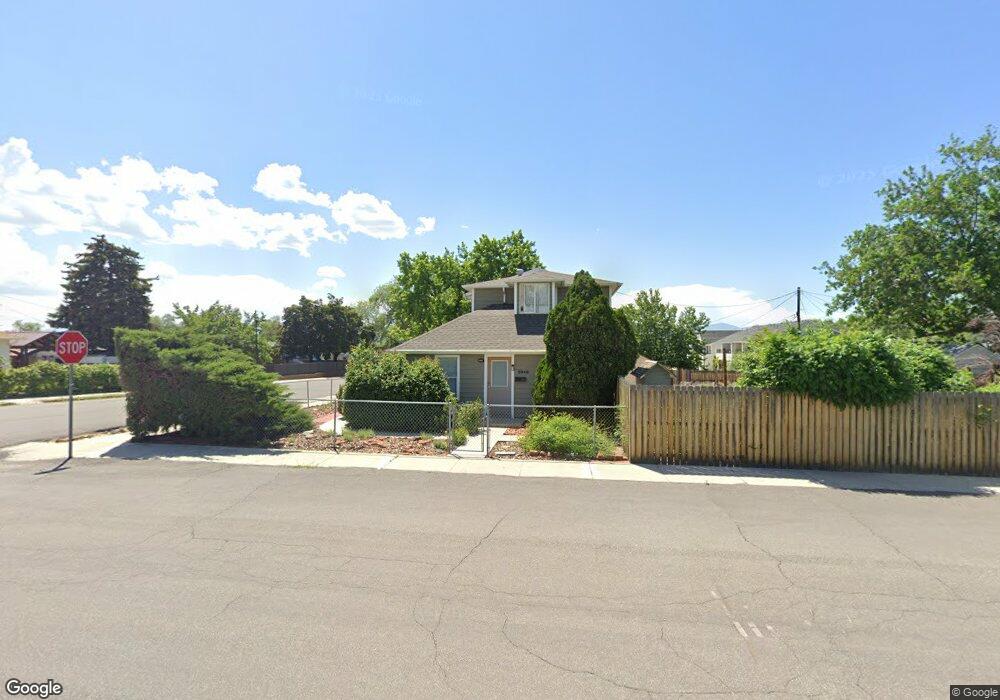
This home is located at 8948 S 250 E, Sandy, UT 84070 and is currently estimated at $451,431, approximately $377 per square foot. 8948 S 250 E is a home located in Salt Lake County with nearby schools including Sandy Elementary School, Mount Jordan Middle School, and Jordan High.
Ownership History
Date
Name
Owned For
Owner Type
Purchase Details
Closed on
Jun 15, 2006
Sold by
8948 South 250 East Property Assoc Llc
Bought by
Watson Drake
Current Estimated Value
Purchase Details
Closed on
Dec 15, 2005
Sold by
Sharp Wayne L
Bought by
8948 South 250 East Property Assoc Llc
Home Financials for this Owner
Home Financials are based on the most recent Mortgage that was taken out on this home.
Original Mortgage
$87,000
Interest Rate
6.31%
Mortgage Type
Unknown
Purchase Details
Closed on
Jun 29, 2005
Sold by
Moore Denny L
Bought by
Sharp Wayne L
Purchase Details
Closed on
Oct 17, 2002
Sold by
Dorius Brent and Dorius Orval
Bought by
Sharp Wayne L
Purchase Details
Closed on
Aug 22, 2002
Sold by
Dorius Orval L
Bought by
Dorius Brent S
Create a Home Valuation Report for This Property
The Home Valuation Report is an in-depth analysis detailing your home's value as well as a comparison with similar homes in the area
Home Values in the Area
Average Home Value in this Area
Purchase History
| Date | Buyer | Sale Price | Title Company |
|---|---|---|---|
| Watson Drake | -- | Meridian Title | |
| 8948 South 250 East Property Assoc Llc | -- | None Available | |
| Sharp Wayne L | -- | Meridian Title | |
| Sharp Wayne L | -- | -- | |
| Dorius Brent S | -- | -- |
Source: Public Records
Mortgage History
| Date | Status | Borrower | Loan Amount |
|---|---|---|---|
| Previous Owner | 8948 South 250 East Property Assoc Llc | $87,000 |
Source: Public Records
Tax History
| Year | Tax Paid | Tax Assessment Tax Assessment Total Assessment is a certain percentage of the fair market value that is determined by local assessors to be the total taxable value of land and additions on the property. | Land | Improvement |
|---|---|---|---|---|
| 2025 | -- | $446,600 | $133,200 | $313,400 |
| 2024 | -- | $393,800 | $122,200 | $271,600 |
| 2023 | -- | $354,800 | $116,100 | $238,700 |
| 2022 | $0 | $368,800 | $113,900 | $254,900 |
| 2021 | $2,405 | $298,200 | $89,100 | $209,100 |
| 2020 | $1,834 | $265,200 | $89,100 | $176,100 |
| 2019 | $1,658 | $233,600 | $89,100 | $144,500 |
| 2016 | $1,377 | $186,500 | $64,200 | $122,300 |
Source: Public Records
Map
Nearby Homes
- 181 E 9180 S
- 362 E 9150 S
- 412 E 8760 S
- 8558 S Center St
- 270 E 8680 S
- 112 E 8680 S
- 220 E Pioneer Ave
- 194 Pioneer Ave
- 487 E 9270 S
- 8732 S 620 E
- 149 E Pioneer Ave
- 87 Pioneer Ave
- 37 Crawford Place
- 8459 S 300 E
- 87 W 8710 S
- 227 E St Germain Way
- 8470 Solar Way
- 136 W Freedom Ave Unit 136
- 140 W 8710 S
- 8797 Green Way Unit 3
Your Personal Tour Guide
Ask me questions while you tour the home.