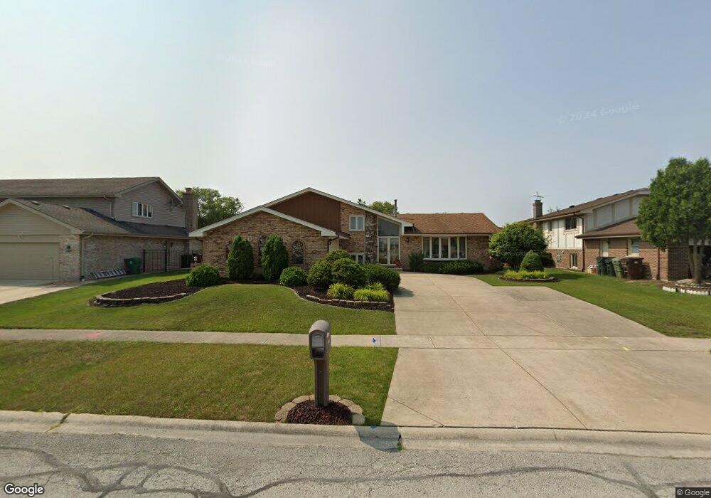
8949 Poplar St Tinley Park, IL 60487
Central Tinley Park NeighborhoodEstimated Value: $430,000 - $501,000
4
Beds
3
Baths
2,672
Sq Ft
$175/Sq Ft
Est. Value
About This Home
This home is located at 8949 Poplar St, Tinley Park, IL 60487 and is currently estimated at $467,144, approximately $174 per square foot. 8949 Poplar St is a home located in Cook County with nearby schools including Christa Mcauliffe School, Prairie View Middle School, and Victor J Andrew High School.
Ownership History
Date
Name
Owned For
Owner Type
Purchase Details
Closed on
Dec 10, 2012
Sold by
Malecki Joseph A
Bought by
Malecki Joseph A and Malecki Diane M
Current Estimated Value
Home Financials for this Owner
Home Financials are based on the most recent Mortgage that was taken out on this home.
Original Mortgage
$125,000
Interest Rate
3.34%
Mortgage Type
New Conventional
Create a Home Valuation Report for This Property
The Home Valuation Report is an in-depth analysis detailing your home's value as well as a comparison with similar homes in the area
Home Values in the Area
Average Home Value in this Area
Purchase History
| Date | Buyer | Sale Price | Title Company |
|---|---|---|---|
| Malecki Joseph A | -- | First American Title Insuran |
Source: Public Records
Mortgage History
| Date | Status | Borrower | Loan Amount |
|---|---|---|---|
| Closed | Malecki Joseph A | $125,000 |
Source: Public Records
Tax History Compared to Growth
Tax History
| Year | Tax Paid | Tax Assessment Tax Assessment Total Assessment is a certain percentage of the fair market value that is determined by local assessors to be the total taxable value of land and additions on the property. | Land | Improvement |
|---|---|---|---|---|
| 2024 | $4,989 | $40,000 | $5,725 | $34,275 |
| 2023 | $6,365 | $40,000 | $5,725 | $34,275 |
| 2022 | $6,365 | $25,379 | $5,009 | $20,370 |
| 2021 | $6,229 | $25,379 | $5,009 | $20,370 |
| 2020 | $5,332 | $25,379 | $5,009 | $20,370 |
| 2019 | $5,688 | $29,340 | $4,531 | $24,809 |
| 2018 | $5,576 | $29,340 | $4,531 | $24,809 |
| 2017 | $5,333 | $29,340 | $4,531 | $24,809 |
| 2016 | $6,771 | $28,674 | $4,054 | $24,620 |
| 2015 | $7,698 | $28,674 | $4,054 | $24,620 |
| 2014 | $7,309 | $28,674 | $4,054 | $24,620 |
| 2013 | $7,602 | $29,678 | $4,054 | $25,624 |
Source: Public Records
Map
Nearby Homes
- 17964 Upland Dr
- 17533 Pecan Ln
- 18055 Upland Dr
- 17631 Dover Ct
- 9038 Mansfield Dr Unit 8
- 9280 Windsor Pkwy Unit 92
- 9260 Windsor Pkwy Unit 80
- 9051 Mansfield Dr Unit 1
- 9201 175th St
- 18248 Murphy Cir Unit 182
- Fremont Plan at Radcliffe Place
- Calysta Plan at Radcliffe Place
- Danbury Plan at Radcliffe Place
- Briarcliffe Plan at Radcliffe Place
- Eden Plan at Radcliffe Place
- Amberwood Plan at Radcliffe Place
- 17535 S La Grange Rd
- 17535-2 Lagrange Rd
- 17500 Lagrange Rd
- 8423 Stratford Dr Unit 8423