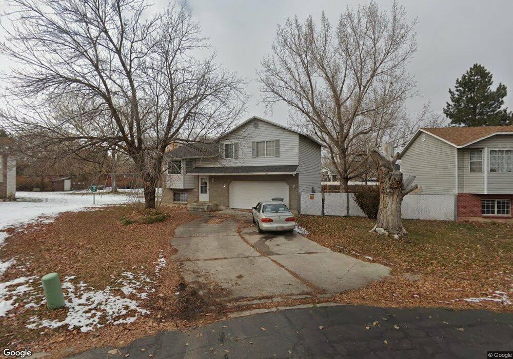
895 Brookside Cir Ogden, UT 84404
Lynn NeighborhoodEstimated Value: $363,901 - $411,000
4
Beds
2
Baths
1,402
Sq Ft
$272/Sq Ft
Est. Value
About This Home
This home is located at 895 Brookside Cir, Ogden, UT 84404 and is currently estimated at $381,225, approximately $271 per square foot. 895 Brookside Cir is a home located in Weber County with nearby schools including Heritage Elementary School, Highland Junior High School, and Ben Lomond High School.
Ownership History
Date
Name
Owned For
Owner Type
Purchase Details
Closed on
Aug 27, 2004
Sold by
Taylor Karen Joy and Gerhardt Karen Joy
Bought by
Gerhardt Karen Joy
Current Estimated Value
Home Financials for this Owner
Home Financials are based on the most recent Mortgage that was taken out on this home.
Original Mortgage
$112,595
Outstanding Balance
$55,931
Interest Rate
5.92%
Mortgage Type
FHA
Estimated Equity
$325,294
Purchase Details
Closed on
Jan 24, 1996
Sold by
Devries Dean C
Bought by
Arciaga Voni L
Create a Home Valuation Report for This Property
The Home Valuation Report is an in-depth analysis detailing your home's value as well as a comparison with similar homes in the area
Home Values in the Area
Average Home Value in this Area
Purchase History
| Date | Buyer | Sale Price | Title Company |
|---|---|---|---|
| Gerhardt Karen Joy | -- | Heritage West | |
| Arciaga Voni L | -- | -- |
Source: Public Records
Mortgage History
| Date | Status | Borrower | Loan Amount |
|---|---|---|---|
| Open | Gerhardt Karen Joy | $112,595 |
Source: Public Records
Tax History
| Year | Tax Paid | Tax Assessment Tax Assessment Total Assessment is a certain percentage of the fair market value that is determined by local assessors to be the total taxable value of land and additions on the property. | Land | Improvement |
|---|---|---|---|---|
| 2025 | $2,542 | $204,930 | $65,079 | $139,851 |
| 2024 | $2,529 | $200,199 | $65,078 | $135,121 |
| 2023 | $2,429 | $193,600 | $60,616 | $132,984 |
| 2022 | $2,334 | $186,450 | $44,430 | $142,020 |
| 2021 | $1,923 | $255,000 | $56,117 | $198,883 |
| 2020 | $1,845 | $226,000 | $41,723 | $184,277 |
| 2019 | $1,748 | $201,000 | $32,098 | $168,902 |
| 2018 | $1,505 | $172,000 | $32,009 | $139,991 |
| 2017 | $1,387 | $148,000 | $32,281 | $115,719 |
| 2016 | $1,203 | $69,423 | $17,755 | $51,668 |
| 2015 | $1,190 | $66,995 | $17,755 | $49,240 |
| 2014 | $1,192 | $65,907 | $14,880 | $51,027 |
Source: Public Records
Map
Nearby Homes
- 889 S Clover Cir
- 820 S Wildflower Cir
- 900 Century Dr Unit 130
- 900 Century Dr Unit 69
- 900 Century Dr Unit 60
- 900 Century Dr Unit 66
- 445 950 S
- 447 950 S
- 447 W 980 S
- 451 W 980 S
- 1446 S 410 W Unit 135
- 617 S 375 W
- 155 E 900 St S Unit 108
- 155 E 900 St S Unit 202
- 1288 Lincoln Ave
- 130 7th #C304 St
- 142 7th St Unit B304
- 1325 Lincoln Ave Unit 19
- 1325 Lincoln Ave Unit 52
- 1325 Lincoln Ave Unit 110
- 891 S Brookside Cir
- 891 Brookside Cir
- 901 S Brookside Cir
- 901 Brookside Cir
- 887 Brookside Cir
- 903 Brookside Cir
- 898 S Brookside Cir
- 345 Meadowbrook Dr
- 898 Brookside Cir
- 351 Meadowbrook Dr
- 329 Meadowbrook Dr
- 911 Brookside Cir Unit 53
- 357 Meadowbrook Dr
- 323 9th St
- 323 W 900 S
- 323 W Meadowbrook Dr
- 908 Brookside Cir
- 323 W 900 South St
- 917 Brookside Cir
- 365 Meadowbrook Dr
Your Personal Tour Guide
Ask me questions while you tour the home.