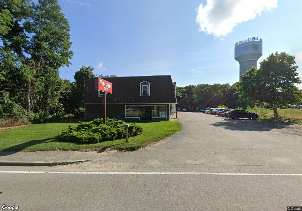
895 Main St West Dennis, MA 2670
West Dennis Neighborhood
--
Bed
--
Bath
7,500
Sq Ft
1.65
Acres
About This Home
This home is located at 895 Main St, West Dennis, MA 2670. 895 Main St is a home located in Barnstable County with nearby schools including Dennis-Yarmouth Regional High School and St. Pius X. School.
Ownership History
Date
Name
Owned For
Owner Type
Purchase Details
Closed on
Feb 15, 2005
Sold by
Nolan David F and Nolan Kevin H
Bought by
Dnk Brothers Llc
Home Financials for this Owner
Home Financials are based on the most recent Mortgage that was taken out on this home.
Original Mortgage
$200,000
Outstanding Balance
$102,191
Interest Rate
5.83%
Mortgage Type
Commercial
Purchase Details
Closed on
Nov 26, 2004
Sold by
895 Main Street Rt
Bought by
Nolan David F and Nolan Kevin H
Create a Home Valuation Report for This Property
The Home Valuation Report is an in-depth analysis detailing your home's value as well as a comparison with similar homes in the area
Home Values in the Area
Average Home Value in this Area
Purchase History
| Date | Buyer | Sale Price | Title Company |
|---|---|---|---|
| Dnk Brothers Llc | -- | -- | |
| Nolan David F | $54,049 | -- |
Source: Public Records
Mortgage History
| Date | Status | Borrower | Loan Amount |
|---|---|---|---|
| Open | Dnk Brothers Llc | $200,000 |
Source: Public Records
Tax History Compared to Growth
Tax History
| Year | Tax Paid | Tax Assessment Tax Assessment Total Assessment is a certain percentage of the fair market value that is determined by local assessors to be the total taxable value of land and additions on the property. | Land | Improvement |
|---|---|---|---|---|
| 2025 | $3,821 | $882,500 | $530,400 | $352,100 |
| 2024 | $3,719 | $847,100 | $511,200 | $335,900 |
| 2023 | $3,766 | $806,400 | $486,800 | $319,600 |
| 2022 | $4,285 | $765,100 | $459,200 | $305,900 |
| 2021 | $3,581 | $743,200 | $450,200 | $293,000 |
| 2020 | $4,475 | $733,600 | $447,800 | $285,800 |
| 2019 | $4,383 | $710,400 | $447,800 | $262,600 |
| 2018 | $4,520 | $713,000 | $447,800 | $265,200 |
| 2017 | $4,385 | $713,000 | $447,800 | $265,200 |
| 2016 | $4,383 | $671,200 | $447,800 | $223,400 |
| 2015 | $4,296 | $671,200 | $447,800 | $223,400 |
| 2014 | $4,010 | $631,500 | $447,800 | $183,700 |
Source: Public Records
Map
Nearby Homes
- 12 Spoonbill Rd
- 15 Woodside Park Rd
- 26 Center St
- 71 Main St
- 95 Center St
- 4 Coffey Ln
- 19 Standish Way
- 125 Main St Unit 3
- 3 Pinefield Ln
- 80 Michaels Ave
- 61 Trotters Ln
- 22 Wixon Rd
- 72 Bassett Ln
- 268 Main St
- 31 Easy St
- 20 Aunt Debbys Rd
- 467 Main St
- 78 Upper County Rd Unit A&B
- 78 Upper County Rd
- 37 Ocean Dr Unit 2