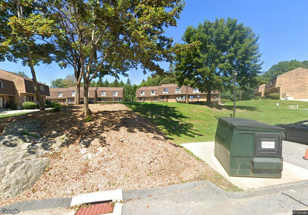
895 Matthews St Unit 56 Bristol, CT 06010
North Bristol NeighborhoodEstimated Value: $200,000 - $208,000
2
Beds
2
Baths
971
Sq Ft
$211/Sq Ft
Est. Value
About This Home
This home is located at 895 Matthews St Unit 56, Bristol, CT 06010 and is currently estimated at $204,613, approximately $210 per square foot. 895 Matthews St Unit 56 is a home located in Hartford County with nearby schools including West Bristol Sch, Bristol Central High School, and Immanuel Lutheran School.
Ownership History
Date
Name
Owned For
Owner Type
Purchase Details
Closed on
Dec 8, 2020
Sold by
Sahlin Diann
Bought by
Diann Sahlin Ft
Current Estimated Value
Purchase Details
Closed on
Jun 12, 2015
Sold by
Mac Freddie
Bought by
Sahlin Diann
Purchase Details
Closed on
Apr 21, 2014
Sold by
First Horizon Hm Loans
Bought by
Fhlmc
Create a Home Valuation Report for This Property
The Home Valuation Report is an in-depth analysis detailing your home's value as well as a comparison with similar homes in the area
Home Values in the Area
Average Home Value in this Area
Purchase History
| Date | Buyer | Sale Price | Title Company |
|---|---|---|---|
| Diann Sahlin Ft | -- | None Available | |
| Sahlin Diann | -- | -- | |
| Fhlmc | -- | -- |
Source: Public Records
Mortgage History
| Date | Status | Borrower | Loan Amount |
|---|---|---|---|
| Previous Owner | Fhlmc | $96,950 |
Source: Public Records
Tax History Compared to Growth
Tax History
| Year | Tax Paid | Tax Assessment Tax Assessment Total Assessment is a certain percentage of the fair market value that is determined by local assessors to be the total taxable value of land and additions on the property. | Land | Improvement |
|---|---|---|---|---|
| 2025 | $3,393 | $100,520 | $0 | $100,520 |
| 2024 | $3,202 | $100,520 | $0 | $100,520 |
| 2023 | $3,051 | $100,520 | $0 | $100,520 |
| 2022 | $2,180 | $56,840 | $0 | $56,840 |
| 2021 | $2,180 | $56,840 | $0 | $56,840 |
| 2020 | $2,180 | $56,840 | $0 | $56,840 |
| 2019 | $2,163 | $56,840 | $0 | $56,840 |
| 2018 | $2,096 | $56,840 | $0 | $56,840 |
| 2017 | $2,431 | $67,480 | $0 | $67,480 |
| 2016 | $2,431 | $67,480 | $0 | $67,480 |
| 2015 | $2,335 | $67,480 | $0 | $67,480 |
| 2014 | $2,335 | $67,480 | $0 | $67,480 |
Source: Public Records
Map
Nearby Homes
- 565 Clark Ave Unit 17
- 820 Matthews St Unit 29
- 441 Clark Ave Unit 2
- 441 Clark Ave Unit 5
- 19 Main St
- 26 Martin Rd
- 40 Wiegert Way
- 14 Church St
- Lots 16, 18 and 22 E Hill St
- 2 Sandra Ave
- 65 Gino Dr
- 62 Gino Dr
- 66 Gino Dr
- 7 Kearney St
- 120 Barlow St
- 11 William St
- 15 Woodside Ln
- 10 Diamond St
- 321 Matthews St
- 35 James P Casey Rd
- 895 Matthews St Unit 62
- 895 Matthews St Unit 61
- 895 Matthews St Unit 60
- 895 Matthews St Unit 59
- 895 Matthews St Unit 58
- 895 Matthews St Unit 57
- 895 Matthews St Unit 55
- 895 Matthews St Unit 54
- 895 Matthews St Unit 53
- 895 Matthews St Unit 52
- 895 Matthews St Unit 51
- 895 Matthews St Unit 50
- 895 Matthews St Unit 49
- 895 Matthews St Unit 48
- 895 Matthews St Unit 47
- 895 Matthews St Unit 45
- 895 Matthews St Unit 44
- 895 Matthews St Unit 43
- 895 Matthews St Unit 41
- 895 Matthews St Unit 40