Estimated Value: $158,000 - $217,000
4
Beds
2
Baths
2,117
Sq Ft
$88/Sq Ft
Est. Value
About This Home
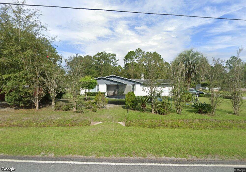
This home is located at 895 N Palm St, Jesup, GA 31546 and is currently estimated at $186,890, approximately $88 per square foot. 895 N Palm St is a home located in Wayne County with nearby schools including Jesup Elementary School, Arthur Williams Middle School, and Wayne County High School.
Ownership History
Date
Name
Owned For
Owner Type
Purchase Details
Closed on
Jul 7, 2007
Sold by
Stevens Betty L
Bought by
Canidate Bobbie W
Current Estimated Value
Purchase Details
Closed on
Apr 1, 2000
Bought by
Stevens Betty L and Stevens Jacob
Purchase Details
Closed on
Jun 1, 1996
Purchase Details
Closed on
Jan 1, 1991
Purchase Details
Closed on
Aug 1, 1984
Purchase Details
Closed on
Oct 1, 1973
Purchase Details
Closed on
Oct 1, 1971
Create a Home Valuation Report for This Property
The Home Valuation Report is an in-depth analysis detailing your home's value as well as a comparison with similar homes in the area
Home Values in the Area
Average Home Value in this Area
Purchase History
| Date | Buyer | Sale Price | Title Company |
|---|---|---|---|
| Canidate Bobbie W | $105,000 | -- | |
| Stevens Betty L | $69,000 | -- | |
| -- | $61,000 | -- | |
| -- | $62,700 | -- | |
| -- | $69,000 | -- | |
| -- | -- | -- | |
| -- | -- | -- |
Source: Public Records
Tax History Compared to Growth
Tax History
| Year | Tax Paid | Tax Assessment Tax Assessment Total Assessment is a certain percentage of the fair market value that is determined by local assessors to be the total taxable value of land and additions on the property. | Land | Improvement |
|---|---|---|---|---|
| 2024 | -- | $58,629 | $2,830 | $55,799 |
| 2023 | $1,836 | $51,892 | $2,830 | $49,062 |
| 2022 | $1,632 | $46,134 | $2,862 | $43,272 |
| 2021 | $1,632 | $46,134 | $2,862 | $43,272 |
| 2020 | $1,632 | $46,134 | $2,862 | $43,272 |
| 2019 | $679 | $46,134 | $2,862 | $43,272 |
| 2018 | $0 | $46,134 | $2,862 | $43,272 |
| 2017 | $0 | $46,134 | $2,862 | $43,272 |
| 2016 | $1,231 | $46,134 | $2,862 | $43,272 |
| 2014 | $1,234 | $46,134 | $2,862 | $43,272 |
| 2013 | -- | $46,134 | $2,862 | $43,272 |
Source: Public Records
Map
Nearby Homes
- 548 N Cypress St
- 455 N Mahogany St
- 0 E Oak St
- Apt E Oak St
- 385 N Hickory St
- 658 E Walnut St
- 447 NE Broad St
- 498 NE Broad St
- 436-441 Brunswick St
- 111 N Mahogany St
- 249 Pine Ridge Rd
- 301 U S 301
- 217 E Pine St
- 217 Pine Ridge Rd
- 207 E Pine St
- 197 NW Broad St
- 661 E Plum St
- 15 Bethlehem Rd
- 0 Bethlehem Rd Unit 10523941
- 0 Bethlehem Rd Unit 1654015