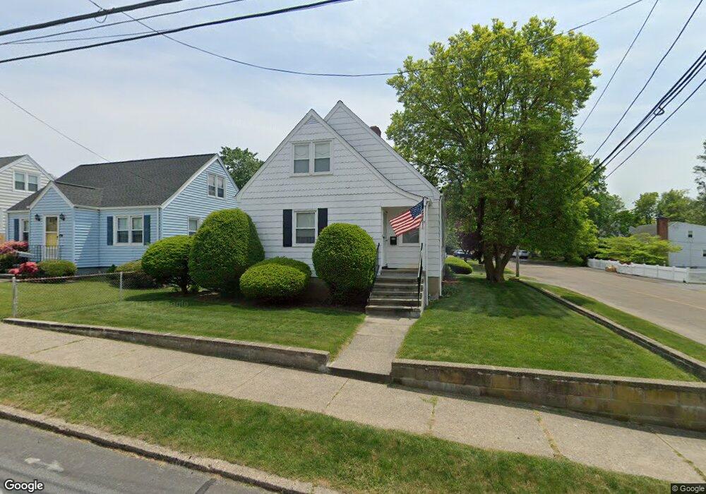
895 Queen St Bridgeport, CT 06606
North End NeighborhoodEstimated Value: $389,000 - $415,434
3
Beds
1
Bath
1,296
Sq Ft
$312/Sq Ft
Est. Value
About This Home
This home is located at 895 Queen St, Bridgeport, CT 06606 and is currently estimated at $404,109, approximately $311 per square foot. 895 Queen St is a home located in Fairfield County with nearby schools including Blackham School, Central High School, and The Unquowa School.
Create a Home Valuation Report for This Property
The Home Valuation Report is an in-depth analysis detailing your home's value as well as a comparison with similar homes in the area
Home Values in the Area
Average Home Value in this Area
Tax History
| Year | Tax Paid | Tax Assessment Tax Assessment Total Assessment is a certain percentage of the fair market value that is determined by local assessors to be the total taxable value of land and additions on the property. | Land | Improvement |
|---|---|---|---|---|
| 2025 | $6,707 | $154,360 | $75,310 | $79,050 |
| 2024 | $6,707 | $154,360 | $75,310 | $79,050 |
| 2023 | $6,707 | $154,360 | $75,310 | $79,050 |
| 2022 | $6,707 | $154,360 | $75,310 | $79,050 |
| 2021 | $6,707 | $154,360 | $75,310 | $79,050 |
| 2020 | $5,729 | $106,120 | $39,340 | $66,780 |
| 2019 | $5,729 | $106,120 | $39,340 | $66,780 |
| 2018 | $5,770 | $106,120 | $39,340 | $66,780 |
| 2017 | $5,770 | $106,120 | $39,340 | $66,780 |
| 2016 | $5,770 | $106,120 | $39,340 | $66,780 |
| 2015 | $6,059 | $143,590 | $47,600 | $95,990 |
| 2014 | $6,059 | $143,590 | $47,600 | $95,990 |
Source: Public Records
Map
Nearby Homes
- 720 Queen St
- 932 Thorme St
- 619 Queen St
- 605 Merritt St
- 90 Lu Manor Dr
- 260 Toilsome Place
- 575 Burnsford Ave
- 3989 Park Ave
- 533 Glendale Ave
- 604 Birmingham St
- 3200 Park Ave Unit 11E2
- 3200 Park Ave Unit 5F1
- 419 Valley Rd
- 574 Thorme St
- 339 Goldenrod Ave
- 316 Goldenrod Ave
- 2800 Madison Ave Unit 1B
- 230 Cherry Hill Dr Unit 2B
- 153 Cherry Hill Dr Unit 2B
- 81 Cherry Hill Dr Unit 1B
Your Personal Tour Guide
Ask me questions while you tour the home.