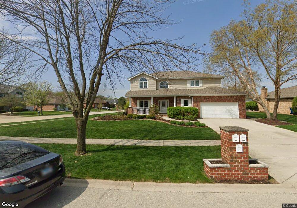
895 Spinnaker Dr Unit 3 New Lenox, IL 60451
Estimated Value: $490,000 - $540,000
--
Bed
--
Bath
--
Sq Ft
0.31
Acres
About This Home
This home is located at 895 Spinnaker Dr Unit 3, New Lenox, IL 60451 and is currently estimated at $505,975. 895 Spinnaker Dr Unit 3 is a home located in Will County with nearby schools including Spencer Trail, Spencer Pointe, and Spencer Crossing Intermediate School.
Ownership History
Date
Name
Owned For
Owner Type
Purchase Details
Closed on
Jan 24, 2014
Sold by
Patrick Thomas C and Patrick Kathleen L
Bought by
Thomas C Patrick & Kathleen L Living Tru
Current Estimated Value
Purchase Details
Closed on
Dec 23, 2003
Sold by
T J Cachey Builders Inc
Bought by
Patrick Thomas C and Patrick Kathleen L
Home Financials for this Owner
Home Financials are based on the most recent Mortgage that was taken out on this home.
Original Mortgage
$135,000
Interest Rate
5.84%
Mortgage Type
Purchase Money Mortgage
Create a Home Valuation Report for This Property
The Home Valuation Report is an in-depth analysis detailing your home's value as well as a comparison with similar homes in the area
Home Values in the Area
Average Home Value in this Area
Purchase History
| Date | Buyer | Sale Price | Title Company |
|---|---|---|---|
| Thomas C Patrick & Kathleen L Living Tru | -- | None Available | |
| Patrick Thomas C | $265,000 | Greater Illinois Title Compa |
Source: Public Records
Mortgage History
| Date | Status | Borrower | Loan Amount |
|---|---|---|---|
| Closed | Patrick Thomas C | $135,000 |
Source: Public Records
Tax History Compared to Growth
Tax History
| Year | Tax Paid | Tax Assessment Tax Assessment Total Assessment is a certain percentage of the fair market value that is determined by local assessors to be the total taxable value of land and additions on the property. | Land | Improvement |
|---|---|---|---|---|
| 2024 | $12,152 | $157,745 | $36,393 | $121,352 |
| 2023 | $12,152 | $143,797 | $33,175 | $110,622 |
| 2022 | $10,943 | $132,471 | $30,562 | $101,909 |
| 2021 | $10,393 | $124,585 | $28,743 | $95,842 |
| 2020 | $10,100 | $120,139 | $27,717 | $92,422 |
| 2019 | $9,669 | $116,414 | $26,858 | $89,556 |
| 2018 | $9,448 | $112,401 | $25,932 | $86,469 |
| 2017 | $8,980 | $109,169 | $25,186 | $83,983 |
| 2016 | $8,719 | $106,247 | $24,512 | $81,735 |
| 2015 | $8,444 | $102,902 | $23,740 | $79,162 |
| 2014 | $8,444 | $101,632 | $23,447 | $78,185 |
| 2013 | $8,444 | $103,002 | $23,763 | $79,239 |
Source: Public Records
Map
Nearby Homes
- 2848 Southwind Dr
- 2758 Bluestone Bay Dr
- 21606 Skyway Dr
- 651 Schooner Dr
- 1587 Glenbrooke Ln
- 1591 Glenbrooke Ln
- 1595 Glenbrooke Ln
- 1583 Glenbrooke Ln
- 1579 Glenbrooke Bldg 60 Ln
- 2667 E Lincoln Hwy
- 21359 Saddle Ln
- 1738 Orchard Ln
- 190 Pottawatomie Ln
- Avalon Plan at Leigh Creek - Townhome
- Hampton Plan at Leigh Creek - Townhome
- 21244 Sage Brush Ln
- 1781 Orchard Ln
- 1515 Glenbrooke Ln
- 11826 Leigh Ct
- 701 Bishops Gate
- 887 Spinnaker Dr
- 898 Brigantine Dr Unit 2
- 881 Spinnaker Dr
- 2740 Southwind Dr
- 2730 Southwind Dr
- 890 Brigantine Dr
- 2750 Southwind Dr
- 892 Spinnaker Dr
- 898 Spinnaker Dr
- 2720 Southwind Dr
- 884 Spinnaker Dr
- 873 Spinnaker Dr
- 876 Spinnaker Dr
- 2710 Southwind Dr Unit 2
- 882 Brigantine Dr
- 2770 Southwind Dr
- 868 Spinnaker Dr
- 893 Bristol Ln
- 863 Spinnaker Dr Unit 3
- 887 Bristol Ln