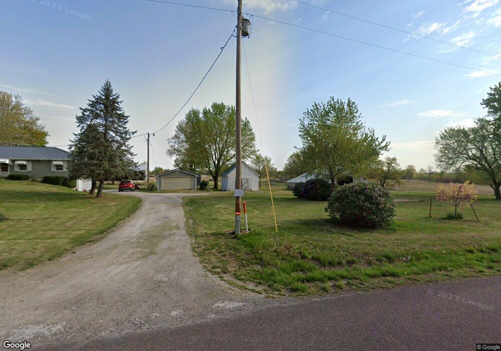
8951 E Old Highway 124 Hallsville, MO 65255
Estimated Value: $371,000 - $376,000
3
Beds
2
Baths
1,556
Sq Ft
$240/Sq Ft
Est. Value
About This Home
This home is located at 8951 E Old Highway 124, Hallsville, MO 65255 and is currently estimated at $373,157, approximately $239 per square foot. 8951 E Old Highway 124 is a home located in Boone County with nearby schools including Hallsville Primary School, Hallsville Intermediate School, and Hallsville Middle School.
Ownership History
Date
Name
Owned For
Owner Type
Purchase Details
Closed on
Jan 24, 2023
Sold by
Allen Millard Reid
Bought by
And Buckman Properties Llc
Current Estimated Value
Home Financials for this Owner
Home Financials are based on the most recent Mortgage that was taken out on this home.
Original Mortgage
$290,000
Outstanding Balance
$254,333
Interest Rate
5.54%
Mortgage Type
Credit Line Revolving
Estimated Equity
$118,824
Purchase Details
Closed on
Jun 6, 2022
Sold by
Thomas Glenn and Thomas Melene
Bought by
Millard Reid Allen
Purchase Details
Closed on
Jul 24, 2013
Sold by
Beaver Dale and Crowder Family Trust
Bought by
Thomas Glenn and Thomas Melene
Home Financials for this Owner
Home Financials are based on the most recent Mortgage that was taken out on this home.
Original Mortgage
$167,346
Interest Rate
3.99%
Mortgage Type
New Conventional
Create a Home Valuation Report for This Property
The Home Valuation Report is an in-depth analysis detailing your home's value as well as a comparison with similar homes in the area
Home Values in the Area
Average Home Value in this Area
Purchase History
| Date | Buyer | Sale Price | Title Company |
|---|---|---|---|
| And Buckman Properties Llc | -- | -- | |
| Millard Reid Allen | -- | None Listed On Document | |
| Millard Reid Allen | -- | None Listed On Document | |
| Thomas Glenn | -- | None Available |
Source: Public Records
Mortgage History
| Date | Status | Borrower | Loan Amount |
|---|---|---|---|
| Open | And Buckman Properties Llc | $290,000 | |
| Previous Owner | Thomas Glenn | $167,346 |
Source: Public Records
Tax History Compared to Growth
Tax History
| Year | Tax Paid | Tax Assessment Tax Assessment Total Assessment is a certain percentage of the fair market value that is determined by local assessors to be the total taxable value of land and additions on the property. | Land | Improvement |
|---|---|---|---|---|
| 2025 | $1,299 | $21,884 | $2,816 | $19,068 |
| 2024 | $1,299 | $19,965 | $2,816 | $17,149 |
| 2023 | $1,282 | $19,965 | $2,816 | $17,149 |
| 2022 | $1,197 | $18,551 | $2,816 | $15,735 |
| 2021 | $1,194 | $18,551 | $2,816 | $15,735 |
| 2020 | $1,212 | $18,551 | $2,816 | $15,735 |
| 2019 | $1,200 | $18,551 | $2,816 | $15,735 |
| 2018 | $1,140 | $0 | $0 | $0 |
| 2017 | $1,140 | $17,236 | $2,816 | $14,420 |
| 2016 | $1,002 | $17,236 | $2,816 | $14,420 |
| 2015 | $1,001 | $17,236 | $2,816 | $14,420 |
| 2014 | $995 | $17,236 | $2,816 | $14,420 |
Source: Public Records
Map
Nearby Homes
- 11 ACRES E Highway Oo
- 7495 E Schooler Rd
- 118 Wesley Ave
- 9575 E Shelly Ln
- 100 Trent Ct
- 14670 Wellstead Dr
- 14600 Mettler Dr
- 6512 Douglas Pkwy
- 14698 Mettler Dr
- 14640 N Ricketts Rd
- 6350 Brooke Dr
- LOT 152 Ruth Ann Dr
- LOT 151 Ruth Ann Dr
- 14640 N Sunnyslope
- 14329 Monarch Dr
- 14331 Ontario Dr
- 0 E Low Crossings Rd
- 13075 N Branch St
- LOT 3 N Hecht Rd
- 10750 Roberts Ln
- 14750 N Level Rd
- 14650 N Level Rd
- 14600 N Level Rd
- 14580 N Level Rd
- 14500 N Level Rd
- 14535 N Level Rd
- 9200 E Old Highway 124
- 14455 N Level Rd
- TRACT 1 Old Hwy 124
- 14400 N Level Rd
- 14350 N Level Rd
- 9451 E Old Highway 124
- 8501 E Old Highway 124
- 14355 N Level Rd
- 8390 E Old Highway 124
- 14201 N Level Rd
- 15060 N Highway 124
- 14850 N Wright Dr
- 14051 N Level Rd
- 15101 N Highway 124