Estimated Value: $656,000 - $704,000
4
Beds
3
Baths
2,068
Sq Ft
$327/Sq Ft
Est. Value
About This Home
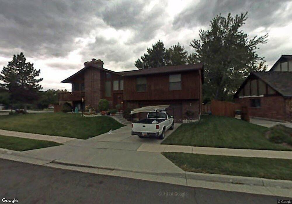
This home is located at 8952 S Sheffield Way, Sandy, UT 84093 and is currently estimated at $675,993, approximately $326 per square foot. 8952 S Sheffield Way is a home located in Salt Lake County with nearby schools including Quail Hollow Elementary School, Albion Middle School, and Brighton High School.
Ownership History
Date
Name
Owned For
Owner Type
Purchase Details
Closed on
Dec 18, 2019
Sold by
Donelson Carl E and Lehenbauer Lisa
Bought by
Burd Robert Joe and Stevens Maevlyn Alette
Current Estimated Value
Home Financials for this Owner
Home Financials are based on the most recent Mortgage that was taken out on this home.
Original Mortgage
$430,000
Outstanding Balance
$379,107
Interest Rate
3.6%
Mortgage Type
VA
Estimated Equity
$296,886
Purchase Details
Closed on
Dec 13, 1999
Sold by
Donelson Carl E and Donelson Verna L
Bought by
Donelson Verna L
Create a Home Valuation Report for This Property
The Home Valuation Report is an in-depth analysis detailing your home's value as well as a comparison with similar homes in the area
Home Values in the Area
Average Home Value in this Area
Purchase History
| Date | Buyer | Sale Price | Title Company |
|---|---|---|---|
| Burd Robert Joe | -- | First American Title | |
| Donelson Verna L | -- | -- |
Source: Public Records
Mortgage History
| Date | Status | Borrower | Loan Amount |
|---|---|---|---|
| Open | Burd Robert Joe | $430,000 |
Source: Public Records
Tax History Compared to Growth
Tax History
| Year | Tax Paid | Tax Assessment Tax Assessment Total Assessment is a certain percentage of the fair market value that is determined by local assessors to be the total taxable value of land and additions on the property. | Land | Improvement |
|---|---|---|---|---|
| 2025 | $884 | $642,400 | $307,700 | $334,700 |
| 2024 | $884 | $625,200 | $296,300 | $328,900 |
| 2023 | $514 | $532,100 | $284,900 | $247,200 |
| 2022 | $1,456 | $526,200 | $279,300 | $246,900 |
| 2021 | $1,033 | $412,500 | $247,000 | $165,500 |
| 2020 | $924 | $383,600 | $237,500 | $146,100 |
| 2019 | $2,303 | $320,700 | $224,000 | $96,700 |
| 2018 | $2,120 | $319,900 | $224,000 | $95,900 |
| 2017 | $2,000 | $288,600 | $224,000 | $64,600 |
| 2016 | $1,942 | $271,000 | $201,900 | $69,100 |
| 2015 | $2,183 | $282,400 | $207,900 | $74,500 |
| 2014 | $2,186 | $277,800 | $207,900 | $69,900 |
Source: Public Records
Map
Nearby Homes
- 8965 Quail Run Dr
- 9034 Cheshire Cir
- 2509 E Cobblestone Way
- 9123 Meadow Ct
- 2311 Snow Mountain Dr
- 9061 S Newcastle Cir
- 2120 E Newcastle Dr
- 2650 Willow Wick Dr
- 2167 E Alta Cove Cir
- 2646 Snow Mountain Dr
- 9293 S Quail Run Dr
- 2360 Woodchuck Way
- 2056 E Meadow Lark Way
- 8597 Mount Majestic Rd
- 8571 Monitor Dr
- 9257 S Quail Hollow Dr
- 2271 E Alta Canyon Dr
- 2131 Gad Way
- 8916 Cobble Crest Ln
- 1922 Southbridge Way
- 8952 Sheffield Way
- 8938 Sheffield Way
- 8938 S Sheffield Way
- 2295 Newcastle Dr
- 8955 Sheffield Way
- 8945 Sheffield Way
- 2285 Newcastle Dr
- 8926 Sheffield Way
- 8926 S Sheffield Way
- 2298 Newcastle Dr
- 8935 Sheffield Way
- 2284 Renegade Rd
- 2284 E Renegade Rd
- 8913 Renegade Rd
- 8970 Quail Run Dr
- 2288 Newcastle Dr
- 2312 E Newcastle Dr
- 2277 Newcastle Dr
- 2277 E Newcastle Dr
- 8954 Quail Run Dr