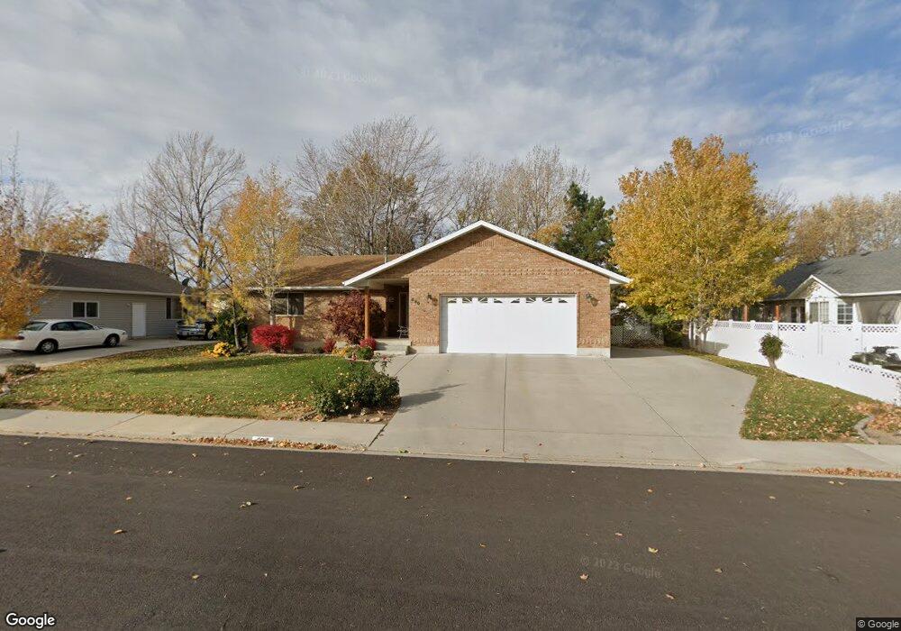
896 S 690 E Unit 10 Spanish Fork, UT 84660
Estimated Value: $501,000 - $532,840
3
Beds
2
Baths
1,435
Sq Ft
$363/Sq Ft
Est. Value
About This Home
This home is located at 896 S 690 E Unit 10, Spanish Fork, UT 84660 and is currently estimated at $521,280, approximately $363 per square foot. 896 S 690 E Unit 10 is a home located in Utah County with nearby schools including Canyon Elementary School, Spanish Fork Jr High School, and Spanish Fork High School.
Ownership History
Date
Name
Owned For
Owner Type
Purchase Details
Closed on
Mar 31, 1999
Sold by
Weight Dennis A
Bought by
Peck Andrew T and Peck Laura W
Current Estimated Value
Home Financials for this Owner
Home Financials are based on the most recent Mortgage that was taken out on this home.
Original Mortgage
$45,000
Interest Rate
6.79%
Purchase Details
Closed on
Aug 23, 1996
Sold by
Sunrise Building Company L L C
Bought by
Weight Dennis A and Weight Anjanette A
Home Financials for this Owner
Home Financials are based on the most recent Mortgage that was taken out on this home.
Original Mortgage
$80,000
Interest Rate
8.23%
Purchase Details
Closed on
Aug 22, 1996
Sold by
Huntsman Norman L
Bought by
Sunrise Building Company L L C
Home Financials for this Owner
Home Financials are based on the most recent Mortgage that was taken out on this home.
Original Mortgage
$80,000
Interest Rate
8.23%
Purchase Details
Closed on
Aug 7, 1996
Sold by
Sunrise Building Company Llc
Bought by
Huntsman Norman L
Home Financials for this Owner
Home Financials are based on the most recent Mortgage that was taken out on this home.
Original Mortgage
$80,000
Interest Rate
8.23%
Create a Home Valuation Report for This Property
The Home Valuation Report is an in-depth analysis detailing your home's value as well as a comparison with similar homes in the area
Home Values in the Area
Average Home Value in this Area
Purchase History
| Date | Buyer | Sale Price | Title Company |
|---|---|---|---|
| Peck Andrew T | -- | First American Title Ins Co | |
| Weight Dennis A | -- | -- | |
| Sunrise Building Company L L C | -- | -- | |
| Huntsman Norman L | -- | -- |
Source: Public Records
Mortgage History
| Date | Status | Borrower | Loan Amount |
|---|---|---|---|
| Closed | Peck Andrew T | $45,000 | |
| Previous Owner | Weight Dennis A | $80,000 |
Source: Public Records
Tax History
| Year | Tax Paid | Tax Assessment Tax Assessment Total Assessment is a certain percentage of the fair market value that is determined by local assessors to be the total taxable value of land and additions on the property. | Land | Improvement |
|---|---|---|---|---|
| 2025 | $2,328 | $256,025 | -- | -- |
| 2024 | $2,328 | $239,910 | $0 | $0 |
| 2023 | $2,397 | $247,335 | $0 | $0 |
| 2022 | $2,359 | $238,755 | $0 | $0 |
| 2021 | $2,010 | $325,500 | $109,100 | $216,400 |
| 2020 | $1,903 | $299,600 | $99,200 | $200,400 |
| 2019 | $1,723 | $285,400 | $85,000 | $200,400 |
| 2018 | $1,606 | $257,100 | $78,000 | $179,100 |
| 2017 | $1,533 | $131,890 | $0 | $0 |
| 2016 | $1,361 | $115,555 | $0 | $0 |
| 2015 | $1,295 | $108,625 | $0 | $0 |
| 2014 | $1,170 | $98,505 | $0 | $0 |
Source: Public Records
Map
Nearby Homes
- 2256 E 760 S Unit 7
- 715 Scenic Dr
- 1105 S 200 E
- 272 E 850 S Unit 7-204
- 272 E 850 S Unit 7-203
- 272 E 850 S Unit 7-201
- 272 E 850 S Unit 7-304
- 237 E 850 S
- 216 E 850 S Unit 6-204
- 837 S 200 E Unit 5-303
- 837 S 200 E Unit 5-202
- 837 S 200 E Unit 5-201
- 837 S 200 E Unit 5-203
- 837 S 200 E Unit 5-301
- 1266 S 3550 E
- 1025 S 3100 E Unit 320
- 1217 S 200 E
- 274 E Ardies Ave Unit 2B
- 1215 S 200 E Unit 11
- 834 S 1300 #16gc E
- 896 S 690 E
- 672 E Quail Dr
- 916 S 690 E
- 672 E Quail Dr
- 871 S Wolf Hollow Dr
- 891 S Wolf Hollow Dr
- 709 E 920 S
- 901 S Wolf Hollow Dr
- 712 E 860 S
- 936 S 690 E
- 671 E Quail Dr
- 937 S 690 E
- 937 S 690 E Unit 17
- 729 E 920 S
- 711 E 860 S
- 711 E 860 S Unit 62
- 935 S Wolf Hollow Dr
- 845 S Wolf Hollow Dr
- 954 S 690 E
- 890 S Wolf Hollow Dr
Your Personal Tour Guide
Ask me questions while you tour the home.