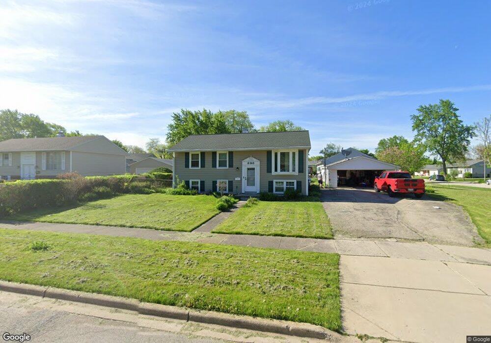
896 Upper Brandon Dr Aurora, IL 60506
North River NeighborhoodEstimated Value: $286,000 - $320,000
4
Beds
1
Bath
1,776
Sq Ft
$168/Sq Ft
Est. Value
About This Home
This home is located at 896 Upper Brandon Dr, Aurora, IL 60506 and is currently estimated at $298,423, approximately $168 per square foot. 896 Upper Brandon Dr is a home located in Kane County with nearby schools including Smith Elementary School, Jewel Middle School, and West Aurora High School.
Ownership History
Date
Name
Owned For
Owner Type
Purchase Details
Closed on
Sep 26, 2003
Sold by
Griffin Vernon and Griffin Mary J
Bought by
Romero John and Romero Maria
Current Estimated Value
Home Financials for this Owner
Home Financials are based on the most recent Mortgage that was taken out on this home.
Original Mortgage
$167,322
Outstanding Balance
$79,259
Interest Rate
6.43%
Mortgage Type
FHA
Estimated Equity
$219,164
Create a Home Valuation Report for This Property
The Home Valuation Report is an in-depth analysis detailing your home's value as well as a comparison with similar homes in the area
Home Values in the Area
Average Home Value in this Area
Purchase History
| Date | Buyer | Sale Price | Title Company |
|---|---|---|---|
| Romero John | $170,000 | Chicago Title Insurance Comp |
Source: Public Records
Mortgage History
| Date | Status | Borrower | Loan Amount |
|---|---|---|---|
| Open | Romero John | $167,322 |
Source: Public Records
Tax History Compared to Growth
Tax History
| Year | Tax Paid | Tax Assessment Tax Assessment Total Assessment is a certain percentage of the fair market value that is determined by local assessors to be the total taxable value of land and additions on the property. | Land | Improvement |
|---|---|---|---|---|
| 2024 | $4,547 | $73,420 | $15,912 | $57,508 |
| 2023 | $4,248 | $65,600 | $14,217 | $51,383 |
| 2022 | $4,325 | $59,854 | $12,972 | $46,882 |
| 2021 | $4,086 | $55,725 | $12,077 | $43,648 |
| 2020 | $3,577 | $57,341 | $11,218 | $46,123 |
| 2019 | $3,737 | $53,128 | $10,394 | $42,734 |
| 2018 | $3,815 | $49,214 | $9,614 | $39,600 |
| 2017 | $3,430 | $44,330 | $8,858 | $35,472 |
| 2016 | $3,800 | $41,774 | $7,593 | $34,181 |
| 2015 | -- | $36,306 | $6,529 | $29,777 |
| 2014 | -- | $34,918 | $6,279 | $28,639 |
| 2013 | -- | $35,466 | $6,190 | $29,276 |
Source: Public Records
Map
Nearby Homes
- 910 Southbridge Dr
- 461 Sullivan Rd
- 795 N Elmwood Dr
- 781 N Elmwood Dr
- 740 N Elmwood Dr
- 1104 New Haven Ave
- 1351 Monomoy St Unit D
- 1389 Monomoy St Unit B2
- 833 N Randall Rd Unit C4
- 811 N Randall Rd Unit B
- 616 Morton Ave
- 1421 Heather Dr
- 418 W Illinois Ave
- 742 N Glenwood Place
- 602 N May St
- 526 N View St
- 1815 Brighton Cir
- 967 Sapphire Ln
- 959 Sapphire Ln
- 971 Sapphire Ln
- 1341 Post Rd
- 880 Upper Brandon Dr
- 1331 Post Rd
- 1340 Durham Dr
- 1350 Post Rd
- 891 Upper Brandon Dr
- 901 Upper Brandon Dr Unit 1
- 1330 Durham Dr Unit 1
- 1340 Post Rd
- 911 Upper Brandon Dr
- 1321 Post Rd
- 871 Upper Brandon Dr Unit 1
- 1330 Post Rd
- 934 Upper Brandon Dr Unit 2
- 921 Upper Brandon Dr
- 1320 Durham Dr Unit 1
- 1305 Post Rd
- 1320 Post Rd Unit 1
- 1373 Eastwood Dr
- 861 Upper Brandon Dr Unit 1