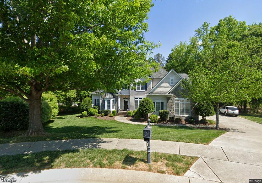
8963 Landsdowne Ave Harrisburg, NC 28075
Estimated Value: $704,000 - $766,000
5
Beds
5
Baths
3,843
Sq Ft
$192/Sq Ft
Est. Value
About This Home
This home is located at 8963 Landsdowne Ave, Harrisburg, NC 28075 and is currently estimated at $738,417, approximately $192 per square foot. 8963 Landsdowne Ave is a home located in Cabarrus County with nearby schools including Hickory Ridge Elementary School, Hickory Ridge Middle, and Hickory Ridge High School.
Ownership History
Date
Name
Owned For
Owner Type
Purchase Details
Closed on
Oct 15, 2004
Sold by
Rocky River Charlotte Aip Iii Llc
Bought by
Jones Raymond and Jones Daun L
Current Estimated Value
Home Financials for this Owner
Home Financials are based on the most recent Mortgage that was taken out on this home.
Original Mortgage
$459,300
Outstanding Balance
$239,741
Interest Rate
5.64%
Mortgage Type
Construction
Estimated Equity
$498,676
Create a Home Valuation Report for This Property
The Home Valuation Report is an in-depth analysis detailing your home's value as well as a comparison with similar homes in the area
Home Values in the Area
Average Home Value in this Area
Purchase History
| Date | Buyer | Sale Price | Title Company |
|---|---|---|---|
| Jones Raymond | $75,500 | -- |
Source: Public Records
Mortgage History
| Date | Status | Borrower | Loan Amount |
|---|---|---|---|
| Open | Jones Raymond | $459,300 |
Source: Public Records
Tax History Compared to Growth
Tax History
| Year | Tax Paid | Tax Assessment Tax Assessment Total Assessment is a certain percentage of the fair market value that is determined by local assessors to be the total taxable value of land and additions on the property. | Land | Improvement |
|---|---|---|---|---|
| 2025 | $6,694 | $678,910 | $160,000 | $518,910 |
| 2024 | $6,694 | $678,910 | $160,000 | $518,910 |
| 2023 | $5,047 | $429,500 | $69,000 | $360,500 |
| 2022 | $5,047 | $429,500 | $69,000 | $360,500 |
| 2021 | $4,703 | $429,500 | $69,000 | $360,500 |
| 2020 | $4,703 | $429,500 | $69,000 | $360,500 |
| 2019 | $4,472 | $408,360 | $70,000 | $338,360 |
| 2018 | $4,390 | $408,360 | $70,000 | $338,360 |
| 2017 | $4,043 | $408,360 | $70,000 | $338,360 |
| 2016 | $4,043 | $436,260 | $55,000 | $381,260 |
| 2015 | $3,054 | $436,260 | $55,000 | $381,260 |
| 2014 | $3,054 | $436,260 | $55,000 | $381,260 |
Source: Public Records
Map
Nearby Homes
- 4156 Green Park Ct
- 8379 Burgundy Ridge Dr
- 4151 Green Park Ct
- 3904 Hounslow Ln
- 8914 Landsdowne Ave
- 4134 Burnage Hall Rd
- 8105 Stillhouse Ln Unit 23
- 4831 Reason Ct Unit 72
- 8021 Stillhouse Ln Unit 18
- 4826 Reason Ct Unit 68
- 4813 Reason Ct Unit 75
- 4818 Reason Ct Unit 74
- 9034 Kensington Forest Dr
- 8698 Rocky River Rd
- 8979 Rocky River Rd
- 3422 Burnage Hall Rd
- 8340 Breton Way
- 8491 Penton Place
- 8985 Rocky River Rd
- 9230 Robinson Church Rd Unit 3
- 8955 Landsdowne Ave
- 3909 Balmoral Ave
- 8971 Landsdowne Ave Unit 43
- 3925 Balmoral Ave
- 8947 Landsdowne Ave
- 8954 Landsdowne Ave
- 8355 Burgundy Ridge Dr
- 8361 Burgundy Ridge Dr
- 3916 Balmoral Ave
- 8939 Landsdowne Ave
- 8349 Burgundy Ridge Dr
- 3908 Balmoral Ave
- 3926 Balmoral Ave
- 8946 Landsdowne Ave
- 8343 Burgundy Ridge Dr
- 4144 Green Park Ct
- 8367 Burgundy Ridge Dr
- 4148 Green Park Ct
- 4140 Green Park Ct
- 4140 Green Park Ct Unit 341