Estimated Value: $234,000 - $304,000
Studio
--
Bath
1,608
Sq Ft
$159/Sq Ft
Est. Value
About This Home
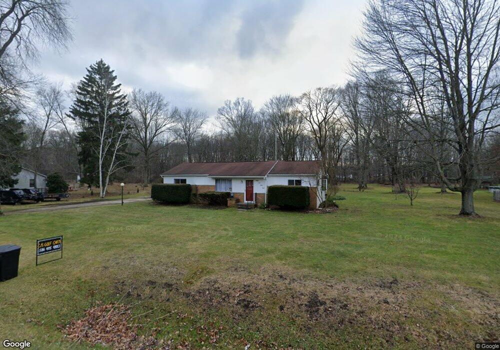
This home is located at 8968 Stone Rd, Clay, MI 48001 and is currently estimated at $255,197, approximately $158 per square foot. 8968 Stone Rd is a home located in St. Clair County.
Ownership History
Date
Name
Owned For
Owner Type
Purchase Details
Closed on
Oct 30, 2020
Sold by
Laplane Sarah L
Bought by
Laplante Jeff and Laplante Carrie Kreinbring
Current Estimated Value
Purchase Details
Closed on
Nov 4, 2014
Sold by
Laplante Sarah L
Bought by
Laplante Sarah L and Laplante Jeff
Purchase Details
Closed on
Mar 31, 2014
Sold by
Folkerts Martha and Renaud Eva
Bought by
Laplante Sarah L
Home Financials for this Owner
Home Financials are based on the most recent Mortgage that was taken out on this home.
Original Mortgage
$6,187
Interest Rate
4.34%
Mortgage Type
Purchase Money Mortgage
Purchase Details
Closed on
Dec 29, 2005
Sold by
Renaud John M and Renaud Eva D
Bought by
Renaud John M and Renaud Eva D
Create a Home Valuation Report for This Property
The Home Valuation Report is an in-depth analysis detailing your home's value as well as a comparison with similar homes in the area
Home Values in the Area
Average Home Value in this Area
Purchase History
| Date | Buyer | Sale Price | Title Company |
|---|---|---|---|
| Laplante Jeff | -- | None Available | |
| Laplante Sarah L | -- | First American Title Ins Co | |
| Laplante Sarah L | $75,000 | First American Title Ins Co | |
| Renaud John M | -- | None Available |
Source: Public Records
Mortgage History
| Date | Status | Borrower | Loan Amount |
|---|---|---|---|
| Previous Owner | Laplante Sarah L | $6,187 |
Source: Public Records
Tax History
| Year | Tax Paid | Tax Assessment Tax Assessment Total Assessment is a certain percentage of the fair market value that is determined by local assessors to be the total taxable value of land and additions on the property. | Land | Improvement |
|---|---|---|---|---|
| 2025 | $1,251 | $110,200 | $0 | $0 |
| 2024 | $1,227 | $102,500 | $0 | $0 |
| 2023 | $1,182 | $91,800 | $0 | $0 |
| 2022 | $2,201 | $84,900 | $0 | $0 |
| 2020 | $2,091 | $75,500 | $75,500 | $0 |
| 2019 | $2,058 | $60,300 | $0 | $0 |
| 2018 | $2,032 | $54,100 | $0 | $0 |
| 2017 | $1,877 | $52,500 | $0 | $0 |
| 2016 | $999 | $52,500 | $0 | $0 |
| 2015 | -- | $52,900 | $52,900 | $0 |
| 2014 | -- | $47,500 | $47,500 | $0 |
| 2013 | -- | $45,000 | $0 | $0 |
Source: Public Records
Map
Nearby Homes
- 8846 Stone Rd
- 6303 High Rd
- 00 Dickinson Island
- 6136 High Rd
- 9188 Marsh Rd
- 9084 Island Dr
- 8866 Marsh Rd
- 9279 Oakdale St
- 9309 Oakdale
- 24 Vacant Lots Land
- 3202 Fruit St
- 9399 Oakdale St
- 6630 Holland St
- 8658 Marsh Rd
- 5966 Starboard Ct Unit 284
- 9761 Marina Cir Unit 292
- 1103 Beth Ct
- 6493 Benoit Rd
- 9665 River St
- 9658 Seaway Dr Unit 91
Your Personal Tour Guide
Ask me questions while you tour the home.