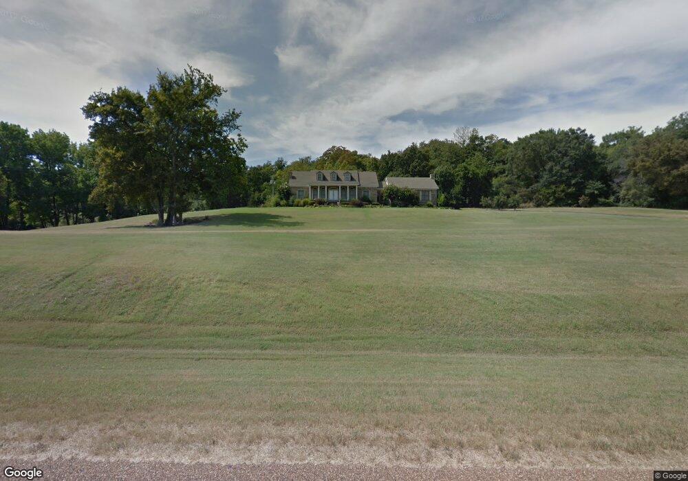
897 Highway 50 N Forrest City, AR 72335
Estimated Value: $290,132 - $363,000
--
Bed
3
Baths
4,504
Sq Ft
$73/Sq Ft
Est. Value
About This Home
This home is located at 897 Highway 50 N, Forrest City, AR 72335 and is currently estimated at $330,711, approximately $73 per square foot. 897 Highway 50 N is a home located in St. Francis County with nearby schools including Central Elementary School, Stewart Elementary School, and Forrest City Junior High School.
Ownership History
Date
Name
Owned For
Owner Type
Purchase Details
Closed on
Feb 7, 2008
Sold by
Trail W J and Trail Michelle
Bought by
Trail W J and Trail Marsha
Current Estimated Value
Create a Home Valuation Report for This Property
The Home Valuation Report is an in-depth analysis detailing your home's value as well as a comparison with similar homes in the area
Home Values in the Area
Average Home Value in this Area
Purchase History
| Date | Buyer | Sale Price | Title Company |
|---|---|---|---|
| Trail W J | $180,000 | -- | |
| Trail W J | $180,000 | None Available |
Source: Public Records
Tax History Compared to Growth
Tax History
| Year | Tax Paid | Tax Assessment Tax Assessment Total Assessment is a certain percentage of the fair market value that is determined by local assessors to be the total taxable value of land and additions on the property. | Land | Improvement |
|---|---|---|---|---|
| 2024 | $1,840 | $49,830 | $2,200 | $47,630 |
| 2023 | $1,840 | $49,830 | $2,200 | $47,630 |
| 2022 | $1,419 | $49,830 | $2,200 | $47,630 |
| 2021 | $1,419 | $48,280 | $1,600 | $46,680 |
| 2020 | $1,419 | $48,280 | $1,600 | $46,680 |
| 2019 | $1,465 | $48,280 | $1,600 | $46,680 |
| 2018 | $1,490 | $48,280 | $1,600 | $46,680 |
| 2017 | $1,840 | $48,280 | $1,600 | $46,680 |
| 2016 | $1,894 | $47,590 | $2,350 | $45,240 |
| 2015 | $1,894 | $47,590 | $2,350 | $45,240 |
| 2014 | $1,894 | $47,590 | $2,350 | $45,240 |
Source: Public Records
Map
Nearby Homes
- 105 Elm Ave
- 719 Jackson St
- 51 Sfc 445
- 2 Ridgewood Ln
- 0 E Oaks Cove
- 189 Tallwood St
- 105 Sue Ann Dr
- 917 Calvert Cove
- 21-06-3E Culley Farm
- 1335 Highway 334
- 1255 Chestnut St
- 361 Yorktown Dr
- 654 N Forrest St
- 1216 N Izard St
- 21-06-3 Cullety Trustee
- 28-06 Gipson Farm
- 429 East St
- 1108 N Izard St
- 319 Mississippi St
- 1030 N Izard St
- 1013 Highway 50 N
- 242 Saint Francis Heights
- 230 Saint Francis Heights Unit 238
- 1401 Sfc 430
- 783 Sfc 430
- 273 Highway 50 N
- 221 Saint Francis Heights
- 251 Highway 50 N
- 653 Sfc 430
- 709A E College St
- 623 Sfc 430
- 605 Sfc 430
- 217 Highway 50 N Unit 233
- 661 Sfc 430
- 30 Sfc 412
- 24-5-3 24-5-3
- 160 Saint Francis Heights
- 123 Sfc 412
- 108 Heights Rd
- 161 Saint Francis Heights