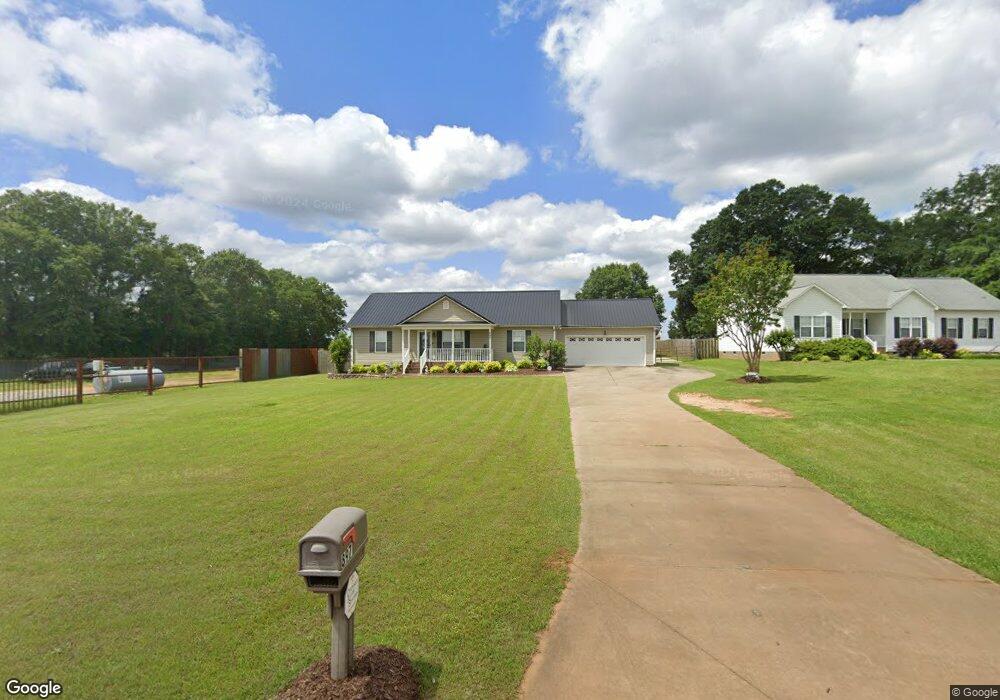
897 Martin Camp Rd Chesnee, SC 29323
Estimated Value: $234,000 - $269,000
3
Beds
2
Baths
1,410
Sq Ft
$181/Sq Ft
Est. Value
About This Home
This home is located at 897 Martin Camp Rd, Chesnee, SC 29323 and is currently estimated at $255,901, approximately $181 per square foot. 897 Martin Camp Rd is a home located in Spartanburg County with nearby schools including Cooley Springs-Fingerville Elementary School, Chesnee Middle School, and Chesnee High School.
Ownership History
Date
Name
Owned For
Owner Type
Purchase Details
Closed on
Jul 26, 2013
Sold by
Steadman Thomas D
Bought by
Steadman Thomas D and Steadman Marie C
Current Estimated Value
Home Financials for this Owner
Home Financials are based on the most recent Mortgage that was taken out on this home.
Original Mortgage
$126,000
Interest Rate
3.96%
Mortgage Type
New Conventional
Create a Home Valuation Report for This Property
The Home Valuation Report is an in-depth analysis detailing your home's value as well as a comparison with similar homes in the area
Home Values in the Area
Average Home Value in this Area
Purchase History
| Date | Buyer | Sale Price | Title Company |
|---|---|---|---|
| Steadman Thomas D | -- | -- |
Source: Public Records
Mortgage History
| Date | Status | Borrower | Loan Amount |
|---|---|---|---|
| Closed | Steadman Thomas D | $126,000 |
Source: Public Records
Tax History Compared to Growth
Tax History
| Year | Tax Paid | Tax Assessment Tax Assessment Total Assessment is a certain percentage of the fair market value that is determined by local assessors to be the total taxable value of land and additions on the property. | Land | Improvement |
|---|---|---|---|---|
| 2025 | $1,327 | $8,199 | $439 | $7,760 |
| 2024 | $1,327 | $8,199 | $439 | $7,760 |
| 2023 | $1,327 | $8,199 | $439 | $7,760 |
| 2022 | $1,203 | $7,130 | $290 | $6,840 |
| 2021 | $1,203 | $7,130 | $290 | $6,840 |
| 2020 | $1,181 | $7,130 | $290 | $6,840 |
| 2019 | $1,181 | $7,130 | $290 | $6,840 |
| 2018 | $1,153 | $7,130 | $290 | $6,840 |
| 2017 | $1,021 | $6,200 | $300 | $5,900 |
| 2016 | $1,021 | $6,200 | $300 | $5,900 |
| 2015 | $1,016 | $6,200 | $300 | $5,900 |
| 2014 | $835 | $5,072 | $300 | $4,772 |
Source: Public Records
Map
Nearby Homes
- 402 Dodger Ave
- 406 Dodger Ave
- 407 Dodger Ave
- 411 Dodger Ave
- 410 Dodger Ave
- 415 Dodger Ave
- 750 Mason Rd
- 107 Brooklyn Church Rd
- 138 Lowe Rd
- 0 Cantrell Dr
- 291 Robbins Rd
- 372 Long Branch Rd
- 292 Long Branch Rd
- 0 Fosters Grove Rd Unit SPN329427
- 0 Hwy 11 W Unit SPN321718
- 896 Anderson Rd
- 1010 Wall Cir
- 351 Smith Wall Rd
- 2705 Fairfield Rd
- 2715 Fairfield Rd
- 906 Martin Camp Rd
- 846 Martin Camp Rd
- 837 Martin Camp Rd
- 845 Martin Camp Rd
- 918 Martin Camp Rd
- 118 Sulphur Springs Rd
- 825 Martin Camp Rd
- 124 Sulphur Springs Rd
- 815 Martin Camp Rd
- 949 Martin Camp Rd
- 142 Sulphur Springs Rd
- 148 Sulphur Springs Rd
- 166 Sulphur Springs Rd
- 855 Martin Camp Rd
- 791 Martin Camp Rd
- 2777 Fairfield Rd
- 2630 Fairfield Rd
- 2785 Fairfield Rd