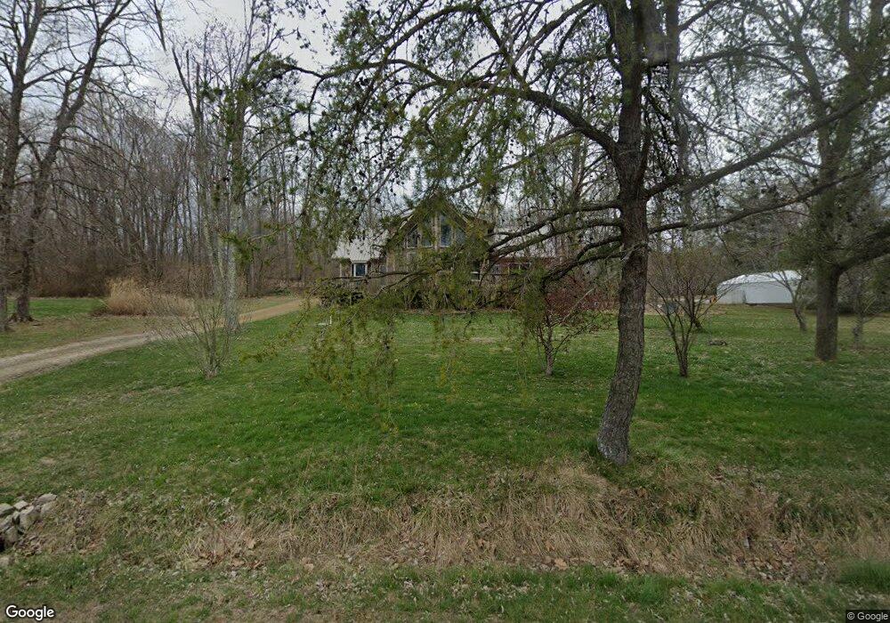
897 N Reid Rd Lexington, IN 47138
Estimated Value: $322,000 - $419,000
3
Beds
3
Baths
2,272
Sq Ft
$162/Sq Ft
Est. Value
About This Home
This home is located at 897 N Reid Rd, Lexington, IN 47138 and is currently estimated at $369,180, approximately $162 per square foot. 897 N Reid Rd is a home located in Scott County with nearby schools including Scottsburg Senior High School.
Ownership History
Date
Name
Owned For
Owner Type
Purchase Details
Closed on
Dec 17, 2008
Sold by
Buzzard Edward L
Bought by
Greathouse Charles and Greathoused Rebecca
Current Estimated Value
Purchase Details
Closed on
Oct 28, 2005
Sold by
Sterrett Clarence P and Sterrett Patricia A
Bought by
Buzzard Edward L
Home Financials for this Owner
Home Financials are based on the most recent Mortgage that was taken out on this home.
Original Mortgage
$14,000
Interest Rate
6.5%
Mortgage Type
Adjustable Rate Mortgage/ARM
Create a Home Valuation Report for This Property
The Home Valuation Report is an in-depth analysis detailing your home's value as well as a comparison with similar homes in the area
Home Values in the Area
Average Home Value in this Area
Purchase History
| Date | Buyer | Sale Price | Title Company |
|---|---|---|---|
| Greathouse Charles | $24,000 | Houston And Thompson Pc | |
| Greathouse Charles | -- | None Available | |
| Buzzard Edward L | -- | None Available |
Source: Public Records
Mortgage History
| Date | Status | Borrower | Loan Amount |
|---|---|---|---|
| Previous Owner | Buzzard Edward L | $14,000 |
Source: Public Records
Tax History Compared to Growth
Tax History
| Year | Tax Paid | Tax Assessment Tax Assessment Total Assessment is a certain percentage of the fair market value that is determined by local assessors to be the total taxable value of land and additions on the property. | Land | Improvement |
|---|---|---|---|---|
| 2024 | $2,677 | $297,900 | $19,200 | $278,700 |
| 2023 | $2,539 | $294,900 | $19,200 | $275,700 |
| 2022 | $1,535 | $284,100 | $19,200 | $264,900 |
| 2021 | $1,505 | $248,800 | $19,200 | $229,600 |
| 2020 | $1,505 | $235,800 | $19,200 | $216,600 |
| 2019 | $1,466 | $233,000 | $19,200 | $213,800 |
| 2018 | $1,491 | $228,500 | $14,700 | $213,800 |
| 2017 | $1,461 | $227,500 | $14,700 | $212,800 |
| 2016 | $1,432 | $202,700 | $14,700 | $188,000 |
| 2014 | $1,362 | $190,500 | $14,700 | $175,800 |
| 2013 | $1,362 | $190,500 | $14,700 | $175,800 |
Source: Public Records
Map
Nearby Homes
- 6981 E Webster Rd
- 6429 E Blocher Rd
- 1514 Skyline Dr
- 5462 E Mockingbird Ln
- 0 E Blocher Rd
- 5628 E Polk Rd
- 1696 N Shea Rd
- 11843 Indiana 56
- 1521 N Spindlebrook Ln
- TBD Kent Indiana 256
- 0 Kent Indiana 256
- 4267 Kent Indiana 256
- 1869 S Getty Rd
- 2621 S Alexander St
- 10105 Indiana 56
- 10242 W Polk Rd
- 969 S Goshen Rd
- 1020 S Goshen Rd
- 1117 S 1000 W
- 10177 Indiana 356
- 853 N Reid Rd
- 7018 E State Road 56
- 951 N Reid Rd
- 6996 E State Road 56
- 803 N Reid Rd
- 6886 Indiana 56
- 6886 E State Road 56
- 653 N Reid Rd
- 807 N Reid Rd
- 1850 S 1400 W
- 6802 E State Road 56
- 7278 E State Road 56
- 625 N Reid Rd
- 7316 E State Road 56
- 6656 E State Road 56
- 7370 E State Road 56
- 1758 S 1400 W
- 7404 E State Road 56 Unit 56
- 7404 E State Road 56
- 1741 S 1400 W