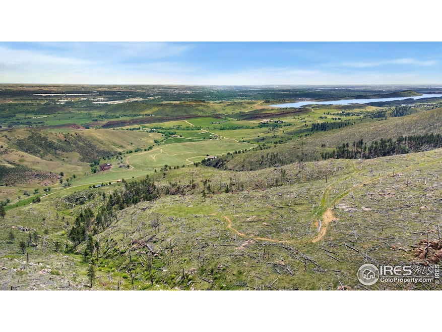
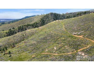
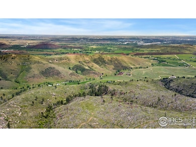
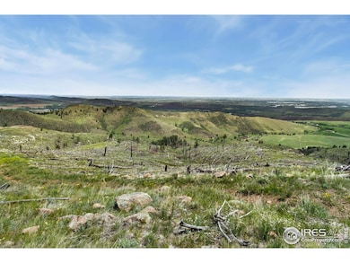
898 Hernia Hill Trail Bellvue, CO 80512
Estimated payment $1,845/month
Highlights
- Water Views
- 36 Acre Lot
- No HOA
- Horses Allowed On Property
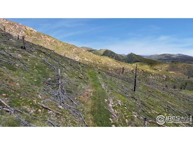
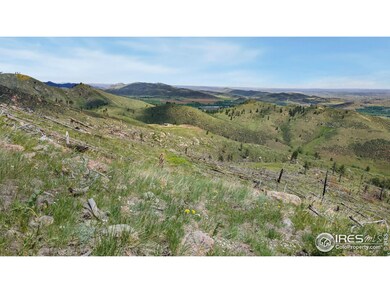
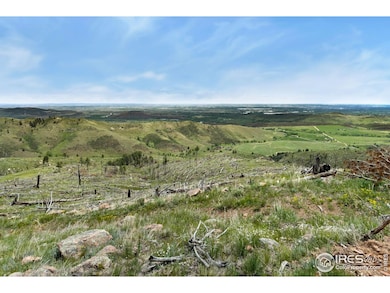
About This Lot
Escape to the Colorado mountains and make your dream a reality with this incredible 36-acre parcel located in the tranquil hills of Bellvue. Surrounded by sweeping views of Horsetooth Reservoir, native pines, and abundant wildlife, this expansive property offers privacy, serenity, and endless potential. With no existing structures, this raw land gives you a rare opportunity to build your ideal mountain retreat from the ground up, whether it's a full-time residence, weekend getaway, off-grid cabin, or recreational basecamp. The terrain provides multiple potential building sites with stunning vistas in every direction. Located just a scenic drive from Fort Collins, the property offers easy access to hiking, hunting, fishing, and the natural wonders of Northern Colorado. Whether you're looking for solitude, adventure, or a future investment, 898 Hernia Hill Trail delivers the space and freedom to make it your own. Come walk the land and envision the possibilities. This is mountain living at its purest!
Property Details
Property Type
- Land
Est. Annual Taxes
- $4,074
Lot Details
- 36 Acre Lot
- Dirt Road
Property Views
- Water
- Panoramic
Schools
- Cache La Poudre Elementary And Middle School
- Poudre High School
Horse Facilities and Amenities
- Horses Allowed On Property
Community Details
- No Home Owners Association
- Outside City Limits Subdivision
Listing and Financial Details
- Assessor Parcel Number R0233765
Map
Home Values in the Area
Average Home Value in this Area
Tax History
| Year | Tax Paid | Tax Assessment Tax Assessment Total Assessment is a certain percentage of the fair market value that is determined by local assessors to be the total taxable value of land and additions on the property. | Land | Improvement |
|---|---|---|---|---|
| 2025 | $4,074 | $42,408 | $42,408 | -- |
| 2024 | $3,876 | $42,408 | $42,408 | -- |
| 2022 | $3,966 | $42,050 | $42,050 | $0 |
| 2021 | $3,888 | $42,050 | $42,050 | $0 |
| 2020 | $3,246 | $34,800 | $34,800 | $0 |
| 2019 | $3,261 | $34,800 | $34,800 | $0 |
| 2018 | $2,501 | $27,550 | $27,550 | $0 |
| 2017 | $2,493 | $27,550 | $27,550 | $0 |
| 2016 | $1,530 | $16,820 | $16,820 | $0 |
| 2015 | $1,519 | $16,820 | $16,820 | $0 |
| 2014 | $1,121 | $12,330 | $12,330 | $0 |
Property History
| Date | Event | Price | List to Sale | Price per Sq Ft |
|---|---|---|---|---|
| 05/23/2025 05/23/25 | For Sale | $285,000 | -- | -- |
Purchase History
| Date | Type | Sale Price | Title Company |
|---|---|---|---|
| Warranty Deed | $141,500 | Guaranteed Title Group Llc | |
| Warranty Deed | $85,000 | None Available | |
| Interfamily Deed Transfer | -- | -- | |
| Warranty Deed | $55,000 | -- | |
| Quit Claim Deed | -- | -- | |
| Quit Claim Deed | -- | -- | |
| Quit Claim Deed | -- | -- |
Mortgage History
| Date | Status | Loan Amount | Loan Type |
|---|---|---|---|
| Open | $97,000 | Future Advance Clause Open End Mortgage | |
| Previous Owner | $44,490 | No Value Available |
Source: IRES MLS
MLS Number: 1034848
APN: 08340-00-035
Disclaimer: Certain information contained herein is derived from information provided by parties other than Homes.com. All information provided is deemed reliable, but is not guaranteed to be accurate and should be independently verified.
![]() Information source: Information and Real Estate Services, LLC. Provided for limited non-commercial use only under IRES Rules © Copyright IRES.
Information source: Information and Real Estate Services, LLC. Provided for limited non-commercial use only under IRES Rules © Copyright IRES.
Listing information is provided exclusively for consumers' personal, non-commercial use and may not be used for any purpose other than to identify prospective properties consumers may be interested in purchasing.
Information deemed reliable but not guaranteed by the MLS.
- 100 Canyon Gulch Rd
- 1600 Whale Rock Rd
- 2518 Whale Rock Rd
- 0 Pine Acres Way Unit 1045910
- 0 Pine Acres Rd Unit 1041697
- 620 Davis Ranch Rd
- 6508 Jackpine Dr
- 269 Cox Ct
- 10435 Roan Mountain Rd
- 865 Redstone Dr
- 2720 N County Road 23
- 3235 Davis Ranch Rd
- 0 Rist Creek Rd Unit 4284551
- 0 Rist Creek Rd Unit REC4803675
- 3805 Davis Ranch Rd
- 3501 Raptor Ridge Ln
- 89 Aspen Leaf Ln
- 427 Wilderness Ridge Way
- 4516 Bingham Hill Rd
- 4528 W County Road 54g
- 1000 Cuerto Ln
- 3200 Azalea Dr
- 2424 W Mulberry St
- 155 Briarwood Rd
- 2516 W Plum St
- 1942 Pecan St Unit 2
- 1942 Pecan St Unit 4
- 1931 Ross Ct Unit 4
- 3005 Ross Dr
- 3025 W Stuart St
- 2155 Orchard Place
- 2955 W Stuart St Unit 8
- 2929 Ross Dr S74
- 2930 W Stuart St
- 1121 Ponderosa Dr
- 2020 W Plum St
- 1405 Village Ln
- 1648 Northbrook Dr
- 521 S Bryan Ave Unit 1/2
- 521 S Bryan Ave Unit 3/4
