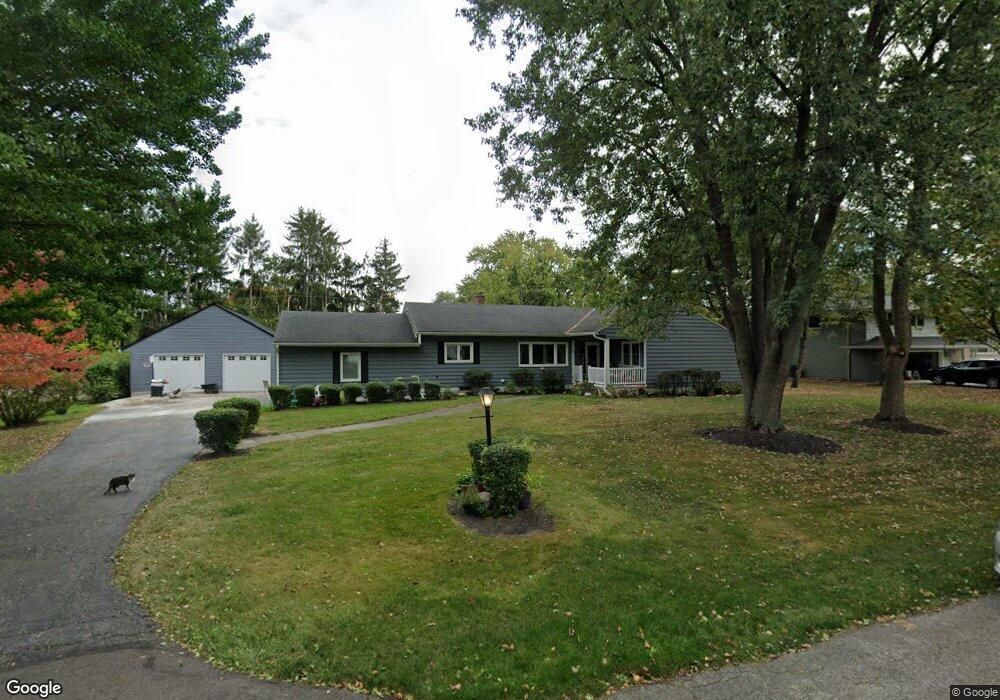
898 Leetonia Rd Marion, OH 43302
Estimated Value: $296,571 - $311,000
3
Beds
4
Baths
2,162
Sq Ft
$139/Sq Ft
Est. Value
About This Home
This home is located at 898 Leetonia Rd, Marion, OH 43302 and is currently estimated at $301,393, approximately $139 per square foot. 898 Leetonia Rd is a home located in Marion County with nearby schools including Benjamin Harrison Elementary School, Ulysses S. Grant Middle School, and Harding High School.
Ownership History
Date
Name
Owned For
Owner Type
Purchase Details
Closed on
Sep 10, 2019
Sold by
Novik Miranda M and Mayberry Miranda M
Bought by
Mayberry Miranda M and Mayberry Billy
Current Estimated Value
Purchase Details
Closed on
Nov 12, 2010
Sold by
Arnold Henrietta B and Whelan James F
Bought by
Novik Miranda M
Home Financials for this Owner
Home Financials are based on the most recent Mortgage that was taken out on this home.
Original Mortgage
$83,870
Outstanding Balance
$55,981
Interest Rate
4.5%
Mortgage Type
FHA
Estimated Equity
$245,412
Purchase Details
Closed on
Mar 19, 2008
Sold by
Arnold Calvin C and Arnold Henrietta B
Bought by
Arnold Calvin C and Arnold Henrietta B
Create a Home Valuation Report for This Property
The Home Valuation Report is an in-depth analysis detailing your home's value as well as a comparison with similar homes in the area
Home Values in the Area
Average Home Value in this Area
Purchase History
| Date | Buyer | Sale Price | Title Company |
|---|---|---|---|
| Mayberry Miranda M | -- | None Available | |
| Novik Miranda M | $85,000 | Chicago Title | |
| Arnold Calvin C | -- | None Available |
Source: Public Records
Mortgage History
| Date | Status | Borrower | Loan Amount |
|---|---|---|---|
| Open | Novik Miranda M | $83,870 |
Source: Public Records
Tax History Compared to Growth
Tax History
| Year | Tax Paid | Tax Assessment Tax Assessment Total Assessment is a certain percentage of the fair market value that is determined by local assessors to be the total taxable value of land and additions on the property. | Land | Improvement |
|---|---|---|---|---|
| 2024 | $3,019 | $80,360 | $14,280 | $66,080 |
| 2023 | $3,019 | $80,360 | $14,280 | $66,080 |
| 2022 | $2,730 | $78,450 | $14,280 | $64,170 |
| 2021 | $2,059 | $53,440 | $12,420 | $41,020 |
| 2020 | $2,024 | $52,520 | $12,420 | $40,100 |
| 2019 | $2,022 | $52,520 | $12,420 | $40,100 |
| 2018 | $1,688 | $43,900 | $13,310 | $30,590 |
| 2017 | $1,711 | $43,900 | $13,310 | $30,590 |
| 2016 | $1,704 | $43,900 | $13,310 | $30,590 |
| 2015 | $1,694 | $42,680 | $12,680 | $30,000 |
| 2014 | $1,693 | $42,680 | $12,680 | $30,000 |
| 2012 | $2,150 | $53,750 | $14,020 | $39,730 |
Source: Public Records
Map
Nearby Homes
- 769 Summit St
- 763 Leetonia Rd
- 991 Uhler Rd
- 858 Vernon Heights Cir
- 701 Brightwood Dr
- 667 King Ave
- 1290 Old Pond Dr
- 556 Hane Ave
- 840 Forest Lawn Dr
- 514 King Ave
- 556 S Vine St
- 482 King Ave
- 1043 Harding Memorial Pkwy
- 193 E Walnut St
- 338 Powhattan St
- 772 Villandry Dr
- 587 Normandy Dr
- 686 Mount Vernon Ave Unit AV
- 523 Normandy Dr
- 127 E Walnut St
- 916 Leetonia Rd
- 880 Leetonia Rd
- 1020 Leetonia Rd
- 1080 Uhler Rd
- 905 Leetonia Rd
- 1000 Leetonia Rd
- 868 Leetonia Rd
- 889 Leetonia Rd
- 956 Leetonia Rd
- 919 Leetonia Rd
- 877 Leetonia Rd
- 974 Leetonia Rd
- 860 Leetonia Rd
- 1084 Uhler Rd
- 939 Leetonia Rd
- 875 Leetonia Rd
- 1034 Uhler Rd
- 1001 Leetonia Rd
- 1055 Uhler Rd
- 950 Vernon Heights Blvd