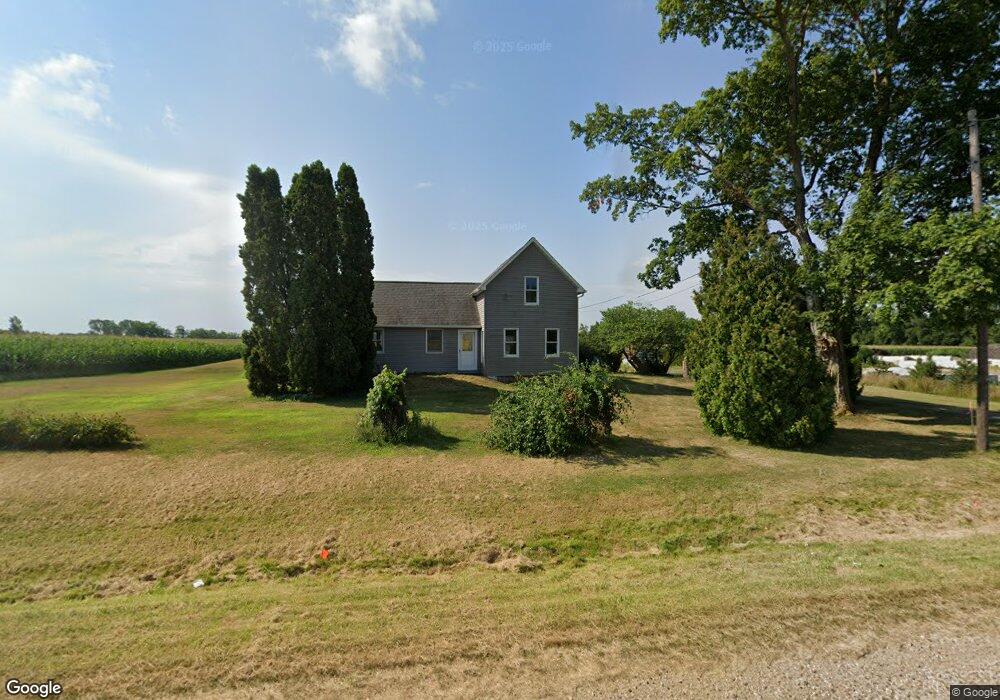
8982 Us Highway 12 New Buffalo, MI 49117
Estimated Value: $318,069 - $2,982,000
3
Beds
1
Bath
1,056
Sq Ft
$1,101/Sq Ft
Est. Value
About This Home
This home is located at 8982 Us Highway 12, New Buffalo, MI 49117 and is currently estimated at $1,162,767, approximately $1,101 per square foot. 8982 Us Highway 12 is a home located in Berrien County with nearby schools including New Buffalo Elementary School, New Buffalo Middle School, and New Buffalo Senior High School.
Ownership History
Date
Name
Owned For
Owner Type
Purchase Details
Closed on
Aug 16, 2024
Sold by
Deeds Michael Evert and Deeds Karen Sue
Bought by
Crosby Michael Lee
Current Estimated Value
Home Financials for this Owner
Home Financials are based on the most recent Mortgage that was taken out on this home.
Original Mortgage
$194,000
Interest Rate
6.35%
Mortgage Type
New Conventional
Purchase Details
Closed on
Jun 25, 1990
Create a Home Valuation Report for This Property
The Home Valuation Report is an in-depth analysis detailing your home's value as well as a comparison with similar homes in the area
Home Values in the Area
Average Home Value in this Area
Purchase History
| Date | Buyer | Sale Price | Title Company |
|---|---|---|---|
| Crosby Michael Lee | -- | None Listed On Document | |
| -- | $100 | -- |
Source: Public Records
Mortgage History
| Date | Status | Borrower | Loan Amount |
|---|---|---|---|
| Previous Owner | Crosby Michael Lee | $194,000 |
Source: Public Records
Tax History Compared to Growth
Tax History
| Year | Tax Paid | Tax Assessment Tax Assessment Total Assessment is a certain percentage of the fair market value that is determined by local assessors to be the total taxable value of land and additions on the property. | Land | Improvement |
|---|---|---|---|---|
| 2025 | $731 | $125,300 | $0 | $0 |
| 2024 | $562 | $136,900 | $0 | $0 |
| 2023 | $535 | $81,800 | $0 | $0 |
| 2022 | $509 | $85,100 | $0 | $0 |
| 2021 | $640 | $71,700 | $23,200 | $48,500 |
| 2020 | $622 | $72,500 | $0 | $0 |
| 2019 | $620 | $71,200 | $19,400 | $51,800 |
| 2018 | $625 | $76,800 | $0 | $0 |
| 2017 | $637 | $74,700 | $0 | $0 |
| 2016 | $575 | $77,700 | $0 | $0 |
| 2015 | $578 | $79,700 | $0 | $0 |
| 2014 | $458 | $77,900 | $0 | $0 |
Source: Public Records
Map
Nearby Homes
- 17567 A Lakeside Rd
- 18020 Hoder Rd
- 10172 Us Highway 12
- 16800 Riverside Dr
- 9701 Kruger Rd
- 16431 Glassman Rd
- 9695 Community Hall Rd
- 9604 9704 Community Hall Rd
- Lot 7 Driftwood Cottages
- Lot 8 Driftwood Cottages
- Lot 9 Driftwood Cottages
- Lot 12 Driftwood Cottages
- Lot 11 Driftwood Cottages
- Lot 10 Driftwood Cottages
- Lot 13 Driftwood Cottages
- Lot 7 Driftwood Path
- 16253 1st Ln
- Lot 2 Driftwood Path
- Lot 3 Driftwood Path
- Lot 4 Driftwood Path
- 0 Lakeside Rd Unit M22003446
- 0 Lakeside Rd Unit M22003445
- 0 Lakeside Rd Unit 69022003446
- 0 Lakeside Rd Unit 69022003445
- 0 Lakeside Rd Unit 4 22003446
- 0 Lakeside Rd Unit 3 22003445
- 16328 Lakeside Rd
- 0 Lakeside Rd
- 19825 Lakeside Rd
- 9200 Us Highway 12
- 8834 U S 12
- 8708 Us Highway 12
- 17365 Lakeside Rd
- 8694 Us Highway 12
- 8709 Us Highway 12
- 8675 Us Highway 12
- 8675 Us Highway 12
- 17300 Lakeside Rd
- 9371 Us Highway 12
- 9400 Us Highway 12