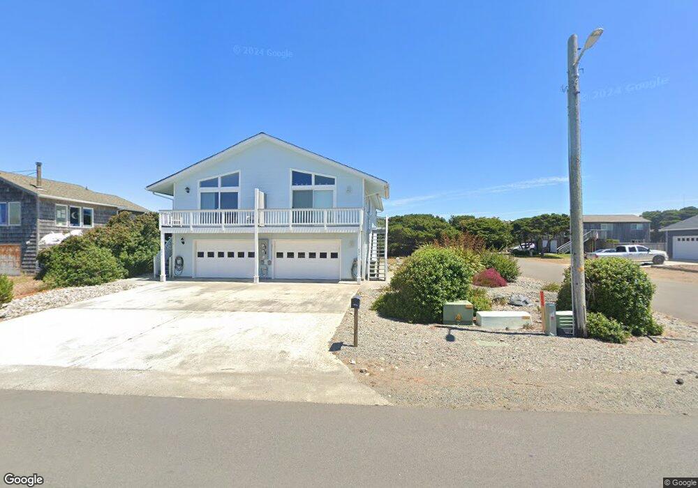
899 Beach Loop Dr SW Bandon, OR 97411
Estimated Value: $379,049 - $624,000
3
Beds
3
Baths
1,354
Sq Ft
$367/Sq Ft
Est. Value
About This Home
This home is located at 899 Beach Loop Dr SW, Bandon, OR 97411 and is currently estimated at $497,262, approximately $367 per square foot. 899 Beach Loop Dr SW is a home located in Coos County with nearby schools including Ocean Crest Elementary School, Harbor Lights Middle School, and Bandon Senior High School.
Ownership History
Date
Name
Owned For
Owner Type
Purchase Details
Closed on
Feb 11, 2015
Sold by
Bibb Farrell
Bought by
Bittick Shaun K and Dangler Michael J
Current Estimated Value
Home Financials for this Owner
Home Financials are based on the most recent Mortgage that was taken out on this home.
Original Mortgage
$142,500
Outstanding Balance
$108,669
Interest Rate
3.8%
Mortgage Type
Commercial
Estimated Equity
$388,593
Purchase Details
Closed on
May 11, 2012
Sold by
Latteri Anthony and Latteri Jamie
Bought by
Bibb Farrell
Create a Home Valuation Report for This Property
The Home Valuation Report is an in-depth analysis detailing your home's value as well as a comparison with similar homes in the area
Home Values in the Area
Average Home Value in this Area
Purchase History
| Date | Buyer | Sale Price | Title Company |
|---|---|---|---|
| Bittick Shaun K | $190,000 | Ticor Title Company | |
| Bibb Farrell | $140,000 | Ticor Title Company |
Source: Public Records
Mortgage History
| Date | Status | Borrower | Loan Amount |
|---|---|---|---|
| Open | Bittick Shaun K | $142,500 |
Source: Public Records
Tax History Compared to Growth
Tax History
| Year | Tax Paid | Tax Assessment Tax Assessment Total Assessment is a certain percentage of the fair market value that is determined by local assessors to be the total taxable value of land and additions on the property. | Land | Improvement |
|---|---|---|---|---|
| 2025 | $3,118 | $282,980 | -- | -- |
| 2024 | $3,055 | $272,100 | -- | -- |
| 2023 | $3,425 | $304,170 | $0 | $0 |
| 2022 | $2,856 | $245,300 | $0 | $0 |
| 2021 | $2,569 | $223,000 | $0 | $0 |
| 2020 | $2,204 | $204,590 | $0 | $0 |
| 2019 | $2,219 | $200,580 | $0 | $0 |
| 2018 | $1,791 | $167,150 | $0 | $0 |
| 2017 | $1,802 | $167,150 | $0 | $0 |
| 2016 | $1,606 | $149,240 | $0 | $0 |
| 2015 | $1,840 | $165,820 | $0 | $0 |
| 2014 | $1,840 | $165,820 | $0 | $0 |
Source: Public Records
Map
Nearby Homes
- 1257 7th St SW
- 1280 Ocean Dr SW
- 1575 Beach Loop Dr SW
- 875 12th St SW
- 0 Jetty Rd SW Unit 269553922
- 0 Jetty Rd SW Unit 267448665
- 835 SW 11th
- 0 Eighth St SW Unit 797186006
- 875 Ocean Dr SW
- 0 SW Eighth at Harrison Ave
- 000 Jetty Rd Unit 100
- 737 11th St SW
- 323 Madison Ave SW
- 535 Harrison Ave SW
- 0 Franklin Ave SW Unit 23128327
- 1950 Beach Loop Dr SW
- 1312 Village Loop
- 1313 Village Loop
- 1323 Village Loop
- 2131 Beach Loop Dr SW
- 897 Beach Loop Dr SW Unit 1
- 867 Beach Loop Dr SW
- 1333 9th St SW
- 835 Beach Loop Dr SW
- 890 Newport Ave SW
- 910 Newport Ave SW
- 0 Newport Ave SW Unit 21464928
- 0 Newport Ave SW Unit 7700 21025546
- 0 Newport Ave SW Unit 2500 20510261
- 0 Newport Ave SW
- 947 Beach Loop Dr SW
- 854 Newport Ave SW
- 969 Beach Loop Dr SW
- 965 Beach Loop Dr SW Unit 3
- 965 Beach Loop Dr SW
- 930 Newport Ave SW
- 934 Beach Loop Dr SW
- 879 Portland Ave SW
- 960 Newport Ave SW
- 966 Beach Loop Dr