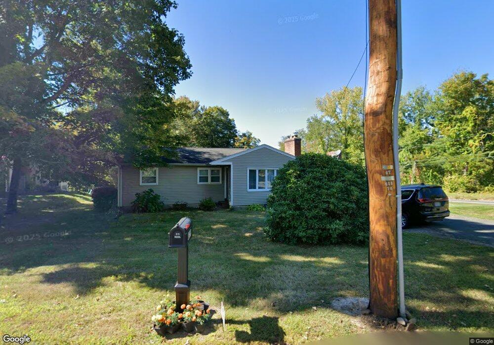
899 Birnie Ave West Springfield, MA 01089
Estimated Value: $356,876 - $407,000
3
Beds
1
Bath
1,332
Sq Ft
$287/Sq Ft
Est. Value
About This Home
This home is located at 899 Birnie Ave, West Springfield, MA 01089 and is currently estimated at $382,219, approximately $286 per square foot. 899 Birnie Ave is a home located in Hampden County with nearby schools including West Springfield High School, Holyoke Community Charter School, and Blessed Sacrament School.
Ownership History
Date
Name
Owned For
Owner Type
Purchase Details
Closed on
Jan 30, 2009
Sold by
Dubreuil Cheryl R
Bought by
Vanden-Top Steven K and Vanden-Top Kristine Z
Current Estimated Value
Home Financials for this Owner
Home Financials are based on the most recent Mortgage that was taken out on this home.
Original Mortgage
$199,368
Outstanding Balance
$125,040
Interest Rate
5.28%
Mortgage Type
Purchase Money Mortgage
Estimated Equity
$257,179
Purchase Details
Closed on
Aug 20, 1997
Sold by
Demagistris Robert T and Demagistris Geralyn
Bought by
Dubreuil Cheryl R
Home Financials for this Owner
Home Financials are based on the most recent Mortgage that was taken out on this home.
Original Mortgage
$88,614
Interest Rate
7.42%
Mortgage Type
Purchase Money Mortgage
Create a Home Valuation Report for This Property
The Home Valuation Report is an in-depth analysis detailing your home's value as well as a comparison with similar homes in the area
Home Values in the Area
Average Home Value in this Area
Purchase History
| Date | Buyer | Sale Price | Title Company |
|---|---|---|---|
| Vanden-Top Steven K | $202,000 | -- | |
| Dubreuil Cheryl R | $89,000 | -- |
Source: Public Records
Mortgage History
| Date | Status | Borrower | Loan Amount |
|---|---|---|---|
| Open | Vanden-Top Steven K | $199,368 | |
| Previous Owner | Dubreuil Cheryl R | $88,770 | |
| Previous Owner | Dubreuil Cheryl R | $88,614 | |
| Previous Owner | Dubreuil Cheryl R | $51,000 |
Source: Public Records
Tax History
| Year | Tax Paid | Tax Assessment Tax Assessment Total Assessment is a certain percentage of the fair market value that is determined by local assessors to be the total taxable value of land and additions on the property. | Land | Improvement |
|---|---|---|---|---|
| 2025 | $4,442 | $298,700 | $119,500 | $179,200 |
| 2024 | $4,387 | $296,200 | $119,500 | $176,700 |
| 2023 | $4,224 | $271,800 | $119,500 | $152,300 |
| 2022 | $3,850 | $244,300 | $108,700 | $135,600 |
| 2021 | $3,554 | $210,300 | $88,000 | $122,300 |
| 2020 | $3,573 | $210,300 | $88,000 | $122,300 |
| 2019 | $3,567 | $210,300 | $88,000 | $122,300 |
| 2018 | $3,586 | $210,300 | $88,000 | $122,300 |
| 2017 | $3,586 | $210,300 | $88,000 | $122,300 |
| 2016 | $3,510 | $206,600 | $82,600 | $124,000 |
| 2015 | $3,400 | $200,100 | $81,100 | $119,000 |
| 2014 | $812 | $200,100 | $81,100 | $119,000 |
Source: Public Records
Map
Nearby Homes
- 361 Prospect Ave
- 11 Annie's Way
- 48 Mountain Ave
- 89-111 Whitney Ave
- 287 Whitney Ave
- 80 Brush Hill Ave Unit 61
- 156 Canterbury Way
- 86 Beaumont Ave
- 87 Blanchwood Ave
- 60 Lower Westfield Rd
- 51 Beaumont Ave
- 791 Morgan Rd
- 655 Morgan Rd
- 17 Vincent Dr
- 439 Oldfield Rd
- 76 Joy St
- 269 Chicopee St Unit 6
- 26 Dayton St
- 34 High Meadow Dr
- 26 Whitin Ave
- 891 Birnie Ave
- 881 Birnie Ave
- 888 Birnie Ave
- 869 Birnie Ave
- 551 Prospect Ave
- 894 Birnie Ave
- 872 Birnie Ave
- 537 Prospect Ave
- 523 Prospect Ave
- 511 Prospect Ave
- 651 Prospect Ave
- 810 Birnie Ave
- 503 Prospect Ave
- 665 Prospect Ave
- LOT 4 Appaloosa Ln
- L C1 Frederick St
- LOT 9 Prospect Ave
- LOT20 Beauregard
- LT39 Christine
- LOT17 Cedar Woods Glen
Your Personal Tour Guide
Ask me questions while you tour the home.